Property Record
1141 Saratoga Ave, San Jose, CA 95129


NEARBY LISTINGS FOR SALE OR LEASE
Property Detail
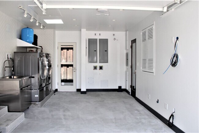
1141 Saratoga Ave
381-17-091
TRACT 2569 BOOK 124 PAGE 26 PAGE 27 LOT 30
Financialbuilding
Santa Clara
D
California
06085C0236H
30
2024
0.16 AC
2025
West San Jose
506202
South Bay/San Jose
1,293 SF
San Jose-Sunnyvale-Santa Clara, CA
DEMOGRAPHICS near 1141 Saratoga Ave
1 Mile
3 Mile
5 Mile
2024 Total Population
31,451
224,858
530,179
2029 Population
30,266
216,426
511,286
Pop Growth 2024-2029
(3.77%)
(3.75%)
(3.56%)
Average Age
39
40
40
2024 Total Households
11,122
82,307
193,748
HH Growth 2024-2029
(4.06%)
(3.99%)
(3.79%)
Median Household Inc
$120,567
$146,292
$155,628
Avg Household Size
2.80
2.70
2.70
2024 Avg HH Vehicles
2.00
2.00
2.00
Median Home Value
$1,134,311
$1,126,519
$1,126,381
Median Year Built
1966
1967
1968
Nearby Places
Map Layers
Map Styles
 Street
 Aerial
- Restaurants
- Banks
- Shops
- Fitness
- Groceries
PUBLIC TRANSPORTATION
COMMUTER RAIL
Santa Clara (Caltrain - Caltrain (Caltrain))
DRIVE
WALK
Distance
Santa Clara (Caltrain - Caltrain (Caltrain))
10 min
4.6 mi
DRIVE
WALK
Distance
11 min
4.7 mi
AIRPORT
Norman Y Mineta San Jose International
DRIVE
WALK
Distance
Norman Y Mineta San Jose International
12 min
5.3 mi
San Francisco International
DRIVE
WALK
Distance
San Francisco International
46 min
35.6 mi
Metro Oakland International
DRIVE
WALK
Distance
Metro Oakland International
51 min
40.5 mi
Freight Ports
Port of Redwood City
DRIVE
WALK
Distance
Port of Redwood City
31 min
22.4 mi
Nearby Properties
Address
Land Use
TOTAL SIZE
Lot Size
Zoning
Address
Land Use
TOTAL SIZE
Lot Size
Zoning
2,819,800 SF
91.85 AC
CU
Address
Land Use
TOTAL SIZE
Lot Size
Zoning
57,096 SF
58.04 AC
PM0
Address
Land Use
TOTAL SIZE
Lot Size
Zoning
1,121,228 SF
7.68 AC
RM(PD
Address
Land Use
TOTAL SIZE
Lot Size
Zoning
833,956 SF
55.15 AC
PD
Address
Land Use
TOTAL SIZE
Lot Size
Zoning
304,000 SF
6.79 AC
PM0
Address
Land Use
TOTAL SIZE
Lot Size
Zoning
146,390 SF
9.04 AC
MP
Address
Land Use
TOTAL SIZE
Lot Size
Zoning
4.56 AC
CP
Address
Land Use
TOTAL SIZE
Lot Size
Zoning
32.93 AC
PC
Address
Land Use
TOTAL SIZE
Lot Size
Zoning
252,210 SF
15.85 AC
C2S
Address
Land Use
TOTAL SIZE
Lot Size
Zoning
457,162 SF
3.97 AC
A(PD)
Address
Land Use
TOTAL SIZE
Lot Size
Zoning
617,814 SF
21.96 AC
CG
Address
Land Use
TOTAL SIZE
Lot Size
Zoning
67,435 SF
11.93 AC
C2
Address
Land Use
TOTAL SIZE
Lot Size
Zoning
174,405 SF
9.24 AC
ML
Address
Land Use
TOTAL SIZE
Lot Size
Zoning
161,956 SF
1.30 AC
PD
Address
Land Use
TOTAL SIZE
Lot Size
Zoning
3.40 AC
APD
Address
Land Use
TOTAL SIZE
Lot Size
Zoning
298,461 SF
5.45 AC
C3H
Address
Land Use
TOTAL SIZE
Lot Size
Zoning
4.75 AC
CP-PD
Address
Land Use
TOTAL SIZE
Lot Size
Zoning
346,857 SF
4.26 AC
PD-MC
Address
Land Use
TOTAL SIZE
Lot Size
Zoning
234,622 SF
1.89 AC
A(PD)
Address
Land Use
TOTAL SIZE
Lot Size
Zoning
295,569 SF
30.70 AC
SJ
Address
Land Use
TOTAL SIZE
Lot Size
Zoning
135,840 SF
1.54 AC
PD
Address
Land Use
TOTAL SIZE
Lot Size
Zoning
116,953 SF
8.61 AC
C-2
Address
Land Use
TOTAL SIZE
Lot Size
Zoning
342,432 SF
3.99 AC
PD-MC
Address
Land Use
TOTAL SIZE
Lot Size
Zoning
16.11 AC
CG
Address
Land Use
TOTAL SIZE
Lot Size
Zoning
279,360 SF
9.04 AC
R3
Address
Land Use
TOTAL SIZE
Lot Size
Zoning
161,375 SF
9.27 AC
PD
Address
Land Use
TOTAL SIZE
Lot Size
Zoning
4.04 AC
CT
Address
Land Use
TOTAL SIZE
Lot Size
Zoning
172,772 SF
3.47 AC
PD
Address
Land Use
TOTAL SIZE
Lot Size
Zoning
814,622 SF
14.57 AC
R3
The World's #1 Commercial Real Estate Marketplace
Connect with us
© 2025 CoStar Group
The information above has been obtained from sources believed reliable. While we do not doubt its accuracy we have not verified it and make no guarantee, warranty or representation about it. It is your responsibility to independently confirm its accuracy and completeness. Any projections, opinions, assumptions, or estimates used are for example only and do not represent the current or future performance of the property. The value of this transaction to you depends on tax and other factors which should be evaluated by your tax, financial, and legal advisors. You and your advisors should conduct a careful, independent investigation of the property to determine to your satisfaction the suitability of the property for your needs.