Property Record
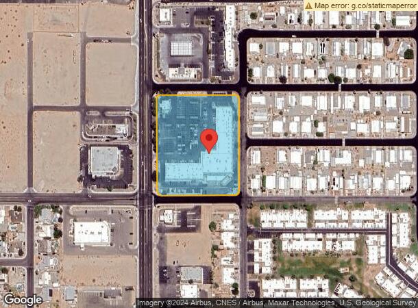
11411 S Fortuna Rd, Yuma, AZ 85367
NEARBY LISTINGS FOR SALE OR LEASE
-
-
View all Yuma listings for sale on LoopNet.com
Property Detail
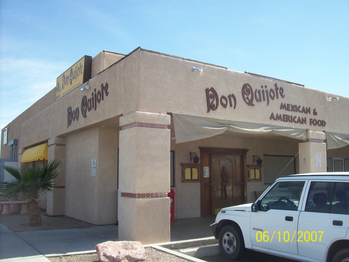
11411 S Fortuna Rd
700-45-153
SECTION: 08 TOWNSHIP: 09S RANGE: 21W BEG 390 FT M/L N OF W4 COR OF SEC 8 T9S R21W AND TH E 470 FT M/L N 145 FT W 25 FT TO W LINE PHOENIX DRIVE TH N TO A PT TH WLY AROUND A CURVE 31.41 FT TH W 355 FT TH SLY AROUND A CURVE 31.41 FT TH W 50 FT TO W LINE
Regionalshoppingcenterormallwithanchorstore
Yuma
X
Arizona
04027C1565E
4.30 AC
2023
Yuma & El Centro
2024
Other Market Areas
011118
Yuma, AZ
42,873 SF
DEMOGRAPHICS near 11411 S Fortuna Rd
1 Mile
3 Mile
5 Mile
2024 Total Population
7,606
34,482
52,499
2029 Population
8,247
37,860
57,849
Pop Growth 2024-2029
+ 8.43%
+ 9.80%
+ 10.19%
Average Age
49
48
48
2024 Total Households
3,271
14,753
21,946
HH Growth 2024-2029
+ 8.22%
+ 9.67%
+ 10.28%
Median Household Inc
$65,228
$58,608
$60,851
Avg Household Size
2.20
2.30
2.30
2024 Avg HH Vehicles
2.00
2.00
2.00
Median Home Value
$188,197
$160,189
$177,401
Median Year Built
2000
1998
1999
Nearby Places
- Restaurants
- Banks
- Shops
- Fitness
- Groceries
PUBLIC TRANSPORTATION
AIRPORT
Yuma International
Drive
Walk
Distance
Yuma International
20 min
12.4 mi
Freight Ports
Port of San Diego
Drive
Walk
Distance
Port of San Diego
204 min
183.0 mi
Nearby Properties
Address
Land Use
TOTAL SIZE
Lot Size
Zoning
Address
Land Use
TOTAL SIZE
Lot Size
Zoning
11388
2.53 AC
Address
Land Use
TOTAL SIZE
Lot Size
Zoning
5864
0.16 AC
LAR3
Address
Land Use
TOTAL SIZE
Lot Size
Zoning
120909
39 AC
AG
Address
Land Use
TOTAL SIZE
Lot Size
Zoning
59637
5.28 AC
C-2
Address
Land Use
TOTAL SIZE
Lot Size
Zoning
221147
21.87 AC
CVSP-C
Address
Land Use
TOTAL SIZE
Lot Size
Zoning
135428
21.56 AC
C-2
Address
Land Use
TOTAL SIZE
Lot Size
Zoning
41452
17.63 AC
C-1
Address
Land Use
TOTAL SIZE
Lot Size
Zoning
101156
11.21 AC
C-2
Address
Land Use
TOTAL SIZE
Lot Size
Zoning
43076
2 AC
C-2
Address
Land Use
TOTAL SIZE
Lot Size
Zoning
52945
2.39 AC
C-2
Address
Land Use
TOTAL SIZE
Lot Size
Zoning
28320
2.83 AC
C-2
Address
Land Use
TOTAL SIZE
Lot Size
Zoning
19849
1.08 AC
RA-10
Address
Land Use
TOTAL SIZE
Lot Size
Zoning
6474
0.37 AC
Address
Land Use
TOTAL SIZE
Lot Size
Zoning
63671
4.19 AC
C-2
Address
Land Use
TOTAL SIZE
Lot Size
Zoning
22532
4.98 AC
MHS-20
Address
Land Use
TOTAL SIZE
Lot Size
Zoning
16322
9.14 AC
RVP
Address
Land Use
TOTAL SIZE
Lot Size
Zoning
20498
14.50 AC
R-1-8
Address
Land Use
TOTAL SIZE
Lot Size
Zoning
6112
0.20 AC
LAR3
Address
Land Use
TOTAL SIZE
Lot Size
Zoning
15140
1.99 AC
C-2
Address
Land Use
TOTAL SIZE
Lot Size
Zoning
10633
2.09 AC
C-2
Address
Land Use
TOTAL SIZE
Lot Size
Zoning
20172
1.52 AC
C-2
Address
Land Use
TOTAL SIZE
Lot Size
Zoning
19003
4.75 AC
CVSP-R
Address
Land Use
TOTAL SIZE
Lot Size
Zoning
14847
1.42 AC
C-2
Address
Land Use
TOTAL SIZE
Lot Size
Zoning
37750
3.91 AC
R-3
Address
Land Use
TOTAL SIZE
Lot Size
Zoning
20568
2.55 AC
CVSP-C
Address
Land Use
TOTAL SIZE
Lot Size
Zoning
22472
3.86 AC
C-2
Address
Land Use
TOTAL SIZE
Lot Size
Zoning
60184
3.82 AC
C-2
Address
Land Use
TOTAL SIZE
Lot Size
Zoning
15577
1.71 AC
C-2
Address
Land Use
TOTAL SIZE
Lot Size
Zoning
4236
41.05 AC
Start a new search to find other properties for sale or lease
Connect with us
© 2024 CoStar Group
The information above has been obtained from sources believed reliable. While we do not doubt its accuracy we have not verified it and make no guarantee, warranty or representation about it. It is your responsibility to independently confirm its accuracy and completeness. Any projections, opinions, assumptions, or estimates used are for example only and do not represent the current or future performance of the property. The value of this transaction to you depends on tax and other factors which should be evaluated by your tax, financial, and legal advisors. You and your advisors should conduct a careful, independent investigation of the property to determine to your satisfaction the suitability of the property for your needs.