Property Record
11444 N Shore Dr, Reston, VA 20190
NEARBY LISTINGS FOR SALE OR LEASE
Property Detail
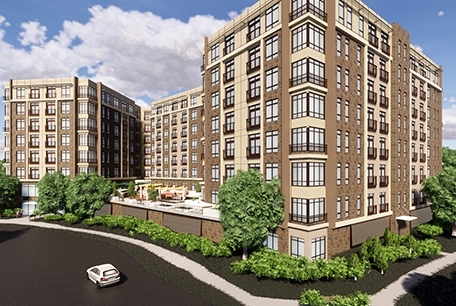
11444 N Shore Dr
Washington-Arlington-Alexandria, DC-VA-MD-WV
Lake Anne House
0172-01-0002D
GUNSTON MANOR LTS 48 49 BLK 24 SEC B
Apartment
Fairfax
X
Virginia
51059C0130E
48
2023
1.96 AC
2023
Reston
482201
Washington, DC
DEMOGRAPHICS near 11444 N Shore Dr
1 Mile
3 Mile
5 Mile
2024 Total Population
18,977
96,224
223,997
2029 Population
18,741
95,348
225,219
Pop Growth 2024-2029
(1.24%)
(0.91%)
+ 0.55%
Average Age
41
41
39
2024 Total Households
8,670
39,355
81,661
HH Growth 2024-2029
(1.43%)
(0.80%)
+ 0.46%
Median Household Inc
$120,438
$139,328
$142,869
Avg Household Size
2.20
2.40
2.70
2024 Avg HH Vehicles
2.00
2.00
2.00
Median Home Value
$618,545
$666,127
$685,214
Median Year Built
1981
1984
1986
Nearby Places
- Restaurants
- Banks
- Shops
- Fitness
- Groceries
PUBLIC TRANSPORTATION
AIRPORT
Washington Dulles International
DRIVE
WALK
Distance
Washington Dulles International
17 min
7.9 mi
Ronald Reagan Washington Ntl
DRIVE
WALK
Distance
Ronald Reagan Washington Ntl
37 min
23.6 mi
Freight Ports
Port of Baltimore
DRIVE
WALK
Distance
Port of Baltimore
77 min
55.6 mi
Nearby Properties
Address
Land Use
TOTAL SIZE
Lot Size
Zoning
Address
Land Use
TOTAL SIZE
Lot Size
Zoning
6.67 AC
PDC
Address
Land Use
TOTAL SIZE
Lot Size
Zoning
1,071,881 SF
PRC
Address
Land Use
TOTAL SIZE
Lot Size
Zoning
643,232 SF
2.81 AC
PRC
Address
Land Use
TOTAL SIZE
Lot Size
Zoning
473,458 SF
13.74 AC
I-4
Address
Land Use
TOTAL SIZE
Lot Size
Zoning
1,096,572 SF
85.06 AC
R-1
Address
Land Use
TOTAL SIZE
Lot Size
Zoning
446,810 SF
1.12 AC
PRC
Address
Land Use
TOTAL SIZE
Lot Size
Zoning
450,397 SF
1.07 AC
PRC
Address
Land Use
TOTAL SIZE
Lot Size
Zoning
332,957 SF
12.68 AC
I-5
Address
Land Use
TOTAL SIZE
Lot Size
Zoning
275,809 SF
0.75 AC
PRC
Address
Land Use
TOTAL SIZE
Lot Size
Zoning
469,276 SF
11.42 AC
PRC
Address
Land Use
TOTAL SIZE
Lot Size
Zoning
532,480 SF
4.62 AC
373
Address
Land Use
TOTAL SIZE
Lot Size
Zoning
498,299 SF
7.40 AC
PDC
Address
Land Use
TOTAL SIZE
Lot Size
Zoning
560,356 SF
4.33 AC
PRC
Address
Land Use
TOTAL SIZE
Lot Size
Zoning
263,767 SF
2.34 AC
PRC
Address
Land Use
TOTAL SIZE
Lot Size
Zoning
337,921 SF
13.57 AC
PRC
Address
Land Use
TOTAL SIZE
Lot Size
Zoning
264,888 SF
8.59 AC
I-4
Address
Land Use
TOTAL SIZE
Lot Size
Zoning
411,519 SF
3.48 AC
PRM
Address
Land Use
TOTAL SIZE
Lot Size
Zoning
407,812 SF
33.12 AC
PRC
Address
Land Use
TOTAL SIZE
Lot Size
Zoning
274,082 SF
1.08 AC
PRC
Address
Land Use
TOTAL SIZE
Lot Size
Zoning
408,315 SF
5.06 AC
PDC
Address
Land Use
TOTAL SIZE
Lot Size
Zoning
337,100 SF
2.19 AC
PRC
Address
Land Use
TOTAL SIZE
Lot Size
Zoning
340,778 SF
13.50 AC
PDC
Address
Land Use
TOTAL SIZE
Lot Size
Zoning
337,399 SF
3.06 AC
PRC
Address
Land Use
TOTAL SIZE
Lot Size
Zoning
394,900 SF
5.30 AC
PRC
Address
Land Use
TOTAL SIZE
Lot Size
Zoning
285,599 SF
8.01 AC
C-3
Address
Land Use
TOTAL SIZE
Lot Size
Zoning
223,230 SF
PDC
Address
Land Use
TOTAL SIZE
Lot Size
Zoning
267,665 SF
1.84 AC
PRM
Address
Land Use
TOTAL SIZE
Lot Size
Zoning
239,175 SF
3.48 AC
PRC
Address
Land Use
TOTAL SIZE
Lot Size
Zoning
269,524 SF
13.47 AC
O&LI
Address
Land Use
TOTAL SIZE
Lot Size
Zoning
242,813 SF
2.91 AC
PRM
The World's #1 Commercial Real Estate Marketplace
Connect with us
© 2025 CoStar Group
The information above has been obtained from sources believed reliable. While we do not doubt its accuracy we have not verified it and make no guarantee, warranty or representation about it. It is your responsibility to independently confirm its accuracy and completeness. Any projections, opinions, assumptions, or estimates used are for example only and do not represent the current or future performance of the property. The value of this transaction to you depends on tax and other factors which should be evaluated by your tax, financial, and legal advisors. You and your advisors should conduct a careful, independent investigation of the property to determine to your satisfaction the suitability of the property for your needs.