Property Record
11475 E Via Linda, Scottsdale, AZ 85259

NEARBY LISTINGS FOR SALE OR LEASE
Property Detail
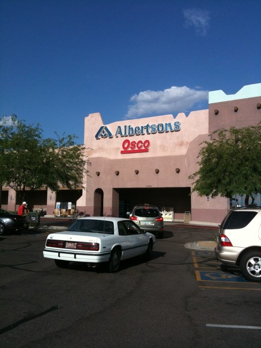
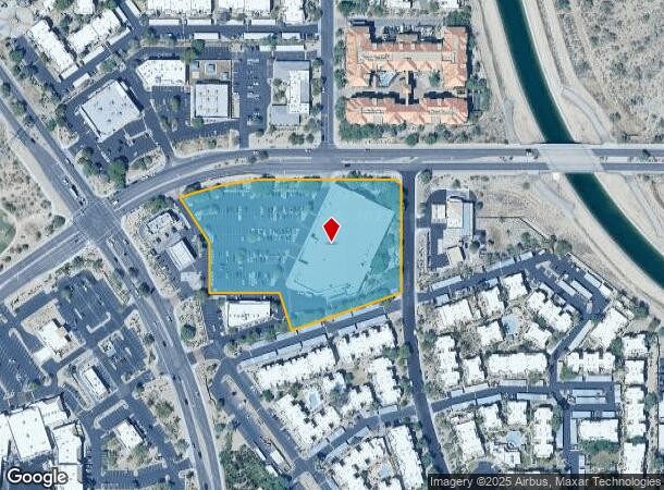
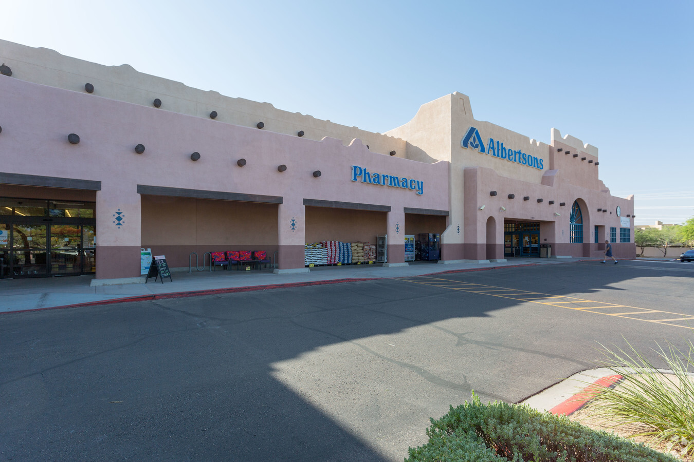
11475 E Via Linda
217-28-009X
Adobe Village
Regionalshoppingcenterormallwithanchorstore
PT N2 SW4 SEC 22 DAF COM CENTER SEC 22 TH W ALG N LN SW4 SD SEC 22 & C/L VIA LINDA DR 791.81F TH S 55F TO PT ON S R/W LN SD VIA LINDA DR & TPOB TH S 44D 48M E 21.21F TO PT ON W R/W LN 115TH ST TH S 315F TO BEG TAN CUR CONC TO E HAV RAD 1530F TH SLY A
X
Maricopa
04013C1780L
Arizona
2024
5.07 AC
2025
Central Scottsdale
216837
Phoenix
58,836 SF
Phoenix-Mesa-Scottsdale, AZ
DEMOGRAPHICS near 11475 E Via Linda
1 Mile
3 Mile
5 Mile
2024 Total Population
10,061
49,085
101,192
2029 Population
10,908
53,407
110,569
Pop Growth 2024-2029
+ 8.42%
+ 8.81%
+ 9.27%
Average Age
44
47
46
2024 Total Households
4,638
21,749
45,639
HH Growth 2024-2029
+ 8.43%
+ 9.04%
+ 9.43%
Median Household Inc
$96,373
$115,034
$113,321
Avg Household Size
2.10
2.20
2.20
2024 Avg HH Vehicles
2.00
2.00
2.00
Median Home Value
$668,210
$713,630
$708,003
Median Year Built
1989
1990
1991
Nearby Places
- Restaurants
- Banks
- Shops
- Fitness
- Groceries
PUBLIC TRANSPORTATION
AIRPORT
Phoenix Sky Harbor International
DRIVE
WALK
Distance
Phoenix Sky Harbor International
30 min
20.9 mi
Phoenix-Mesa Gateway
DRIVE
WALK
Distance
Phoenix-Mesa Gateway
50 min
35.9 mi
Freight Ports
Port of San Diego
DRIVE
WALK
Distance
Port of San Diego
425 min
386.5 mi
Nearby Properties
Address
Land Use
TOTAL SIZE
Lot Size
Zoning
Address
Land Use
TOTAL SIZE
Lot Size
Zoning
582,125 SF
74.02 AC
R-43
Address
Land Use
TOTAL SIZE
Lot Size
Zoning
701,903 SF
35.56 AC
C-T
Address
Land Use
TOTAL SIZE
Lot Size
Zoning
124,656 SF
160 AC
R-35
Address
Land Use
TOTAL SIZE
Lot Size
Zoning
380,106 SF
38.10 AC
C-T
Address
Land Use
TOTAL SIZE
Lot Size
Zoning
20,355 SF
38.96 AC
M-H
Address
Land Use
TOTAL SIZE
Lot Size
Zoning
206,966 SF
6 AC
C-T
Address
Land Use
TOTAL SIZE
Lot Size
Zoning
256,962 SF
5.20 AC
PF
Address
Land Use
TOTAL SIZE
Lot Size
Zoning
361,486 SF
16.92 AC
M-H
Address
Land Use
TOTAL SIZE
Lot Size
Zoning
184,912 SF
18.07 AC
PF
Address
Land Use
TOTAL SIZE
Lot Size
Zoning
63,321 SF
15.65 AC
R-10
Address
Land Use
TOTAL SIZE
Lot Size
Zoning
107,123 SF
8.54 AC
C-T
Address
Land Use
TOTAL SIZE
Lot Size
Zoning
292,054 SF
13.87 AC
M-H
Address
Land Use
TOTAL SIZE
Lot Size
Zoning
167,091 SF
7.44 AC
C-T
Address
Land Use
TOTAL SIZE
Lot Size
Zoning
73 AC
OS
Address
Land Use
TOTAL SIZE
Lot Size
Zoning
68,276 SF
6.19 AC
C-T
Address
Land Use
TOTAL SIZE
Lot Size
Zoning
110,358 SF
6.60 AC
C-C
Address
Land Use
TOTAL SIZE
Lot Size
Zoning
120,360 SF
8.59 AC
C-O
Address
Land Use
TOTAL SIZE
Lot Size
Zoning
73,950 SF
7.02 AC
Address
Land Use
TOTAL SIZE
Lot Size
Zoning
220,863 SF
11.50 AC
M-H
Address
Land Use
TOTAL SIZE
Lot Size
Zoning
247,990 SF
3.83 AC
M-H
Address
Land Use
TOTAL SIZE
Lot Size
Zoning
142,893 SF
6.09 AC
M-H
Address
Land Use
TOTAL SIZE
Lot Size
Zoning
81,720 SF
11.63 AC
PF
Address
Land Use
TOTAL SIZE
Lot Size
Zoning
165,002 SF
8.71 AC
M-H
Address
Land Use
TOTAL SIZE
Lot Size
Zoning
60,922 SF
8.94 AC
R-43
Address
Land Use
TOTAL SIZE
Lot Size
Zoning
192,752 SF
9.30 AC
M-H
Address
Land Use
TOTAL SIZE
Lot Size
Zoning
78,934 SF
0.73 AC
PF
Address
Land Use
TOTAL SIZE
Lot Size
Zoning
70,733 SF
8.18 AC
R-10
Address
Land Use
TOTAL SIZE
Lot Size
Zoning
33.56 AC
C-T
Address
Land Use
TOTAL SIZE
Lot Size
Zoning
80,757 SF
17 AC
R-35
Address
Land Use
TOTAL SIZE
Lot Size
Zoning
156,724 SF
8.11 AC
M-H
The World's #1 Commercial Real Estate Marketplace
Connect with us
© 2025 CoStar Group
The information above has been obtained from sources believed reliable. While we do not doubt its accuracy we have not verified it and make no guarantee, warranty or representation about it. It is your responsibility to independently confirm its accuracy and completeness. Any projections, opinions, assumptions, or estimates used are for example only and do not represent the current or future performance of the property. The value of this transaction to you depends on tax and other factors which should be evaluated by your tax, financial, and legal advisors. You and your advisors should conduct a careful, independent investigation of the property to determine to your satisfaction the suitability of the property for your needs.