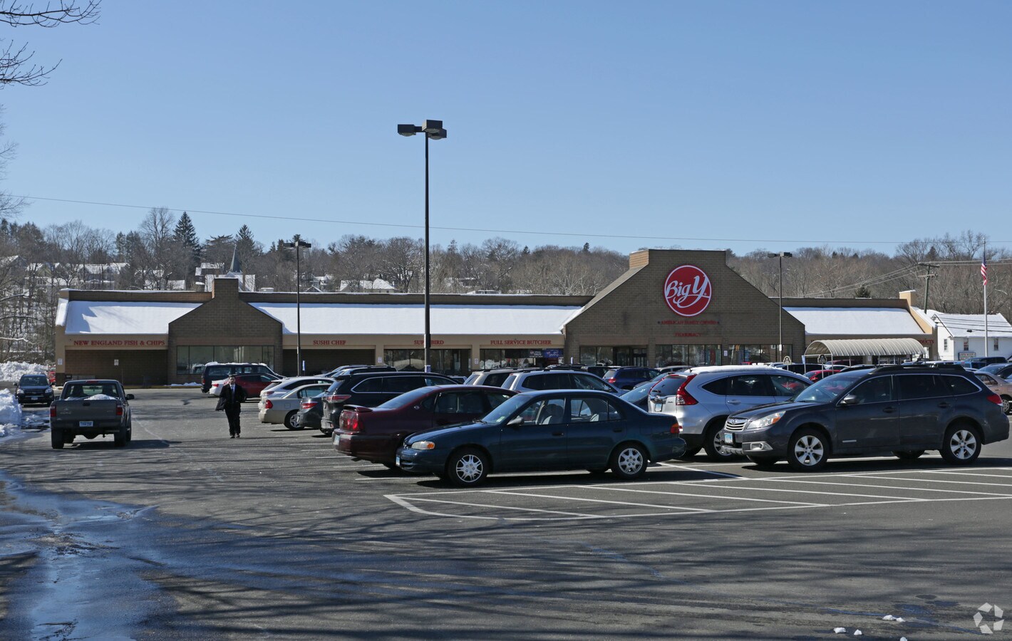
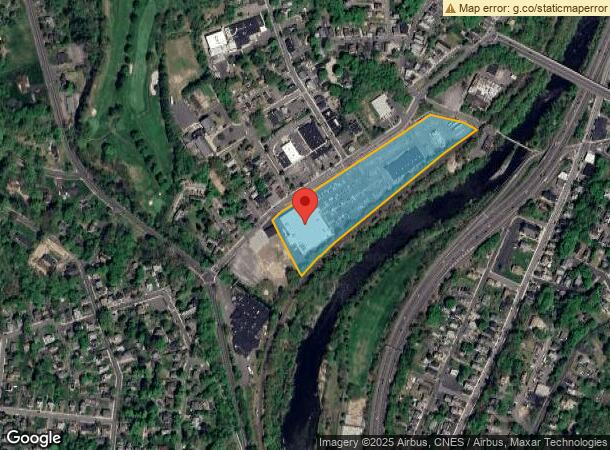
Property Record
115 Bridge St, Naugatuck, CT 06770

NEARBY LISTINGS FOR SALE OR LEASE
Property Detail
115 Bridge St
NAUG-000423-W000876
New Haven
Commercialnec
Connecticut
X
7970
09009C0118H
8.24 AC
2024
Naugatuck
2024
Westchester/So Connecticut
345100
New Haven-Milford, CT
DEMOGRAPHICS near 115 Bridge St
1 Mile
3 Mile
5 Mile
2024 Total Population
13,546
53,945
136,378
2029 Population
13,443
53,695
135,954
Pop Growth 2024-2029
(0.76%)
(0.46%)
(0.31%)
Average Age
40
40
39
2024 Total Households
5,443
21,131
53,151
HH Growth 2024-2029
(0.85%)
(0.56%)
(0.34%)
Median Household Inc
$79,050
$77,080
$62,323
Avg Household Size
2.40
2.50
2.50
2024 Avg HH Vehicles
2.00
2.00
2.00
Median Home Value
$195,850
$186,359
$199,219
Median Year Built
1957
1962
1960
Nearby Places
- Restaurants
- Banks
- Shops
- Fitness
- Groceries
PUBLIC TRANSPORTATION
COMMUTER RAIL
Naugatuck Station (New Haven Line - Metro-North Commuter Railroad Company (Metro-North))
DRIVE
WALK
Distance
Naugatuck Station (New Haven Line - Metro-North Commuter Railroad Company (Metro-North))
2 min
14 min
0.7 mi
Waterbury Station (New Haven Line - Metro-North Commuter Railroad Company (Metro-North))
DRIVE
WALK
Distance
Waterbury Station (New Haven Line - Metro-North Commuter Railroad Company (Metro-North))
9 min
5.0 mi
AIRPORT
Tweed/New Haven
DRIVE
WALK
Distance
Tweed/New Haven
40 min
24.2 mi
Freight Ports
Port of New Haven
DRIVE
WALK
Distance
Port of New Haven
35 min
21.3 mi
Nearby Properties
Address
Land Use
TOTAL SIZE
Lot Size
Zoning
Address
Land Use
TOTAL SIZE
Lot Size
Zoning
29.92 AC
IG
Address
Land Use
TOTAL SIZE
Lot Size
Zoning
149,058 SF
31.04 AC
RS-12
Address
Land Use
TOTAL SIZE
Lot Size
Zoning
17,181 SF
18.82 AC
R30
Address
Land Use
TOTAL SIZE
Lot Size
Zoning
268,279 SF
52.80 AC
RA1
Address
Land Use
TOTAL SIZE
Lot Size
Zoning
26.40 AC
RS-12
Address
Land Use
TOTAL SIZE
Lot Size
Zoning
63,288 SF
2.60 AC
RH
Address
Land Use
TOTAL SIZE
Lot Size
Zoning
14,607 SF
9.24 AC
R8
Address
Land Use
TOTAL SIZE
Lot Size
Zoning
145,226 SF
28.56 AC
R8
Address
Land Use
TOTAL SIZE
Lot Size
Zoning
Address
Land Use
TOTAL SIZE
Lot Size
Zoning
7.15 AC
RM
Address
Land Use
TOTAL SIZE
Lot Size
Zoning
13,440 SF
15.60 AC
RA1
Address
Land Use
TOTAL SIZE
Lot Size
Zoning
21.65 AC
Address
Land Use
TOTAL SIZE
Lot Size
Zoning
112,055 SF
14.19 AC
RA1
Address
Land Use
TOTAL SIZE
Lot Size
Zoning
5.40 AC
R15
Address
Land Use
TOTAL SIZE
Lot Size
Zoning
13,114 SF
7.70 AC
Address
Land Use
TOTAL SIZE
Lot Size
Zoning
46,302 SF
5 AC
R15
Address
Land Use
TOTAL SIZE
Lot Size
Zoning
8.19 AC
CA40
Address
Land Use
TOTAL SIZE
Lot Size
Zoning
52,250 SF
14.32 AC
RA1
Address
Land Use
TOTAL SIZE
Lot Size
Zoning
5.32 AC
RA1
Address
Land Use
TOTAL SIZE
Lot Size
Zoning
81,710 SF
10.86 AC
PD
Address
Land Use
TOTAL SIZE
Lot Size
Zoning
41,056 SF
6.17 AC
RA1
Address
Land Use
TOTAL SIZE
Lot Size
Zoning
59,580 SF
12.45 AC
R8
Address
Land Use
TOTAL SIZE
Lot Size
Zoning
214.78 AC
RS-12
Address
Land Use
TOTAL SIZE
Lot Size
Zoning
40,804 SF
1.90 AC
RL
Address
Land Use
TOTAL SIZE
Lot Size
Zoning
38,700 SF
1.31 AC
RL
Address
Land Use
TOTAL SIZE
Lot Size
Zoning
106,949 SF
16.50 AC
R15
Address
Land Use
TOTAL SIZE
Lot Size
Zoning
32,394 SF
5 AC
RL
Address
Land Use
TOTAL SIZE
Lot Size
Zoning
717.07 AC
RA1
Address
Land Use
TOTAL SIZE
Lot Size
Zoning
37,842 SF
9.07 AC
I1
The World's #1 Commercial Real Estate Marketplace
Connect with us
© 2025 CoStar Group
The information above has been obtained from sources believed reliable. While we do not doubt its accuracy we have not verified it and make no guarantee, warranty or representation about it. It is your responsibility to independently confirm its accuracy and completeness. Any projections, opinions, assumptions, or estimates used are for example only and do not represent the current or future performance of the property. The value of this transaction to you depends on tax and other factors which should be evaluated by your tax, financial, and legal advisors. You and your advisors should conduct a careful, independent investigation of the property to determine to your satisfaction the suitability of the property for your needs.