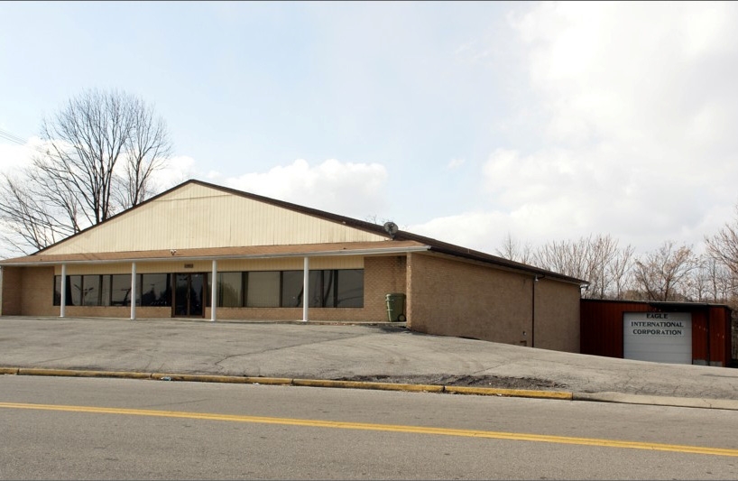
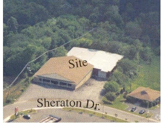
Property Record
115 Sheraton Dr, Salem, VA 24153
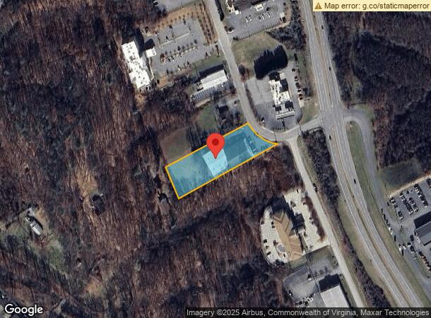
NEARBY LISTINGS FOR SALE OR LEASE
Property Detail
115 Sheraton Dr
5-1-3
Huffman
Religious
S PT TRACT 2 1.536 AC HUFFMAN PROP MASONS CREEK
X
Salem City
51161C0133G
Virginia
0
1.54 AC
2024
Northwest Roanoke
0101001000
Roanoke
17,000 SF
Roanoke, VA
DEMOGRAPHICS near 115 Sheraton Dr
1 Mile
3 Mile
5 Mile
2024 Total Population
3,321
33,395
91,052
2029 Population
3,374
33,545
90,688
Pop Growth 2024-2029
+ 1.60%
+ 0.45%
(0.40%)
Average Age
41
40
41
2024 Total Households
1,336
13,269
37,879
HH Growth 2024-2029
+ 1.65%
+ 0.51%
(0.40%)
Median Household Inc
$77,885
$57,428
$56,945
Avg Household Size
2.40
2.30
2.30
2024 Avg HH Vehicles
2.00
2.00
2.00
Median Home Value
$177,686
$183,716
$189,867
Median Year Built
1974
1969
1966
Nearby Places
- Restaurants
- Banks
- Shops
- Fitness
- Groceries
PUBLIC TRANSPORTATION
COMMUTER RAIL
Roanoke (Northeast Regional - Amtrak)
DRIVE
WALK
Distance
Roanoke (Northeast Regional - Amtrak)
14 min
9.2 mi
AIRPORT
Roanoke/Blacksburg Regional (Woodrum Field)
DRIVE
WALK
Distance
Roanoke/Blacksburg Regional (Woodrum Field)
14 min
7.3 mi
Freight Ports
Virginia Port Authority - Richmond
DRIVE
WALK
Distance
Virginia Port Authority - Richmond
216 min
191.2 mi
Nearby Properties
Address
Land Use
TOTAL SIZE
Lot Size
Zoning
Address
Land Use
TOTAL SIZE
Lot Size
Zoning
3,850 SF
60.20 AC
INPUD
Address
Land Use
TOTAL SIZE
Lot Size
Zoning
52.04 AC
CUDRSF
Address
Land Use
TOTAL SIZE
Lot Size
Zoning
69,111 SF
73.54 AC
HBD
Address
Land Use
TOTAL SIZE
Lot Size
Zoning
49,887 SF
2.28 AC
C1
Address
Land Use
TOTAL SIZE
Lot Size
Zoning
20,646 SF
23.33 AC
R2
Address
Land Use
TOTAL SIZE
Lot Size
Zoning
3.78 AC
CUD
Address
Land Use
TOTAL SIZE
Lot Size
Zoning
83,167 SF
9.75 AC
C1
Address
Land Use
TOTAL SIZE
Lot Size
Zoning
6.24 AC
RMF
Address
Land Use
TOTAL SIZE
Lot Size
Zoning
67,903 SF
11.96 AC
I2
Address
Land Use
TOTAL SIZE
Lot Size
Zoning
864,046 SF
56.04 AC
HM
Address
Land Use
TOTAL SIZE
Lot Size
Zoning
123,651 SF
29.38 AC
R2S
Address
Land Use
TOTAL SIZE
Lot Size
Zoning
65,428 SF
34.05 AC
C1
Address
Land Use
TOTAL SIZE
Lot Size
Zoning
720,088 SF
40.32 AC
HM
Address
Land Use
TOTAL SIZE
Lot Size
Zoning
7,590 SF
14.18 AC
RMF
Address
Land Use
TOTAL SIZE
Lot Size
Zoning
198,089 SF
46.65 AC
AD
Address
Land Use
TOTAL SIZE
Lot Size
Zoning
100 SF
60.09 AC
RSF
Address
Land Use
TOTAL SIZE
Lot Size
Zoning
55,360 SF
1.58 AC
RB
Address
Land Use
TOTAL SIZE
Lot Size
Zoning
12,018 SF
8.78 AC
RMF
Address
Land Use
TOTAL SIZE
Lot Size
Zoning
106,884 SF
16.20 AC
R1S
Address
Land Use
TOTAL SIZE
Lot Size
Zoning
72,042 SF
7.18 AC
C2
Address
Land Use
TOTAL SIZE
Lot Size
Zoning
2.13 AC
DBD
Address
Land Use
TOTAL SIZE
Lot Size
Zoning
110,250 SF
5.50 AC
CLS
Address
Land Use
TOTAL SIZE
Lot Size
Zoning
107,815 SF
19.84 AC
CLS
Address
Land Use
TOTAL SIZE
Lot Size
Zoning
24.54 AC
LM
Address
Land Use
TOTAL SIZE
Lot Size
Zoning
9,021 SF
8.90 AC
RMF
Address
Land Use
TOTAL SIZE
Lot Size
Zoning
5.76 AC
RMF
Address
Land Use
TOTAL SIZE
Lot Size
Zoning
63,191 SF
3.50 AC
HBD
Address
Land Use
TOTAL SIZE
Lot Size
Zoning
71,531 SF
1.77 AC
DBD
Address
Land Use
TOTAL SIZE
Lot Size
Zoning
160,039 SF
13.80 AC
HM
Address
Land Use
TOTAL SIZE
Lot Size
Zoning
84,476 SF
9.69 AC
HBD
The World's #1 Commercial Real Estate Marketplace
Connect with us
© 2025 CoStar Group
The information above has been obtained from sources believed reliable. While we do not doubt its accuracy we have not verified it and make no guarantee, warranty or representation about it. It is your responsibility to independently confirm its accuracy and completeness. Any projections, opinions, assumptions, or estimates used are for example only and do not represent the current or future performance of the property. The value of this transaction to you depends on tax and other factors which should be evaluated by your tax, financial, and legal advisors. You and your advisors should conduct a careful, independent investigation of the property to determine to your satisfaction the suitability of the property for your needs.