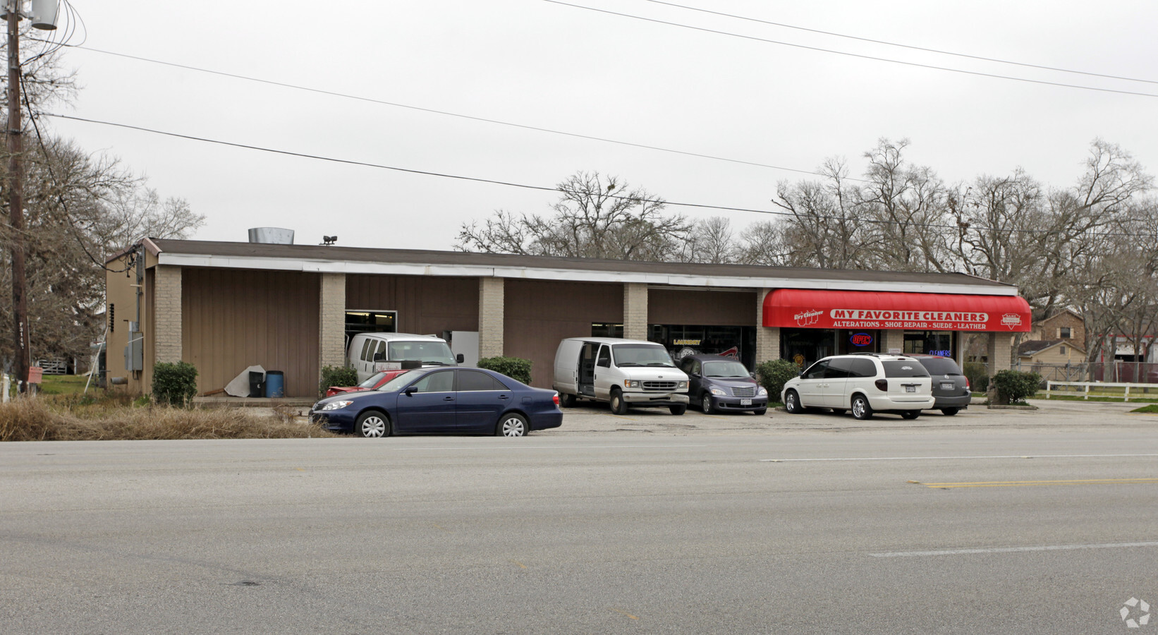
Property Record
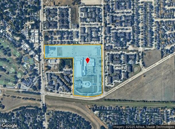
1150 Brand Ln, Stafford, TX 77477

NEARBY LISTINGS FOR SALE OR LEASE
Property Detail
1150 Brand Ln
7300-00-044-0000-907
Stafford Oaks
Taxexempt
STAFFORD OAKS, BLOCK 1, ACRES 23.829, RESTRICTED RESERVE A, BLOCK 1, PSM DEVELOPMENT REPLAT NO 1
X
Fort Bend
48157C0280L
Texas
2023
23.83 AC
2023
Stafford
671402
Houston
11,254 SF
Houston-The Woodlands-Sugar Land, TX
DEMOGRAPHICS near 1150 Brand Ln
1 Mile
3 Mile
5 Mile
2024 Total Population
15,633
89,746
294,307
2029 Population
18,644
107,100
338,246
Pop Growth 2024-2029
+ 19.26%
+ 19.34%
+ 14.93%
Average Age
39
41
39
2024 Total Households
5,696
33,600
101,868
HH Growth 2024-2029
+ 19.93%
+ 19.96%
+ 15.47%
Median Household Inc
$72,613
$76,447
$74,223
Avg Household Size
2.70
2.60
2.80
2024 Avg HH Vehicles
2.00
2.00
2.00
Median Home Value
$327,189
$290,474
$273,988
Median Year Built
1996
1989
1988
Nearby Places
- Restaurants
- Banks
- Shops
- Fitness
- Groceries
PUBLIC TRANSPORTATION
AIRPORT
William P Hobby
DRIVE
WALK
Distance
William P Hobby
36 min
22.2 mi
George Bush Intcntl/Houston
DRIVE
WALK
Distance
George Bush Intcntl/Houston
51 min
40.3 mi
Freight Ports
Port of Houston
DRIVE
WALK
Distance
Port of Houston
37 min
24.3 mi
Nearby Properties
Address
Land Use
TOTAL SIZE
Lot Size
Zoning
Address
Land Use
TOTAL SIZE
Lot Size
Zoning
1,039,730 SF
8.02 AC
Address
Land Use
TOTAL SIZE
Lot Size
Zoning
257,051 SF
64.85 AC
Address
Land Use
TOTAL SIZE
Lot Size
Zoning
12.98 AC
Address
Land Use
TOTAL SIZE
Lot Size
Zoning
637,364 SF
11.57 AC
YQ
Address
Land Use
TOTAL SIZE
Lot Size
Zoning
840,096 SF
8.98 AC
SYJ
Address
Land Use
TOTAL SIZE
Lot Size
Zoning
11.58 AC
Address
Land Use
TOTAL SIZE
Lot Size
Zoning
967,659 SF
75.03 AC
Address
Land Use
TOTAL SIZE
Lot Size
Zoning
699,266 SF
53.01 AC
Address
Land Use
TOTAL SIZE
Lot Size
Zoning
109,083 SF
20.81 AC
Address
Land Use
TOTAL SIZE
Lot Size
Zoning
221,618 SF
6.50 AC
Address
Land Use
TOTAL SIZE
Lot Size
Zoning
76,306 SF
15.84 AC
Address
Land Use
TOTAL SIZE
Lot Size
Zoning
218,755 SF
19.69 AC
MQY
Address
Land Use
TOTAL SIZE
Lot Size
Zoning
194,593 SF
2.29 AC
X
Address
Land Use
TOTAL SIZE
Lot Size
Zoning
12.08 AC
Address
Land Use
TOTAL SIZE
Lot Size
Zoning
49,976 SF
0.79 AC
X
Address
Land Use
TOTAL SIZE
Lot Size
Zoning
176,377 SF
40.40 AC
SM
Address
Land Use
TOTAL SIZE
Lot Size
Zoning
304,006 SF
11.14 AC
Address
Land Use
TOTAL SIZE
Lot Size
Zoning
76,385 SF
17.48 AC
Address
Land Use
TOTAL SIZE
Lot Size
Zoning
422,123 SF
39.85 AC
Address
Land Use
TOTAL SIZE
Lot Size
Zoning
129,813 SF
8.53 AC
Address
Land Use
TOTAL SIZE
Lot Size
Zoning
490,720 SF
26.78 AC
S
Address
Land Use
TOTAL SIZE
Lot Size
Zoning
85,273 SF
11.63 AC
Y
Address
Land Use
TOTAL SIZE
Lot Size
Zoning
127,458 SF
14.21 AC
Address
Land Use
TOTAL SIZE
Lot Size
Zoning
39.26 AC
Address
Land Use
TOTAL SIZE
Lot Size
Zoning
153,036 SF
0.93 AC
Address
Land Use
TOTAL SIZE
Lot Size
Zoning
329,954 SF
15.55 AC
SH
Address
Land Use
TOTAL SIZE
Lot Size
Zoning
254,210 SF
10.59 AC
JT
Address
Land Use
TOTAL SIZE
Lot Size
Zoning
84,509 SF
13.06 AC
Y
Address
Land Use
TOTAL SIZE
Lot Size
Zoning
88,682 SF
10.52 AC
ASY
The World's #1 Commercial Real Estate Marketplace
Connect with us
© 2025 CoStar Group
The information above has been obtained from sources believed reliable. While we do not doubt its accuracy we have not verified it and make no guarantee, warranty or representation about it. It is your responsibility to independently confirm its accuracy and completeness. Any projections, opinions, assumptions, or estimates used are for example only and do not represent the current or future performance of the property. The value of this transaction to you depends on tax and other factors which should be evaluated by your tax, financial, and legal advisors. You and your advisors should conduct a careful, independent investigation of the property to determine to your satisfaction the suitability of the property for your needs.