Property Record
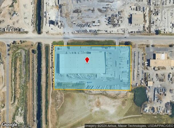
1155 W 2300 N, Salt Lake City, UT 84116


NEARBY LISTINGS FOR SALE OR LEASE
Property Detail
1155 W 2300 N
08-14-300-026-0000
Minor Subdivision
Lightindustrial
BEG N 0^3430 E 1357.41 FT ALG SECTION LINE TO S LINE OF 2300 N STREET & S 89^5230 E 190.92 FT FR SW COR SEC 14, T 1N, R 1W, SLM; S 89^5230 E 800 FT; S 0^34 26 W 462.42 FT; N 89^0321 W 800 FT; N 0^3430 E 450.98 FT TO BEG. 8.4AC M OR L. 7517-0555 8025-
X
Salt Lake
49035C0133G
Utah
2023
8.40 AC
2023
Airport
114700
Salt Lake City
103,724 SF
Salt Lake City, UT
DEMOGRAPHICS near 1155 W 2300 N
1 Mile
3 Mile
5 Mile
2024 Total Population
244
54,280
157,369
2029 Population
246
56,085
163,059
Pop Growth 2024-2029
+ 0.82%
+ 3.33%
+ 3.62%
Average Age
36
35
36
2024 Total Households
78
18,461
63,807
HH Growth 2024-2029
+ 1.28%
+ 3.48%
+ 3.90%
Median Household Inc
$62,250
$68,773
$64,696
Avg Household Size
2.90
2.80
2.40
2024 Avg HH Vehicles
2.00
2.00
2.00
Median Home Value
$361,111
$375,452
$422,370
Median Year Built
1973
1985
1980
Nearby Places
- Restaurants
- Banks
- Shops
- Fitness
- Groceries
PUBLIC TRANSPORTATION
COMMUTER RAIL
Warm Springs Relief Point (FrontRunner - Utah Transit Authority (UTA))
DRIVE
WALK
Distance
Warm Springs Relief Point (FrontRunner - Utah Transit Authority (UTA))
8 min
3.2 mi
North Temple Station (FrontRunner - Utah Transit Authority (UTA))
DRIVE
WALK
Distance
North Temple Station (FrontRunner - Utah Transit Authority (UTA))
8 min
4.1 mi
AIRPORT
Salt Lake City International
DRIVE
WALK
Distance
Salt Lake City International
14 min
9.1 mi
Freight Ports
Port of Stockton
DRIVE
WALK
Distance
Port of Stockton
714 min
699.5 mi
Nearby Properties
Address
Land Use
TOTAL SIZE
Lot Size
Zoning
Address
Land Use
TOTAL SIZE
Lot Size
Zoning
243,202 SF
18.71 AC
BP
Address
Land Use
TOTAL SIZE
Lot Size
Zoning
1,111,969 SF
53.87 AC
B-P
Address
Land Use
TOTAL SIZE
Lot Size
Zoning
187,682 SF
20.46 AC
M-2
Address
Land Use
TOTAL SIZE
Lot Size
Zoning
248,345 SF
50 AC
PL
Address
Land Use
TOTAL SIZE
Lot Size
Zoning
127,348 SF
4.55 AC
BP
Address
Land Use
TOTAL SIZE
Lot Size
Zoning
622,652 SF
2.08 AC
R-MU
Address
Land Use
TOTAL SIZE
Lot Size
Zoning
111,100 SF
7.49 AC
RMF-35
Address
Land Use
TOTAL SIZE
Lot Size
Zoning
218,427 SF
21.65 AC
M-1
Address
Land Use
TOTAL SIZE
Lot Size
Zoning
74,454 SF
12.17 AC
RMF-30
Address
Land Use
TOTAL SIZE
Lot Size
Zoning
380,631 SF
20.34 AC
BP
Address
Land Use
TOTAL SIZE
Lot Size
Zoning
341,830 SF
17.75 AC
BP
Address
Land Use
TOTAL SIZE
Lot Size
Zoning
155,080 SF
8.47 AC
4144
Address
Land Use
TOTAL SIZE
Lot Size
Zoning
47,553 SF
5.58 AC
TSAMUE
Address
Land Use
TOTAL SIZE
Lot Size
Zoning
87,913 SF
18.05 AC
PL
Address
Land Use
TOTAL SIZE
Lot Size
Zoning
463,000 SF
25.21 AC
B-P
Address
Land Use
TOTAL SIZE
Lot Size
Zoning
307,112 SF
15.21 AC
M-1
Address
Land Use
TOTAL SIZE
Lot Size
Zoning
102,025 SF
10.33 AC
IP-M-1
Address
Land Use
TOTAL SIZE
Lot Size
Zoning
247,240 SF
15.06 AC
1205
Address
Land Use
TOTAL SIZE
Lot Size
Zoning
121,083 SF
9.66 AC
IP-M-1
Address
Land Use
TOTAL SIZE
Lot Size
Zoning
6,673 SF
345.82 AC
Address
Land Use
TOTAL SIZE
Lot Size
Zoning
186,948 SF
12.03 AC
IP-M-1
Address
Land Use
TOTAL SIZE
Lot Size
Zoning
21,166 SF
2.30 AC
2300
Address
Land Use
TOTAL SIZE
Lot Size
Zoning
132.55 AC
6192
Address
Land Use
TOTAL SIZE
Lot Size
Zoning
181,565 SF
11.31 AC
M-1
Address
Land Use
TOTAL SIZE
Lot Size
Zoning
4,241 SF
8.67 AC
P
Address
Land Use
TOTAL SIZE
Lot Size
Zoning
194,246 SF
14.97 AC
IP-M-1
Address
Land Use
TOTAL SIZE
Lot Size
Zoning
62,831 SF
7.62 AC
RMF35
Address
Land Use
TOTAL SIZE
Lot Size
Zoning
3,026 SF
14.42 AC
P
Address
Land Use
TOTAL SIZE
Lot Size
Zoning
13,126 SF
7.83 AC
P
Address
Land Use
TOTAL SIZE
Lot Size
Zoning
33,733 SF
2.95 AC
TSAMUE
The World's #1 Commercial Real Estate Marketplace
Connect with us
© 2025 CoStar Group
The information above has been obtained from sources believed reliable. While we do not doubt its accuracy we have not verified it and make no guarantee, warranty or representation about it. It is your responsibility to independently confirm its accuracy and completeness. Any projections, opinions, assumptions, or estimates used are for example only and do not represent the current or future performance of the property. The value of this transaction to you depends on tax and other factors which should be evaluated by your tax, financial, and legal advisors. You and your advisors should conduct a careful, independent investigation of the property to determine to your satisfaction the suitability of the property for your needs.