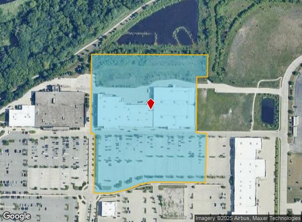
Property Record
1160 W Sunset Dr, Waukesha, WI 53189

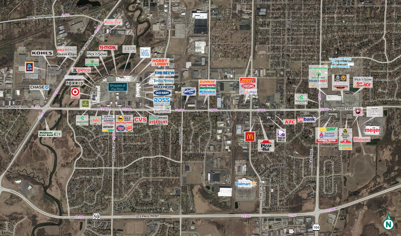
NEARBY LISTINGS FOR SALE OR LEASE
Property Detail
1160 W Sunset Dr
Milwaukee-Waukesha-West Allis, WI
LOT 1 CSM NO 11321 (V112 CSM P37) PT NW1/4 & SW1/4 OF SE1/4 SEC 9 T6N R19E 11.11 AC DOC NO 4386176
WAKC-1332-015
Waukesha
Commercialnec
Wisconsin
X
1
55133C0307H
11.11 AC
2023
Central Waukesha
2023
Milwaukee/Madison
202301
DEMOGRAPHICS near 1160 W Sunset Dr
1 Mile
3 Mile
5 Mile
2024 Total Population
7,476
67,080
94,656
2029 Population
7,778
69,453
97,773
Pop Growth 2024-2029
+ 4.04%
+ 3.54%
+ 3.29%
Average Age
40
40
41
2024 Total Households
3,169
28,016
39,862
HH Growth 2024-2029
+ 4.26%
+ 3.70%
+ 3.40%
Median Household Inc
$71,207
$76,068
$79,120
Avg Household Size
2.20
2.30
2.30
2024 Avg HH Vehicles
2.00
2.00
2.00
Median Home Value
$260,951
$259,475
$277,237
Median Year Built
1977
1977
1979
Nearby Places
- Restaurants
- Banks
- Shops
- Fitness
- Groceries
PUBLIC TRANSPORTATION
AIRPORT
General Mitchell International
DRIVE
WALK
Distance
General Mitchell International
40 min
25.4 mi
Freight Ports
Port Milwaukee
DRIVE
WALK
Distance
Port Milwaukee
38 min
22.9 mi
SALE & LEASE HISTORY
LISTING DATE
SALE/LEASE

Nov 29, 2017
For Lease
Nearby Properties
Address
Land Use
TOTAL SIZE
Lot Size
Zoning
Address
Land Use
TOTAL SIZE
Lot Size
Zoning
23.09 AC
B-1(PUD),C
Address
Land Use
TOTAL SIZE
Lot Size
Zoning
21.73 AC
M-1
Address
Land Use
TOTAL SIZE
Lot Size
Zoning
71.18 AC
M-2
Address
Land Use
TOTAL SIZE
Lot Size
Zoning
68,591 SF
2.97 AC
RM-3(PUD)
Address
Land Use
TOTAL SIZE
Lot Size
Zoning
51,676 SF
7.41 AC
RM-3(PUD)
Address
Land Use
TOTAL SIZE
Lot Size
Zoning
51,676 SF
6.96 AC
RM-3(PUD)
Address
Land Use
TOTAL SIZE
Lot Size
Zoning
91,322 SF
8.48 AC
B-4
Address
Land Use
TOTAL SIZE
Lot Size
Zoning
110,992 SF
12.15 AC
RM-1(PUD)
Address
Land Use
TOTAL SIZE
Lot Size
Zoning
187,050 SF
24.37 AC
B-5, C-1
Address
Land Use
TOTAL SIZE
Lot Size
Zoning
61,299 SF
6.59 AC
RM-2(PUD)
Address
Land Use
TOTAL SIZE
Lot Size
Zoning
28,942 SF
2.31 AC
B-3(22.52)
Address
Land Use
TOTAL SIZE
Lot Size
Zoning
79,529 SF
23.86 AC
I-1
Address
Land Use
TOTAL SIZE
Lot Size
Zoning
29.41 AC
B-5(PUD)
Address
Land Use
TOTAL SIZE
Lot Size
Zoning
4.22 AC
B-5(PUD)
Address
Land Use
TOTAL SIZE
Lot Size
Zoning
24,981 SF
1.79 AC
B-3(22.52)
Address
Land Use
TOTAL SIZE
Lot Size
Zoning
11.55 AC
M-1
Address
Land Use
TOTAL SIZE
Lot Size
Zoning
102,333 SF
11.99 AC
B-5(PUD)
Address
Land Use
TOTAL SIZE
Lot Size
Zoning
0.82 AC
B-2
Address
Land Use
TOTAL SIZE
Lot Size
Zoning
47,353 SF
5.41 AC
RM-2(PUD)
Address
Land Use
TOTAL SIZE
Lot Size
Zoning
111,624 SF
12.91 AC
RM-3(PUD)
Address
Land Use
TOTAL SIZE
Lot Size
Zoning
10.31 AC
B-5
Address
Land Use
TOTAL SIZE
Lot Size
Zoning
36,054 SF
10.63 AC
I-1
Address
Land Use
TOTAL SIZE
Lot Size
Zoning
1.74 AC
RM-3(PUD)
Address
Land Use
TOTAL SIZE
Lot Size
Zoning
4.50 AC
B-5(PUD)
Address
Land Use
TOTAL SIZE
Lot Size
Zoning
24,684 SF
1.56 AC
RM-3(PUD)
Address
Land Use
TOTAL SIZE
Lot Size
Zoning
132,634 SF
9.25 AC
B-5(PUD)
Address
Land Use
TOTAL SIZE
Lot Size
Zoning
65,173 SF
3.83 AC
I-1
Address
Land Use
TOTAL SIZE
Lot Size
Zoning
16.10 AC
M-2
Address
Land Use
TOTAL SIZE
Lot Size
Zoning
9.63 AC
B-5(PUD)
The World's #1 Commercial Real Estate Marketplace
Connect with us
© 2025 CoStar Group
The information above has been obtained from sources believed reliable. While we do not doubt its accuracy we have not verified it and make no guarantee, warranty or representation about it. It is your responsibility to independently confirm its accuracy and completeness. Any projections, opinions, assumptions, or estimates used are for example only and do not represent the current or future performance of the property. The value of this transaction to you depends on tax and other factors which should be evaluated by your tax, financial, and legal advisors. You and your advisors should conduct a careful, independent investigation of the property to determine to your satisfaction the suitability of the property for your needs.