Property Record
1161 New Britain Ave, West Hartford, CT 06110
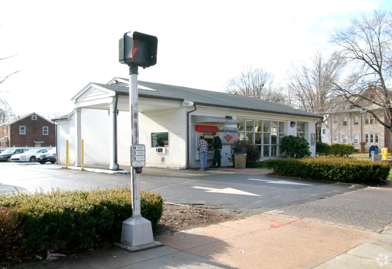
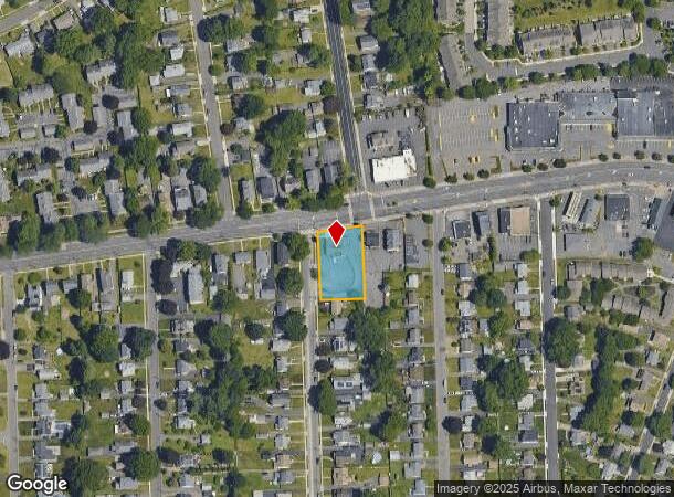

This Property Is For Sale
NEARBY LISTINGS FOR SALE OR LEASE
Property Detail
1161 New Britain Ave
WHAR-000014G-003771-001161
Hartford
Commercialbuilding
Connecticut
X
1161
09003C0501F
0.61 AC
2024
West Hartford
2024
Hartford
496200
Hartford-West Hartford-East Hartford, CT
3,505 SF
DEMOGRAPHICS near 1161 New Britain Ave
1 Mile
3 Mile
5 Mile
2024 Total Population
9,609
114,894
274,393
2029 Population
9,509
113,705
272,548
Pop Growth 2024-2029
(1.04%)
(1.03%)
(0.67%)
Average Age
41
40
39
2024 Total Households
3,984
46,669
110,420
HH Growth 2024-2029
(1.03%)
(1.10%)
(0.59%)
Median Household Inc
$85,929
$72,598
$64,524
Avg Household Size
2.40
2.30
2.30
2024 Avg HH Vehicles
2.00
2.00
1.00
Median Home Value
$255,384
$273,496
$270,840
Median Year Built
1954
1953
1956
Nearby Places
- Restaurants
- Banks
- Shops
- Fitness
- Groceries
PUBLIC TRANSPORTATION
COMMUTER RAIL
Hartford (Hartford Line - Hartford Line)
DRIVE
WALK
Distance
Hartford (Hartford Line - Hartford Line)
8 min
4.4 mi
Hartford Amtrak Station (Amtrak Hartford Line - Amtrak, Northeast Regional - Amtrak, Valley Flyer - Amtrak, Vermonter - Amtrak)
DRIVE
WALK
Distance
Hartford Amtrak Station (Amtrak Hartford Line - Amtrak, Northeast Regional - Amtrak, Valley Flyer - Amtrak, Vermonter - Amtrak)
9 min
4.6 mi
AIRPORT
Bradley International
DRIVE
WALK
Distance
Bradley International
40 min
22.0 mi
Freight Ports
Port of New Haven
DRIVE
WALK
Distance
Port of New Haven
50 min
35.2 mi
Nearby Properties
Address
Land Use
TOTAL SIZE
Lot Size
Zoning
Address
Land Use
TOTAL SIZE
Lot Size
Zoning
31.46 AC
CAMP
Address
Land Use
TOTAL SIZE
Lot Size
Zoning
516,804 SF
32.98 AC
CAMP
Address
Land Use
TOTAL SIZE
Lot Size
Zoning
284,432 SF
32.12 AC
PL
Address
Land Use
TOTAL SIZE
Lot Size
Zoning
261,072 SF
44.47 AC
PL
Address
Land Use
TOTAL SIZE
Lot Size
Zoning
3,605 SF
28.33 AC
R-6,RM
Address
Land Use
TOTAL SIZE
Lot Size
Zoning
20.61 AC
R-10,S
Address
Land Use
TOTAL SIZE
Lot Size
Zoning
416,762 SF
20 AC
CAMP
Address
Land Use
TOTAL SIZE
Lot Size
Zoning
14.56 AC
SDD/BG
Address
Land Use
TOTAL SIZE
Lot Size
Zoning
20.41 AC
MX-2
Address
Land Use
TOTAL SIZE
Lot Size
Zoning
23.62 AC
A3
Address
Land Use
TOTAL SIZE
Lot Size
Zoning
112,975 SF
11.44 AC
RM-3
Address
Land Use
TOTAL SIZE
Lot Size
Zoning
9,238 SF
28.35 AC
R-10,R
Address
Land Use
TOTAL SIZE
Lot Size
Zoning
223,885 SF
43.33 AC
CAMP
Address
Land Use
TOTAL SIZE
Lot Size
Zoning
13.13 AC
SDD/BG
Address
Land Use
TOTAL SIZE
Lot Size
Zoning
3.41 AC
BC,RP
Address
Land Use
TOTAL SIZE
Lot Size
Zoning
86,600 SF
20.05 AC
R-6
Address
Land Use
TOTAL SIZE
Lot Size
Zoning
16.94 AC
C1
Address
Land Use
TOTAL SIZE
Lot Size
Zoning
126.75 AC
OS
Address
Land Use
TOTAL SIZE
Lot Size
Zoning
215,215 SF
42 AC
R-10,R
Address
Land Use
TOTAL SIZE
Lot Size
Zoning
3,416 SF
19.31 AC
SRD
Address
Land Use
TOTAL SIZE
Lot Size
Zoning
171,729 SF
80.59 AC
R-12/
Address
Land Use
TOTAL SIZE
Lot Size
Zoning
2.84 AC
CBDH
Address
Land Use
TOTAL SIZE
Lot Size
Zoning
8.87 AC
BS,R-1
Address
Land Use
TOTAL SIZE
Lot Size
Zoning
638,979 SF
MX-2
Address
Land Use
TOTAL SIZE
Lot Size
Zoning
Address
Land Use
TOTAL SIZE
Lot Size
Zoning
3.21 AC
MX-2
Address
Land Use
TOTAL SIZE
Lot Size
Zoning
111,532 SF
12.50 AC
R-12
Address
Land Use
TOTAL SIZE
Lot Size
Zoning
141,200 SF
5.56 AC
MX-2
Address
Land Use
TOTAL SIZE
Lot Size
Zoning
13.43 AC
SDD/BG
Address
Land Use
TOTAL SIZE
Lot Size
Zoning
5.23 AC
MS-1
The World's #1 Commercial Real Estate Marketplace
Connect with us
© 2025 CoStar Group
The information above has been obtained from sources believed reliable. While we do not doubt its accuracy we have not verified it and make no guarantee, warranty or representation about it. It is your responsibility to independently confirm its accuracy and completeness. Any projections, opinions, assumptions, or estimates used are for example only and do not represent the current or future performance of the property. The value of this transaction to you depends on tax and other factors which should be evaluated by your tax, financial, and legal advisors. You and your advisors should conduct a careful, independent investigation of the property to determine to your satisfaction the suitability of the property for your needs.