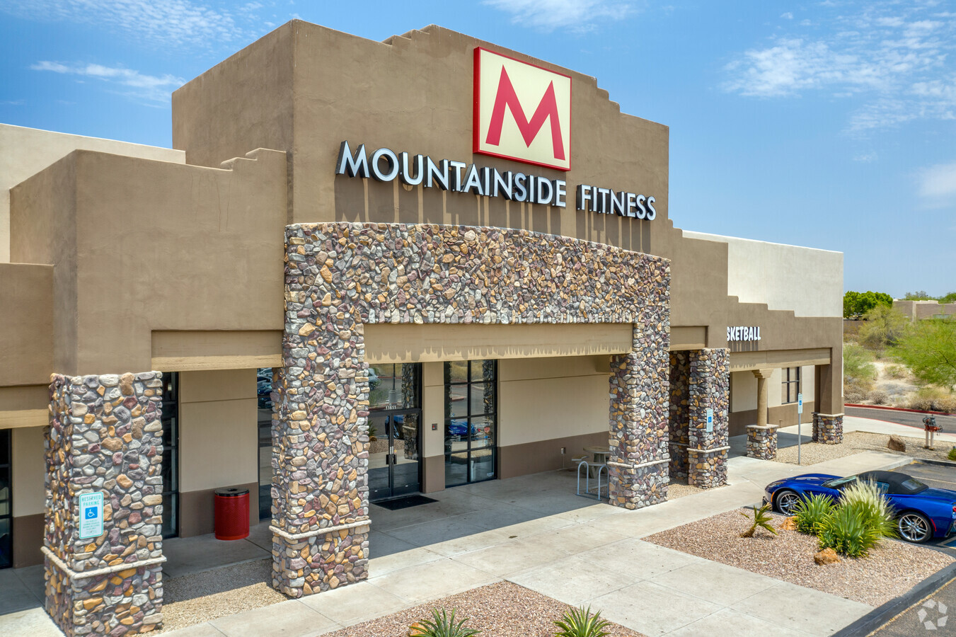
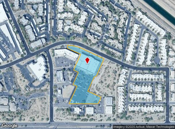
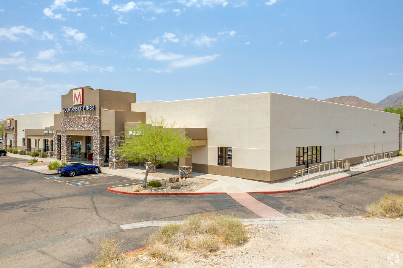
Property Record
11611 E Sahuaro Dr, Scottsdale, AZ 85259
NEARBY LISTINGS FOR SALE OR LEASE
Property Detail
11611 E Sahuaro Dr
Phoenix-Mesa-Scottsdale, AZ
Mountainside Plaza
217-28-985
MOUNTAINSIDE PLAZA MCR 632-30
Gymhealthspa
Maricopa
X
Arizona
04013C1780L
2
2024
3.45 AC
2025
Central Scottsdale
216837
Phoenix
35,915 SF
DEMOGRAPHICS near 11611 E Sahuaro Dr
1 Mile
3 Mile
5 Mile
2024 Total Population
10,376
40,894
97,683
2029 Population
11,256
44,518
106,687
Pop Growth 2024-2029
+ 8.48%
+ 8.86%
+ 9.22%
Average Age
45
47
47
2024 Total Households
4,742
17,816
44,168
HH Growth 2024-2029
+ 8.50%
+ 9.08%
+ 9.38%
Median Household Inc
$99,696
$119,907
$111,640
Avg Household Size
2.20
2.20
2.20
2024 Avg HH Vehicles
2.00
2.00
2.00
Median Home Value
$702,131
$742,550
$702,893
Median Year Built
1991
1990
1991
Nearby Places
- Restaurants
- Banks
- Shops
- Fitness
- Groceries
PUBLIC TRANSPORTATION
AIRPORT
Phoenix Sky Harbor International
DRIVE
WALK
Distance
Phoenix Sky Harbor International
31 min
21.1 mi
Phoenix-Mesa Gateway
DRIVE
WALK
Distance
Phoenix-Mesa Gateway
50 min
36.1 mi
Freight Ports
Port of San Diego
DRIVE
WALK
Distance
Port of San Diego
425 min
386.6 mi
Nearby Properties
Address
Land Use
TOTAL SIZE
Lot Size
Zoning
Address
Land Use
TOTAL SIZE
Lot Size
Zoning
582,125 SF
74.02 AC
R-43
Address
Land Use
TOTAL SIZE
Lot Size
Zoning
701,903 SF
35.56 AC
C-T
Address
Land Use
TOTAL SIZE
Lot Size
Zoning
124,656 SF
160 AC
R-35
Address
Land Use
TOTAL SIZE
Lot Size
Zoning
380,106 SF
38.10 AC
C-T
Address
Land Use
TOTAL SIZE
Lot Size
Zoning
206,966 SF
6 AC
C-T
Address
Land Use
TOTAL SIZE
Lot Size
Zoning
63,321 SF
15.65 AC
R-10
Address
Land Use
TOTAL SIZE
Lot Size
Zoning
292,054 SF
13.87 AC
M-H
Address
Land Use
TOTAL SIZE
Lot Size
Zoning
167,091 SF
7.44 AC
C-T
Address
Land Use
TOTAL SIZE
Lot Size
Zoning
73 AC
OS
Address
Land Use
TOTAL SIZE
Lot Size
Zoning
68,276 SF
6.19 AC
C-T
Address
Land Use
TOTAL SIZE
Lot Size
Zoning
120,360 SF
8.59 AC
C-O
Address
Land Use
TOTAL SIZE
Lot Size
Zoning
73,950 SF
7.02 AC
Address
Land Use
TOTAL SIZE
Lot Size
Zoning
220,863 SF
11.50 AC
M-H
Address
Land Use
TOTAL SIZE
Lot Size
Zoning
247,990 SF
3.83 AC
M-H
Address
Land Use
TOTAL SIZE
Lot Size
Zoning
142,893 SF
6.09 AC
M-H
Address
Land Use
TOTAL SIZE
Lot Size
Zoning
165,002 SF
8.71 AC
M-H
Address
Land Use
TOTAL SIZE
Lot Size
Zoning
60,922 SF
8.94 AC
R-43
Address
Land Use
TOTAL SIZE
Lot Size
Zoning
192,752 SF
9.30 AC
M-H
Address
Land Use
TOTAL SIZE
Lot Size
Zoning
70,733 SF
8.18 AC
R-10
Address
Land Use
TOTAL SIZE
Lot Size
Zoning
33.56 AC
C-T
Address
Land Use
TOTAL SIZE
Lot Size
Zoning
80,757 SF
17 AC
R-35
Address
Land Use
TOTAL SIZE
Lot Size
Zoning
156,724 SF
8.11 AC
M-H
Address
Land Use
TOTAL SIZE
Lot Size
Zoning
71,560 SF
20.08 AC
R-10
Address
Land Use
TOTAL SIZE
Lot Size
Zoning
89,206 SF
10.83 AC
Address
Land Use
TOTAL SIZE
Lot Size
Zoning
151,641 SF
9.64 AC
M-H
Address
Land Use
TOTAL SIZE
Lot Size
Zoning
145,164 SF
8.66 AC
M-H
Address
Land Use
TOTAL SIZE
Lot Size
Zoning
66,747 SF
2.52 AC
C-T
Address
Land Use
TOTAL SIZE
Lot Size
Zoning
378 SF
30.48 AC
R-7
Address
Land Use
TOTAL SIZE
Lot Size
Zoning
127,975 SF
6.82 AC
C4
Address
Land Use
TOTAL SIZE
Lot Size
Zoning
74,891 SF
4.66 AC
R-43
The World's #1 Commercial Real Estate Marketplace
Connect with us
© 2025 CoStar Group
The information above has been obtained from sources believed reliable. While we do not doubt its accuracy we have not verified it and make no guarantee, warranty or representation about it. It is your responsibility to independently confirm its accuracy and completeness. Any projections, opinions, assumptions, or estimates used are for example only and do not represent the current or future performance of the property. The value of this transaction to you depends on tax and other factors which should be evaluated by your tax, financial, and legal advisors. You and your advisors should conduct a careful, independent investigation of the property to determine to your satisfaction the suitability of the property for your needs.