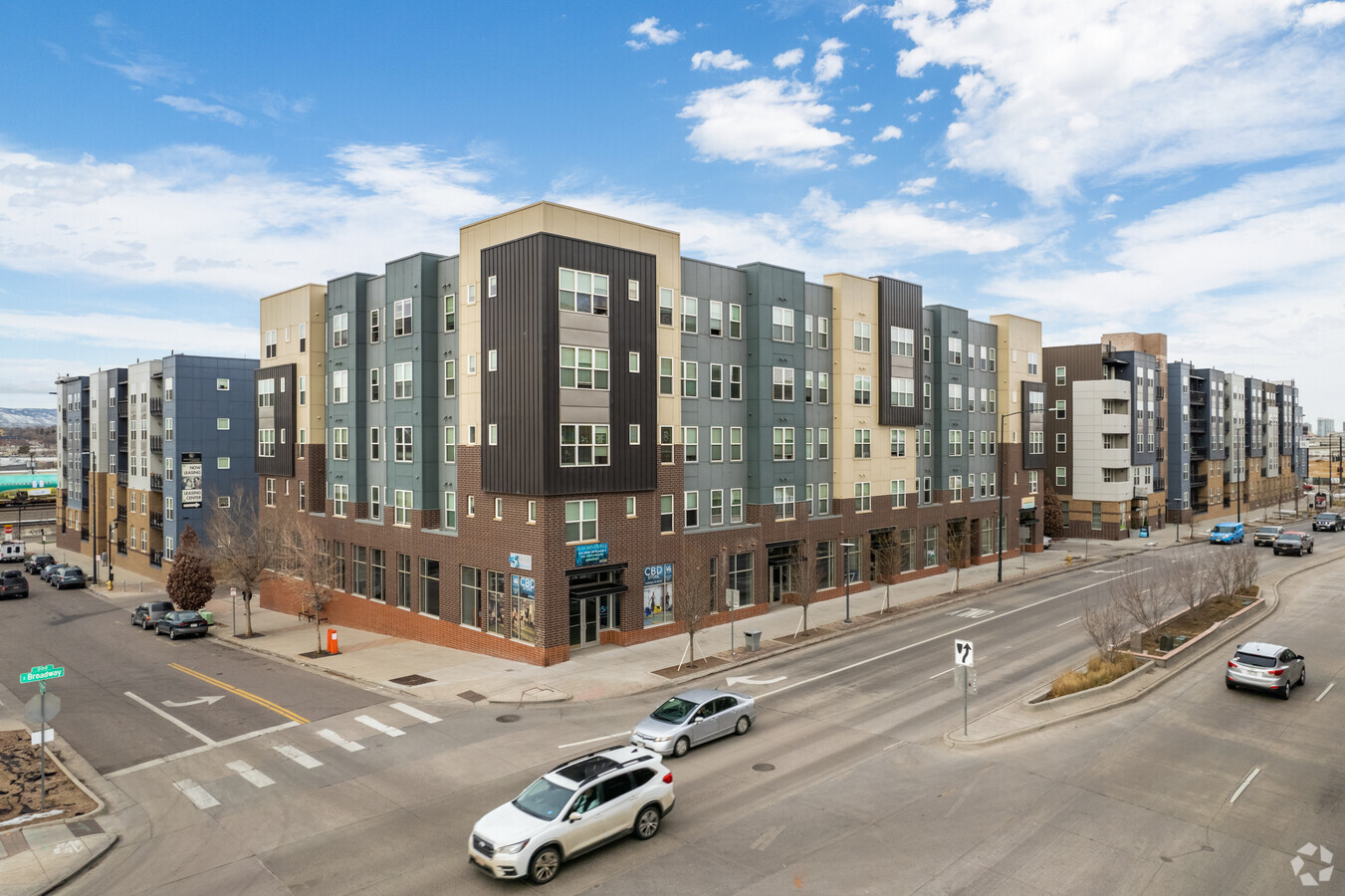
Property Record
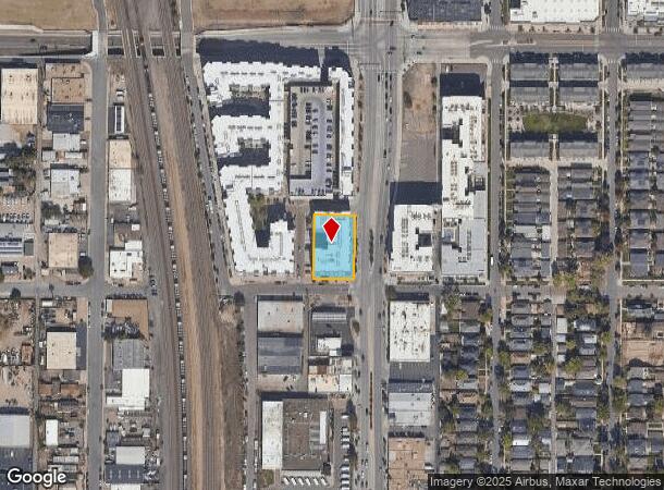
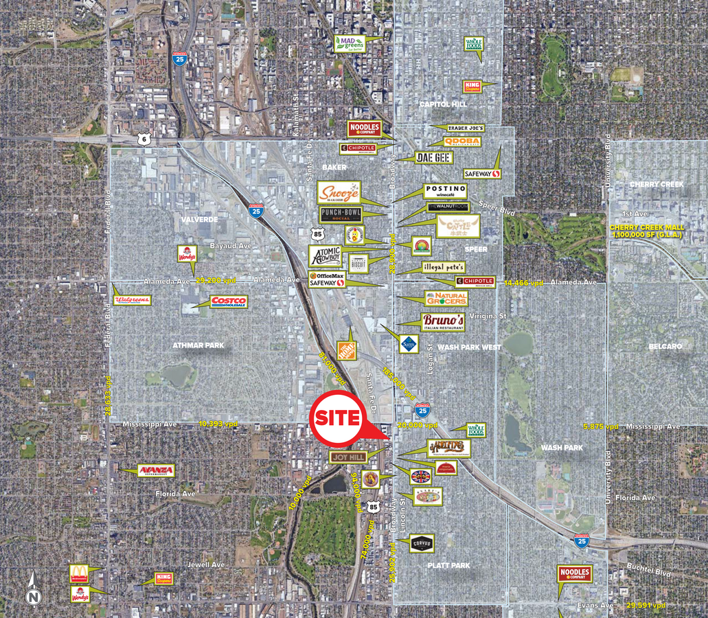
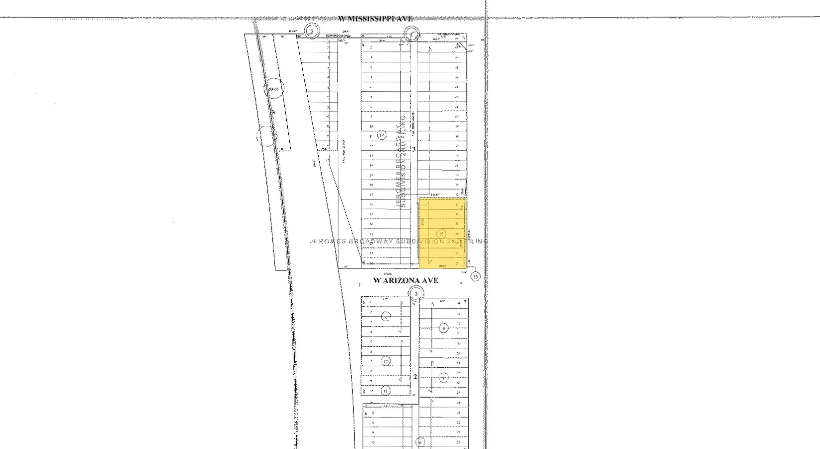
1165 S Broadway, Denver, CO 80210
Current Lease Availabilities
NEARBY LISTINGS FOR SALE OR LEASE
Property Detail
1165 S Broadway
Denver
Gates Condo
Denver-Aurora-Lakewood, CO
RESERVE AT GATES CONDOS RESIDENTIAL UNIT COM N/4 COR SEC S 81.62FT W 50FT S 319.95FT C/L 56.67FT TPOB TH C/L 44.4FT S133.67FT W 112.62FT N 178.52FT E 113.83FT TPOB
5222-02-016
Denver
Governmentalpublicusegeneral
Colorado
0
5
2023
0.36 AC
001403
Overland
48,329 SF
DEMOGRAPHICS near 1165 S Broadway
1 Mile
3 Mile
5 Mile
2024 Total Population
15,324
195,869
518,322
2029 Population
15,340
197,865
524,265
Pop Growth 2024-2029
+ 0.10%
+ 1.02%
+ 1.15%
Average Age
37
38
38
2024 Total Households
7,203
92,601
244,818
HH Growth 2024-2029
(0.29%)
+ 1.13%
+ 1.29%
Median Household Inc
$108,558
$79,745
$80,607
Avg Household Size
2.10
2.00
2.00
2024 Avg HH Vehicles
2.00
2.00
2.00
Median Home Value
$786,821
$663,663
$614,318
Median Year Built
1949
1964
1969
Nearby Places
- Restaurants
- Banks
- Shops
- Fitness
- Groceries
PUBLIC TRANSPORTATION
TRANSIT/SUBWAY
I-25-Broadway (C Line - Denver Regional Transportation District Light Rail (TheRide), D Line - Denver Regional Transportation District Light Rail (TheRide), E Line - Denver Regional Transportation District Light Rail (TheRide), F Line - Denver Regional Transportation District Light Rail (TheRide), H Line - Denver Regional Transportation District Light Rail (TheRide))
DRIVE
WALK
Distance
I-25-Broadway (C Line - Denver Regional Transportation District Light Rail (TheRide), D Line - Denver Regional Transportation District Light Rail (TheRide), E Line - Denver Regional Transportation District Light Rail (TheRide), F Line - Denver Regional Transportation District Light Rail (TheRide), H Line - Denver Regional Transportation District Light Rail (TheRide))
2 min
10 min
0.5 mi
Louisiana-Pearl (E Line - Denver Regional Transportation District Light Rail (TheRide), F Line - Denver Regional Transportation District Light Rail (TheRide), H Line - Denver Regional Transportation District Light Rail (TheRide))
DRIVE
WALK
Distance
Louisiana-Pearl (E Line - Denver Regional Transportation District Light Rail (TheRide), F Line - Denver Regional Transportation District Light Rail (TheRide), H Line - Denver Regional Transportation District Light Rail (TheRide))
2 min
11 min
0.6 mi
COMMUTER RAIL
Union Station: Lodo-Coors Field-16Th Street Mall (C Line - Denver Regional Transportation District Light Rail (TheRide), E Line - Denver Regional Transportation District Light Rail (TheRide), W Line - Denver Regional Transportation District Light Rail (TheRide))
DRIVE
WALK
Distance
Union Station: Lodo-Coors Field-16Th Street Mall (C Line - Denver Regional Transportation District Light Rail (TheRide), E Line - Denver Regional Transportation District Light Rail (TheRide), W Line - Denver Regional Transportation District Light Rail (TheRide))
9 min
5.3 mi
Denver (California Zephyr - Amtrak)
DRIVE
WALK
Distance
Denver (California Zephyr - Amtrak)
10 min
5.5 mi
AIRPORT
Denver International
DRIVE
WALK
Distance
Denver International
39 min
29.6 mi
Freight Ports
Tulsa Port Of Catoosa
DRIVE
WALK
Distance
Tulsa Port Of Catoosa
736 min
715.1 mi
Nearby Properties
Address
Land Use
TOTAL SIZE
Lot Size
Zoning
Address
Land Use
TOTAL SIZE
Lot Size
Zoning
859,638 SF
10.04 AC
B-3
Address
Land Use
TOTAL SIZE
Lot Size
Zoning
1,399,487 SF
16.14 AC
CMP-H
Address
Land Use
TOTAL SIZE
Lot Size
Zoning
1,360,162 SF
6.27 AC
Address
Land Use
TOTAL SIZE
Lot Size
Zoning
697,516 SF
3.05 AC
D-CV
Address
Land Use
TOTAL SIZE
Lot Size
Zoning
1,611,942 SF
35.49 AC
CMP-EI
Address
Land Use
TOTAL SIZE
Lot Size
Zoning
252,992 SF
11.76 AC
B-3
Address
Land Use
TOTAL SIZE
Lot Size
Zoning
488,638 SF
2.44 AC
D-CV
Address
Land Use
TOTAL SIZE
Lot Size
Zoning
796,150 SF
5.16 AC
CMP-H
Address
Land Use
TOTAL SIZE
Lot Size
Zoning
665,799 SF
9.79 AC
H-1-B
Address
Land Use
TOTAL SIZE
Lot Size
Zoning
816,252 SF
13.25 AC
CMP-EI
Address
Land Use
TOTAL SIZE
Lot Size
Zoning
118,077 SF
9.60 AC
I-B
Address
Land Use
TOTAL SIZE
Lot Size
Zoning
285,478 SF
0.56 AC
C-CCN-5
Address
Land Use
TOTAL SIZE
Lot Size
Zoning
584,643 SF
13.43 AC
CMP-EI
Address
Land Use
TOTAL SIZE
Lot Size
Zoning
466,097 SF
3.36 AC
D-GT
Address
Land Use
TOTAL SIZE
Lot Size
Zoning
477,026 SF
29.84 AC
I-B
Address
Land Use
TOTAL SIZE
Lot Size
Zoning
210,214 SF
2.48 AC
B-8-G
Address
Land Use
TOTAL SIZE
Lot Size
Zoning
318,560 SF
0.99 AC
C-MX-16
Address
Land Use
TOTAL SIZE
Lot Size
Zoning
349,226 SF
1.09 AC
C-CCN-12
Address
Land Use
TOTAL SIZE
Lot Size
Zoning
869,166 SF
5.44 AC
B-4
Address
Land Use
TOTAL SIZE
Lot Size
Zoning
686,647 SF
5.20 AC
C-MX-20
Address
Land Use
TOTAL SIZE
Lot Size
Zoning
405,667 SF
2.35 AC
C-MX-20
Address
Land Use
TOTAL SIZE
Lot Size
Zoning
505,731 SF
2.46 AC
G-MU-20
Address
Land Use
TOTAL SIZE
Lot Size
Zoning
306,584 SF
2.25 AC
D-CV
Address
Land Use
TOTAL SIZE
Lot Size
Zoning
267,087 SF
36.55 AC
R-5
Address
Land Use
TOTAL SIZE
Lot Size
Zoning
185,689 SF
2.50 AC
C-CCN-8
Address
Land Use
TOTAL SIZE
Lot Size
Zoning
103,096 SF
0.42 AC
C-CCN-7
Address
Land Use
TOTAL SIZE
Lot Size
Zoning
944,320 SF
3.51 AC
D-GT
Address
Land Use
TOTAL SIZE
Lot Size
Zoning
174,244 SF
17.26 AC
E-SU-DX
Address
Land Use
TOTAL SIZE
Lot Size
Zoning
408,294 SF
4.70 AC
T-MU-30
Address
Land Use
TOTAL SIZE
Lot Size
Zoning
208,177 SF
0.47 AC
C-CCN-8
The World's #1 Commercial Real Estate Marketplace
Connect with us
© 2025 CoStar Group
The information above has been obtained from sources believed reliable. While we do not doubt its accuracy we have not verified it and make no guarantee, warranty or representation about it. It is your responsibility to independently confirm its accuracy and completeness. Any projections, opinions, assumptions, or estimates used are for example only and do not represent the current or future performance of the property. The value of this transaction to you depends on tax and other factors which should be evaluated by your tax, financial, and legal advisors. You and your advisors should conduct a careful, independent investigation of the property to determine to your satisfaction the suitability of the property for your needs.