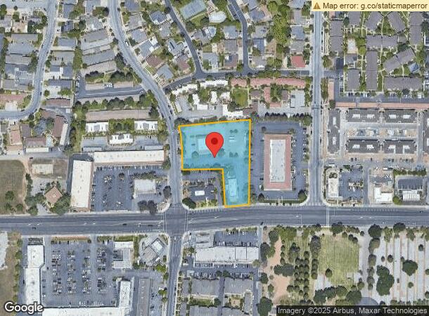
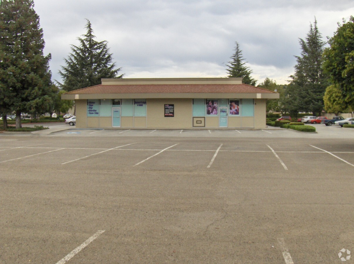
Property Record
1171 1St St, Gilroy, CA 95020


NEARBY LISTINGS FOR SALE OR LEASE
Property Detail
1171 1St St
790-41-055
Mira Loma Valley
Storebuilding
MIRA LOMA VALLEY LOT 10
X
Santa Clara
06085C0639H
California
2023
1.83 AC
2023
Gilroy
512505
South Bay/San Jose
7,980 SF
San Jose-Sunnyvale-Santa Clara, CA
DEMOGRAPHICS near 1171 1St St
1 Mile
3 Mile
5 Mile
2024 Total Population
21,123
58,801
64,622
2029 Population
20,318
56,413
61,794
Pop Growth 2024-2029
(3.81%)
(4.06%)
(4.38%)
Average Age
39
38
39
2024 Total Households
6,596
17,184
18,957
HH Growth 2024-2029
(4.03%)
(4.32%)
(4.67%)
Median Household Inc
$105,318
$111,319
$113,143
Avg Household Size
3.10
3.30
3.30
2024 Avg HH Vehicles
2.00
2.00
2.00
Median Home Value
$787,816
$825,962
$860,293
Median Year Built
1984
1988
1986
Nearby Places
- Restaurants
- Banks
- Shops
- Fitness
- Groceries
PUBLIC TRANSPORTATION
COMMUTER RAIL
Gilroy (Caltrain - Caltrain (Caltrain))
DRIVE
WALK
Distance
Gilroy (Caltrain - Caltrain (Caltrain))
4 min
2.1 mi
San Martin (Caltrain - Caltrain (Caltrain))
DRIVE
WALK
Distance
San Martin (Caltrain - Caltrain (Caltrain))
10 min
6.1 mi
Freight Ports
Port of Redwood City
DRIVE
WALK
Distance
Port of Redwood City
67 min
54.4 mi
SALE & LEASE HISTORY
LISTING DATE
SALE/LEASE

Sep 25, 2016
For Lease
Nearby Properties
Address
Land Use
TOTAL SIZE
Lot Size
Zoning
Address
Land Use
TOTAL SIZE
Lot Size
Zoning
270,205 SF
6.65 AC
M2
Address
Land Use
TOTAL SIZE
Lot Size
Zoning
171,339 SF
16.43 AC
C3
Address
Land Use
TOTAL SIZE
Lot Size
Zoning
43,973 SF
3.38 AC
R3
Address
Land Use
TOTAL SIZE
Lot Size
Zoning
156,290 SF
5.87 AC
APD
Address
Land Use
TOTAL SIZE
Lot Size
Zoning
133,498 SF
12.16 AC
C3
Address
Land Use
TOTAL SIZE
Lot Size
Zoning
113,883 SF
9.63 AC
C1
Address
Land Use
TOTAL SIZE
Lot Size
Zoning
94,345 SF
10.68 AC
C1
Address
Land Use
TOTAL SIZE
Lot Size
Zoning
219,622 SF
19.80 AC
A1-25
Address
Land Use
TOTAL SIZE
Lot Size
Zoning
56.33 AC
M2
Address
Land Use
TOTAL SIZE
Lot Size
Zoning
59.87 AC
M2
Address
Land Use
TOTAL SIZE
Lot Size
Zoning
142,684 SF
4.94 AC
CD
Address
Land Use
TOTAL SIZE
Lot Size
Zoning
123,268 SF
7.62 AC
R3
Address
Land Use
TOTAL SIZE
Lot Size
Zoning
69,080 SF
6.25 AC
C1
Address
Land Use
TOTAL SIZE
Lot Size
Zoning
64,893 SF
4.32 AC
R3
Address
Land Use
TOTAL SIZE
Lot Size
Zoning
72,159 SF
4.16 AC
R3
Address
Land Use
TOTAL SIZE
Lot Size
Zoning
90,677 SF
11.26 AC
C1
Address
Land Use
TOTAL SIZE
Lot Size
Zoning
148,663 SF
14.79 AC
PUD
Address
Land Use
TOTAL SIZE
Lot Size
Zoning
4,853 SF
11.59 AC
HC
Address
Land Use
TOTAL SIZE
Lot Size
Zoning
129,000 SF
6.84 AC
MULIT
Address
Land Use
TOTAL SIZE
Lot Size
Zoning
2.94 AC
A140
Address
Land Use
TOTAL SIZE
Lot Size
Zoning
3.43 AC
APD
Address
Land Use
TOTAL SIZE
Lot Size
Zoning
123,709 SF
9.26 AC
M2
Address
Land Use
TOTAL SIZE
Lot Size
Zoning
138,262 SF
10.83 AC
PUD
Address
Land Use
TOTAL SIZE
Lot Size
Zoning
63,560 SF
7.63 AC
A1-25
Address
Land Use
TOTAL SIZE
Lot Size
Zoning
126,503 SF
4.61 AC
MI
Address
Land Use
TOTAL SIZE
Lot Size
Zoning
20,140.41 AC
SJ
Address
Land Use
TOTAL SIZE
Lot Size
Zoning
70,209 SF
5.40 AC
COM
Address
Land Use
TOTAL SIZE
Lot Size
Zoning
1.51 AC
CM
Address
Land Use
TOTAL SIZE
Lot Size
Zoning
163,200 SF
8.62 AC
M-2
Address
Land Use
TOTAL SIZE
Lot Size
Zoning
56,020 SF
2.61 AC
M2
The World's #1 Commercial Real Estate Marketplace
Connect with us
© 2025 CoStar Group
The information above has been obtained from sources believed reliable. While we do not doubt its accuracy we have not verified it and make no guarantee, warranty or representation about it. It is your responsibility to independently confirm its accuracy and completeness. Any projections, opinions, assumptions, or estimates used are for example only and do not represent the current or future performance of the property. The value of this transaction to you depends on tax and other factors which should be evaluated by your tax, financial, and legal advisors. You and your advisors should conduct a careful, independent investigation of the property to determine to your satisfaction the suitability of the property for your needs.