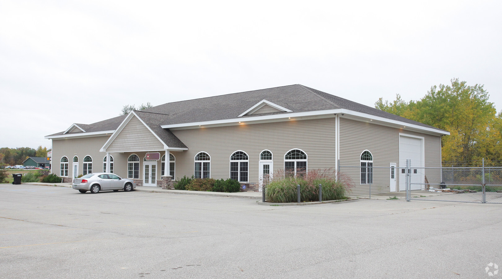
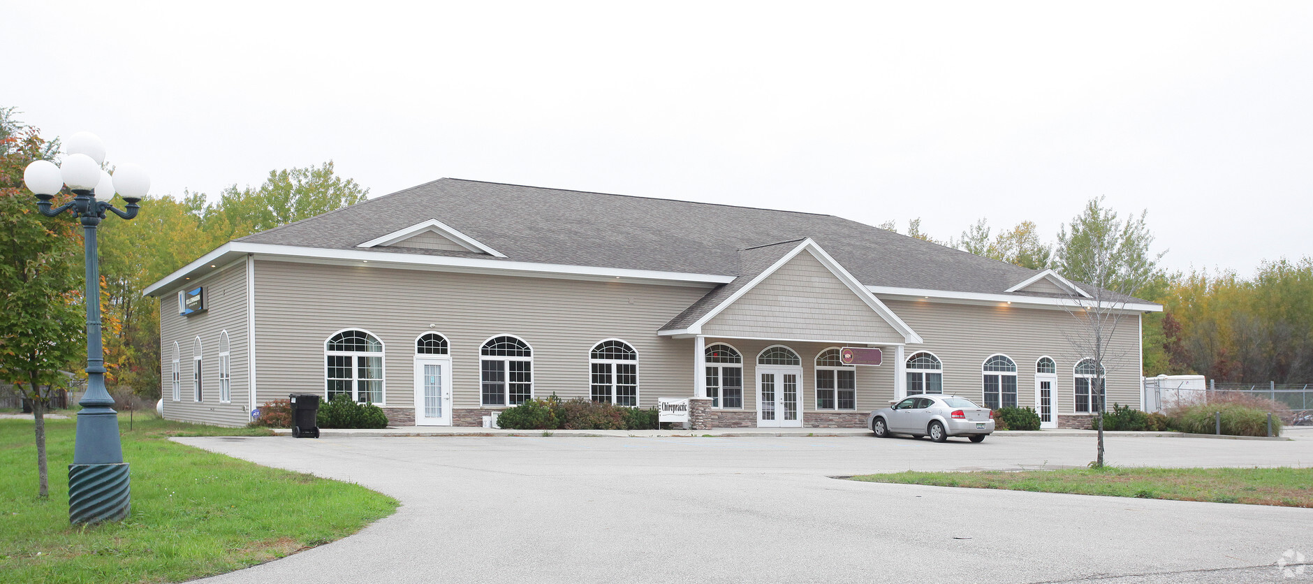
Property Record
11745 Cedar Rock Dr Ne, Rockford, MI 49341
NEARBY LISTINGS FOR SALE OR LEASE
-
-
View all Rockford listings for sale on LoopNet.com
Property Detail
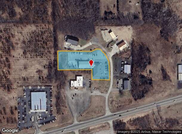
11745 Cedar Rock Dr Ne
West Michigan
Cedar Rock Business Park Kent County Con
Grand Rapids-Wyoming, MI
410612452012 UNIT 2 * CEDAR ROCK BUSINESS PARK KENT COUNTY CONDOMINIUM SUBDIVISION PLAN NO.369 LIBER 4015 PAGE 52 & AS
41-06-12-452-012
Kent
Commercialnec
Michigan
2024
2.32 AC
2024
Outlying Kent County
010602
DEMOGRAPHICS near 11745 Cedar Rock Dr Ne
1 Mile
3 Mile
5 Mile
2024 Total Population
1,225
10,297
32,533
2029 Population
1,240
10,432
32,991
Pop Growth 2024-2029
+ 1.22%
+ 1.31%
+ 1.41%
Average Age
38
39
39
2024 Total Households
424
3,590
11,714
HH Growth 2024-2029
+ 1.18%
+ 1.31%
+ 1.41%
Median Household Inc
$116,820
$105,852
$95,303
Avg Household Size
2.90
2.80
2.70
2024 Avg HH Vehicles
2.00
2.00
2.00
Median Home Value
$281,638
$277,734
$276,121
Median Year Built
1991
1993
1992
Nearby Places
- Restaurants
- Banks
- Shops
- Fitness
- Groceries
PUBLIC TRANSPORTATION
AIRPORT
Gerald R Ford International
DRIVE
WALK
Distance
Gerald R Ford International
40 min
30.5 mi
Freight Ports
Port Milwaukee
DRIVE
WALK
Distance
Port Milwaukee
324 min
279.4 mi
Nearby Properties
Address
Land Use
TOTAL SIZE
Lot Size
Zoning
Address
Land Use
TOTAL SIZE
Lot Size
Zoning
413,330 SF
20.83 AC
I-1
Address
Land Use
TOTAL SIZE
Lot Size
Zoning
40,800 SF
109.96 AC
IC
Address
Land Use
TOTAL SIZE
Lot Size
Zoning
Address
Land Use
TOTAL SIZE
Lot Size
Zoning
99.87 AC
R4
Address
Land Use
TOTAL SIZE
Lot Size
Zoning
13,955 SF
196.11 AC
MHP
Address
Land Use
TOTAL SIZE
Lot Size
Zoning
64,075 SF
11.12 AC
I-1
Address
Land Use
TOTAL SIZE
Lot Size
Zoning
8.86 AC
C2
Address
Land Use
TOTAL SIZE
Lot Size
Zoning
36,324 SF
8.29 AC
C2
Address
Land Use
TOTAL SIZE
Lot Size
Zoning
Address
Land Use
TOTAL SIZE
Lot Size
Zoning
28,345 SF
3.37 AC
B-3
Address
Land Use
TOTAL SIZE
Lot Size
Zoning
66,590 SF
4.06 AC
I-1
Address
Land Use
TOTAL SIZE
Lot Size
Zoning
26,703 SF
5.45 AC
R-1
Address
Land Use
TOTAL SIZE
Lot Size
Zoning
68,724 SF
7.53 AC
I-1
Address
Land Use
TOTAL SIZE
Lot Size
Zoning
Address
Land Use
TOTAL SIZE
Lot Size
Zoning
49,647 SF
5.30 AC
I-1
Address
Land Use
TOTAL SIZE
Lot Size
Zoning
54,186 SF
3.17 AC
I-1
Address
Land Use
TOTAL SIZE
Lot Size
Zoning
61,816 SF
5.10 AC
H-C
Address
Land Use
TOTAL SIZE
Lot Size
Zoning
56,500 SF
5.94 AC
I-1
Address
Land Use
TOTAL SIZE
Lot Size
Zoning
572 SF
16.47 AC
R-4
Address
Land Use
TOTAL SIZE
Lot Size
Zoning
23,280 SF
Address
Land Use
TOTAL SIZE
Lot Size
Zoning
24,800 SF
3.90 AC
Address
Land Use
TOTAL SIZE
Lot Size
Zoning
3.56 AC
C2
Address
Land Use
TOTAL SIZE
Lot Size
Zoning
31,843 SF
3.48 AC
C2
Address
Land Use
TOTAL SIZE
Lot Size
Zoning
64,632 SF
3.75 AC
I-1
Address
Land Use
TOTAL SIZE
Lot Size
Zoning
8,684 SF
3.54 AC
Address
Land Use
TOTAL SIZE
Lot Size
Zoning
Address
Land Use
TOTAL SIZE
Lot Size
Zoning
13,520 SF
Address
Land Use
TOTAL SIZE
Lot Size
Zoning
Address
Land Use
TOTAL SIZE
Lot Size
Zoning
Address
Land Use
TOTAL SIZE
Lot Size
Zoning
16,000 SF
9.83 AC
The World's #1 Commercial Real Estate Marketplace
Connect with us
© 2025 CoStar Group
The information above has been obtained from sources believed reliable. While we do not doubt its accuracy we have not verified it and make no guarantee, warranty or representation about it. It is your responsibility to independently confirm its accuracy and completeness. Any projections, opinions, assumptions, or estimates used are for example only and do not represent the current or future performance of the property. The value of this transaction to you depends on tax and other factors which should be evaluated by your tax, financial, and legal advisors. You and your advisors should conduct a careful, independent investigation of the property to determine to your satisfaction the suitability of the property for your needs.