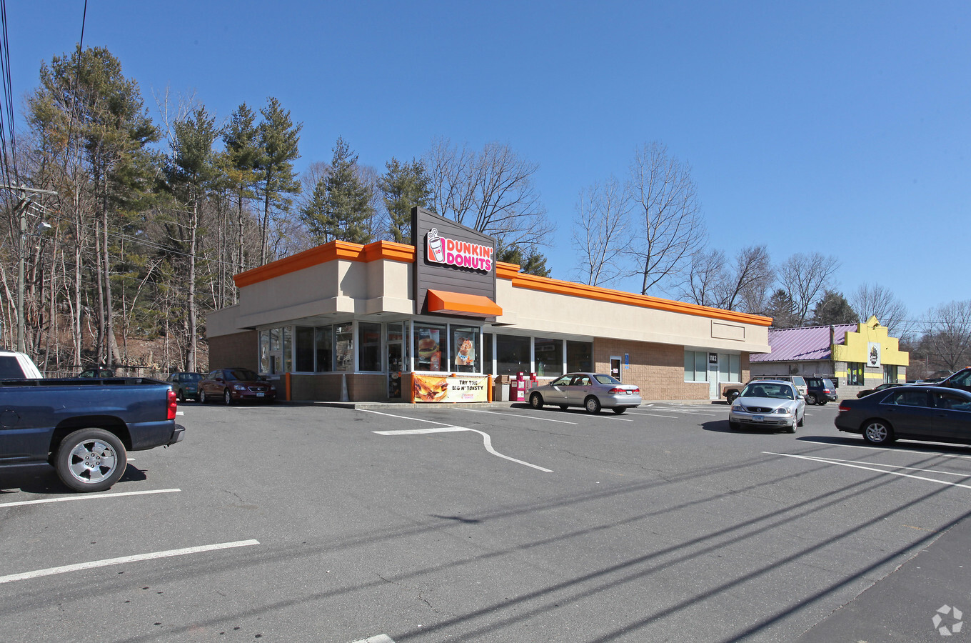
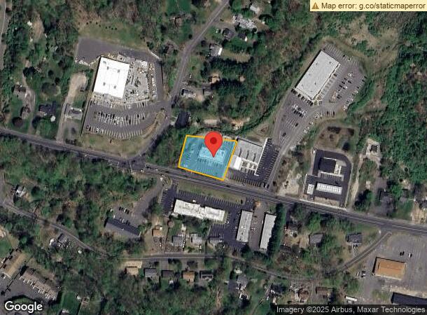
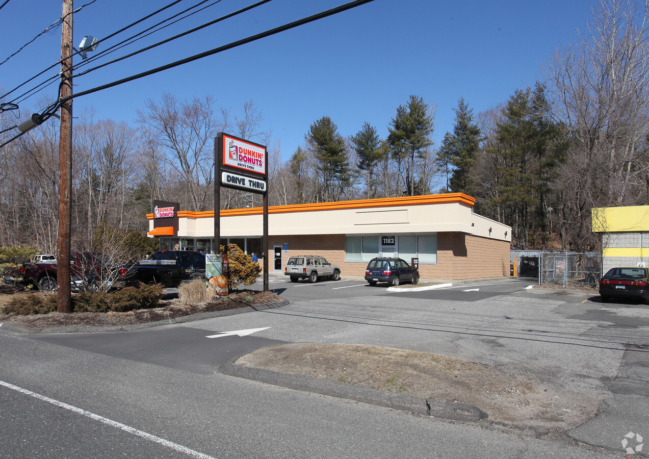
Property Record
1182 New Haven Rd, Naugatuck, CT 06770
NEARBY LISTINGS FOR SALE OR LEASE
Property Detail
1182 New Haven Rd
NAUG-000000S-E002424-000005-A000000
New Haven
Restaurantbuilding
Connecticut
X
4210
09009C0259H
0.80 AC
2024
Naugatuck
2024
Westchester/So Connecticut
345202
New Haven-Milford, CT
5,036 SF
DEMOGRAPHICS near 1182 New Haven Rd
1 Mile
3 Mile
5 Mile
2024 Total Population
5,107
31,224
74,858
2029 Population
5,128
31,095
74,638
Pop Growth 2024-2029
+ 0.41%
(0.41%)
(0.29%)
Average Age
43
41
42
2024 Total Households
1,962
12,154
29,274
HH Growth 2024-2029
+ 0.31%
(0.49%)
(0.38%)
Median Household Inc
$87,984
$98,068
$89,856
Avg Household Size
2.40
2.50
2.50
2024 Avg HH Vehicles
2.00
2.00
2.00
Median Home Value
$175,331
$236,374
$241,377
Median Year Built
1980
1970
1969
Nearby Places
- Restaurants
- Banks
- Shops
- Fitness
- Groceries
PUBLIC TRANSPORTATION
COMMUTER RAIL
Naugatuck Station (New Haven Line - Metro-North Commuter Railroad Company (Metro-North))
DRIVE
WALK
Distance
Naugatuck Station (New Haven Line - Metro-North Commuter Railroad Company (Metro-North))
5 min
2.6 mi
Beacon Falls Station (New Haven Line - Metro-North Commuter Railroad Company (Metro-North))
DRIVE
WALK
Distance
Beacon Falls Station (New Haven Line - Metro-North Commuter Railroad Company (Metro-North))
9 min
4.5 mi
AIRPORT
Tweed/New Haven
DRIVE
WALK
Distance
Tweed/New Haven
35 min
19.8 mi
Freight Ports
Port of New Haven
DRIVE
WALK
Distance
Port of New Haven
30 min
17.0 mi
Nearby Properties
Address
Land Use
TOTAL SIZE
Lot Size
Zoning
Address
Land Use
TOTAL SIZE
Lot Size
Zoning
17,181 SF
18.82 AC
R30
Address
Land Use
TOTAL SIZE
Lot Size
Zoning
268,279 SF
52.80 AC
RA1
Address
Land Use
TOTAL SIZE
Lot Size
Zoning
145,226 SF
28.56 AC
R8
Address
Land Use
TOTAL SIZE
Lot Size
Zoning
Address
Land Use
TOTAL SIZE
Lot Size
Zoning
8.24 AC
Address
Land Use
TOTAL SIZE
Lot Size
Zoning
21.65 AC
Address
Land Use
TOTAL SIZE
Lot Size
Zoning
112,055 SF
14.19 AC
RA1
Address
Land Use
TOTAL SIZE
Lot Size
Zoning
13,114 SF
7.70 AC
Address
Land Use
TOTAL SIZE
Lot Size
Zoning
46,302 SF
5 AC
R15
Address
Land Use
TOTAL SIZE
Lot Size
Zoning
52,250 SF
14.32 AC
RA1
Address
Land Use
TOTAL SIZE
Lot Size
Zoning
5.32 AC
RA1
Address
Land Use
TOTAL SIZE
Lot Size
Zoning
81,710 SF
10.86 AC
PD
Address
Land Use
TOTAL SIZE
Lot Size
Zoning
41,056 SF
6.17 AC
RA1
Address
Land Use
TOTAL SIZE
Lot Size
Zoning
29.04 AC
R-3
Address
Land Use
TOTAL SIZE
Lot Size
Zoning
717.07 AC
RA1
Address
Land Use
TOTAL SIZE
Lot Size
Zoning
37,842 SF
9.07 AC
I1
Address
Land Use
TOTAL SIZE
Lot Size
Zoning
6.47 AC
R15
Address
Land Use
TOTAL SIZE
Lot Size
Zoning
1.69 AC
RA1
Address
Land Use
TOTAL SIZE
Lot Size
Zoning
18,750 SF
4.16 AC
I1
Address
Land Use
TOTAL SIZE
Lot Size
Zoning
77,274 SF
5.99 AC
R8
Address
Land Use
TOTAL SIZE
Lot Size
Zoning
4 AC
RA1
Address
Land Use
TOTAL SIZE
Lot Size
Zoning
6.77 AC
RA1
Address
Land Use
TOTAL SIZE
Lot Size
Zoning
13,523 SF
1.34 AC
R30
Address
Land Use
TOTAL SIZE
Lot Size
Zoning
25,211 SF
7.38 AC
R15
Address
Land Use
TOTAL SIZE
Lot Size
Zoning
26 AC
R15
Address
Land Use
TOTAL SIZE
Lot Size
Zoning
3.60 AC
RA1
Address
Land Use
TOTAL SIZE
Lot Size
Zoning
15,069 SF
B1
Address
Land Use
TOTAL SIZE
Lot Size
Zoning
36,900 SF
8.90 AC
RA1
Address
Land Use
TOTAL SIZE
Lot Size
Zoning
5 AC
RA1
Address
Land Use
TOTAL SIZE
Lot Size
Zoning
55,294 SF
1.46 AC
RA1
The World's #1 Commercial Real Estate Marketplace
Connect with us
© 2025 CoStar Group
The information above has been obtained from sources believed reliable. While we do not doubt its accuracy we have not verified it and make no guarantee, warranty or representation about it. It is your responsibility to independently confirm its accuracy and completeness. Any projections, opinions, assumptions, or estimates used are for example only and do not represent the current or future performance of the property. The value of this transaction to you depends on tax and other factors which should be evaluated by your tax, financial, and legal advisors. You and your advisors should conduct a careful, independent investigation of the property to determine to your satisfaction the suitability of the property for your needs.