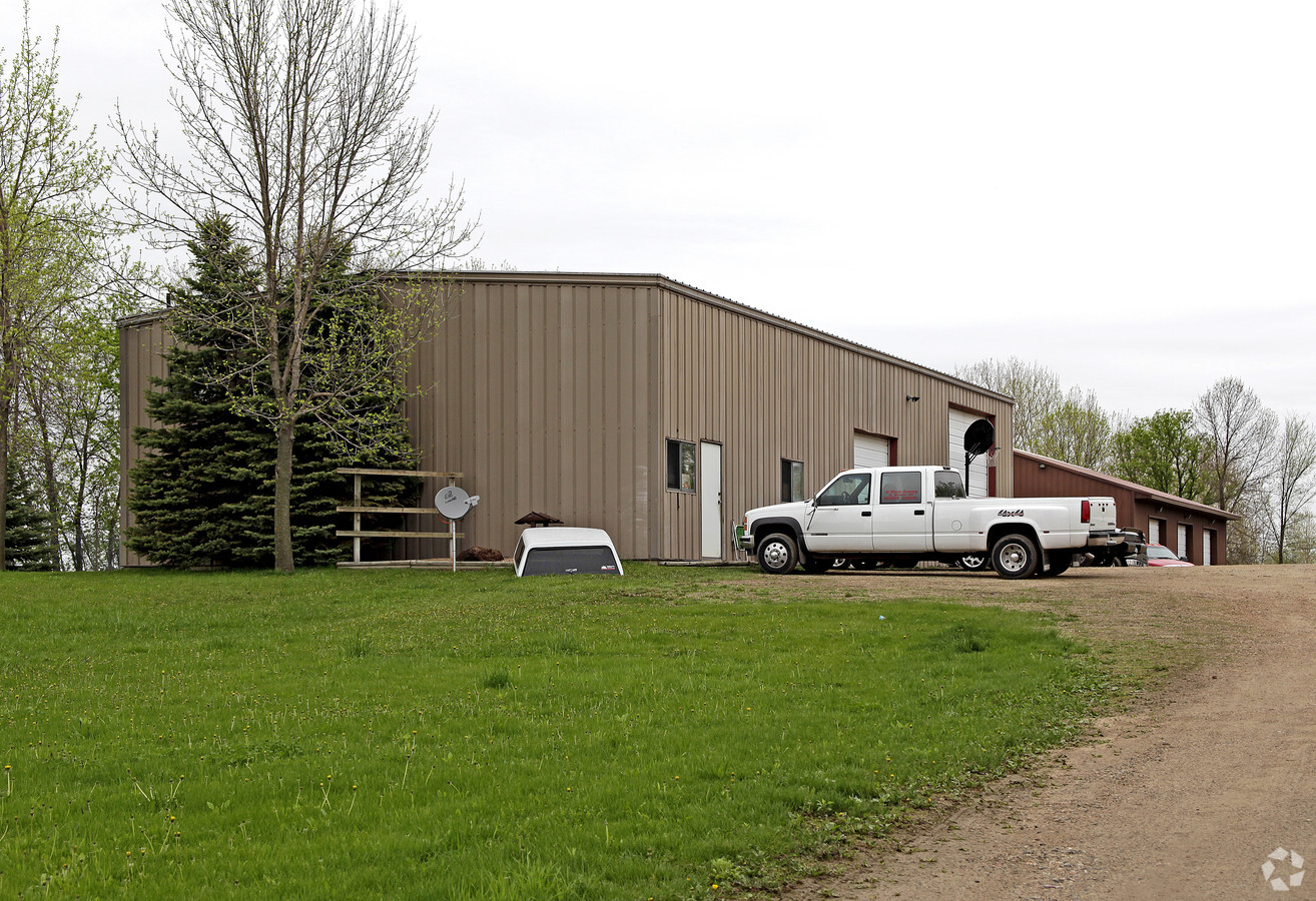
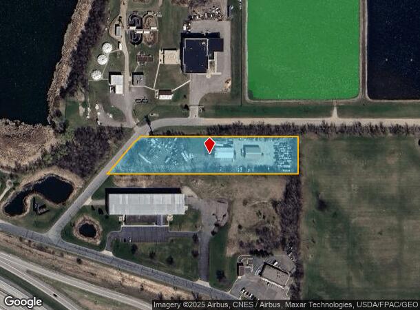
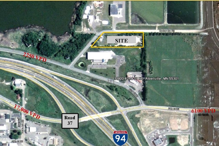
Property Record
11821 63Rd St Ne, Albertville, MN 55301
NEARBY LISTINGS FOR SALE OR LEASE
Property Detail
11821 63Rd St Ne
Minneapolis/St Paul
Unplatted Land Albertville1
Minneapolis-St. Paul-Bloomington, MN-WI
SECT-36 TWP-121 RANGE-024 UNPLATTED LAND ALBERTVILLE1 N150FT OF S60RDS OF SE1/4 OF SE1/4 & N150FT OF S60RDS OF GOV LT9 LY ELY OF CTRLN OF TWP RD &W OF E20A OF S60RDS OF SD SE1/4 OF SE1/4 OF S60RDS OF SE1/4 OF SE1/4 & N150FT OF S60RDS OF GOV LT9 L Y E
101-500-364400
Wright
Commercialnec
Minnesota
2023
9
2023
2.40 AC
1001005066
Wright County
2,400 SF
DEMOGRAPHICS near 11821 63Rd St Ne
1 Mile
3 Mile
5 Mile
2024 Total Population
5,949
30,396
58,418
2029 Population
6,727
34,013
64,723
Pop Growth 2024-2029
+ 13.08%
+ 11.90%
+ 10.79%
Average Age
33
35
36
2024 Total Households
1,882
9,988
19,246
HH Growth 2024-2029
+ 13.07%
+ 11.99%
+ 10.95%
Median Household Inc
$114,810
$118,743
$119,466
Avg Household Size
3.10
3.00
2.90
2024 Avg HH Vehicles
2.00
2.00
2.00
Median Home Value
$320,380
$316,300
$329,337
Median Year Built
2006
2002
2002
Nearby Places
- Restaurants
- Banks
- Shops
- Fitness
- Groceries
PUBLIC TRANSPORTATION
COMMUTER RAIL
Elk River Station (Northstar Corridor - Northstar Commuter Rail)
DRIVE
WALK
Distance
Elk River Station (Northstar Corridor - Northstar Commuter Rail)
16 min
9.8 mi
Freight Ports
Port Milwaukee
DRIVE
WALK
Distance
Port Milwaukee
407 min
368.2 mi
Nearby Properties
Address
Land Use
TOTAL SIZE
Lot Size
Zoning
Address
Land Use
TOTAL SIZE
Lot Size
Zoning
25,380 SF
130.75 AC
Address
Land Use
TOTAL SIZE
Lot Size
Zoning
44.82 AC
Address
Land Use
TOTAL SIZE
Lot Size
Zoning
40,984 SF
21.46 AC
Address
Land Use
TOTAL SIZE
Lot Size
Zoning
40,984 SF
34.62 AC
Address
Land Use
TOTAL SIZE
Lot Size
Zoning
4,240 SF
2.45 AC
Address
Land Use
TOTAL SIZE
Lot Size
Zoning
58.85 AC
Address
Land Use
TOTAL SIZE
Lot Size
Zoning
106,614 SF
19.89 AC
Address
Land Use
TOTAL SIZE
Lot Size
Zoning
110,784 SF
15.36 AC
Address
Land Use
TOTAL SIZE
Lot Size
Zoning
Address
Land Use
TOTAL SIZE
Lot Size
Zoning
Address
Land Use
TOTAL SIZE
Lot Size
Zoning
Address
Land Use
TOTAL SIZE
Lot Size
Zoning
178,398 SF
24 AC
Address
Land Use
TOTAL SIZE
Lot Size
Zoning
Address
Land Use
TOTAL SIZE
Lot Size
Zoning
7,932 SF
13.29 AC
Address
Land Use
TOTAL SIZE
Lot Size
Zoning
Address
Land Use
TOTAL SIZE
Lot Size
Zoning
21,935 SF
4.15 AC
Address
Land Use
TOTAL SIZE
Lot Size
Zoning
31,553 SF
45.33 AC
Address
Land Use
TOTAL SIZE
Lot Size
Zoning
26,187 SF
2.04 AC
Address
Land Use
TOTAL SIZE
Lot Size
Zoning
29,184 SF
5 AC
Address
Land Use
TOTAL SIZE
Lot Size
Zoning
22,258 SF
2.35 AC
Address
Land Use
TOTAL SIZE
Lot Size
Zoning
16.21 AC
Address
Land Use
TOTAL SIZE
Lot Size
Zoning
78,300 SF
3.80 AC
Address
Land Use
TOTAL SIZE
Lot Size
Zoning
Address
Land Use
TOTAL SIZE
Lot Size
Zoning
78,708 SF
7.70 AC
Address
Land Use
TOTAL SIZE
Lot Size
Zoning
80,321 SF
17.88 AC
Address
Land Use
TOTAL SIZE
Lot Size
Zoning
Address
Land Use
TOTAL SIZE
Lot Size
Zoning
22,968 SF
45.81 AC
Address
Land Use
TOTAL SIZE
Lot Size
Zoning
28,764 SF
4.10 AC
Address
Land Use
TOTAL SIZE
Lot Size
Zoning
The World's #1 Commercial Real Estate Marketplace
Connect with us
© 2025 CoStar Group
The information above has been obtained from sources believed reliable. While we do not doubt its accuracy we have not verified it and make no guarantee, warranty or representation about it. It is your responsibility to independently confirm its accuracy and completeness. Any projections, opinions, assumptions, or estimates used are for example only and do not represent the current or future performance of the property. The value of this transaction to you depends on tax and other factors which should be evaluated by your tax, financial, and legal advisors. You and your advisors should conduct a careful, independent investigation of the property to determine to your satisfaction the suitability of the property for your needs.