Property Record
11861 Harvest Ln, Eden Prairie, MN 55347


NEARBY LISTINGS FOR SALE OR LEASE
-
-
View all Eden Prairie listings for sale on LoopNet.com
Property Detail
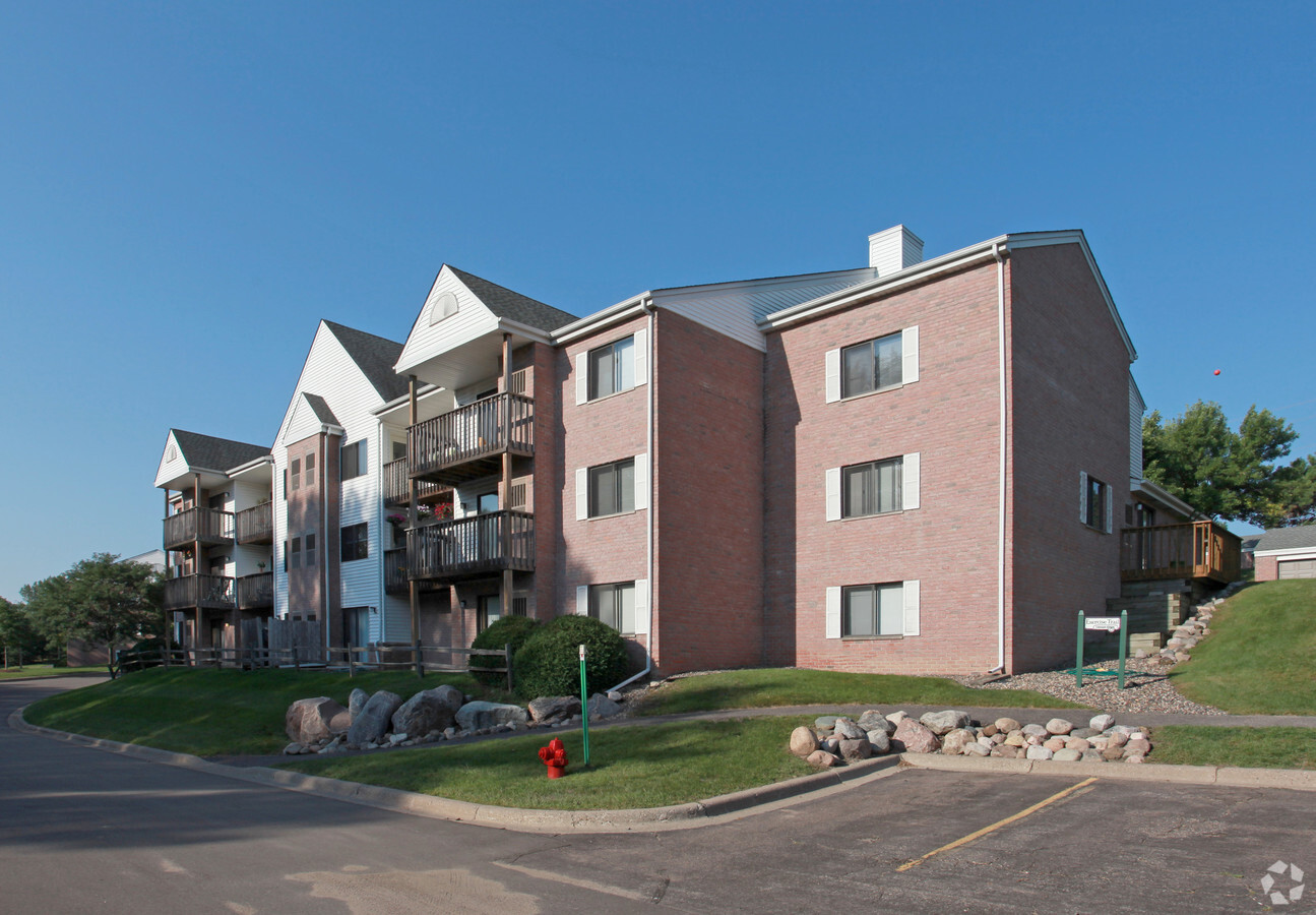
11861 Harvest Ln
Minneapolis-St. Paul-Bloomington, MN-WI
Eden Pointe
26-116-22-13-0080
LOT 001 BLOCK 001 T EDEN POINTE SUBJECT TO HWY IRREGULAR
Apartment
Hennepin
X
Minnesota
27053C0435F
1
2024
15.18 AC
2023
Eden Prairie
026015
Minneapolis/St Paul
73,046 SF
DEMOGRAPHICS near 11861 Harvest Ln
1 Mile
3 Mile
5 Mile
2024 Total Population
6,326
44,905
131,068
2029 Population
6,201
44,280
131,249
Pop Growth 2024-2029
(1.98%)
(1.39%)
+ 0.14%
Average Age
42
41
41
2024 Total Households
2,227
18,318
52,433
HH Growth 2024-2029
(2.11%)
(1.56%)
(0.07%)
Median Household Inc
$156,219
$105,007
$106,201
Avg Household Size
2.70
2.40
2.40
2024 Avg HH Vehicles
2.00
2.00
2.00
Median Home Value
$468,565
$394,395
$397,755
Median Year Built
1986
1985
1985
Nearby Places
- Restaurants
- Banks
- Shops
- Fitness
- Groceries
PUBLIC TRANSPORTATION
AIRPORT
Minneapolis-St Paul International/Wold-Chamberlain
DRIVE
WALK
Distance
Minneapolis-St Paul International/Wold-Chamberlain
24 min
14.0 mi
Freight Ports
Port Milwaukee
DRIVE
WALK
Distance
Port Milwaukee
392 min
351.1 mi
Nearby Properties
Address
Land Use
TOTAL SIZE
Lot Size
Zoning
Address
Land Use
TOTAL SIZE
Lot Size
Zoning
Address
Land Use
TOTAL SIZE
Lot Size
Zoning
Address
Land Use
TOTAL SIZE
Lot Size
Zoning
49,757 SF
2.88 AC
Address
Land Use
TOTAL SIZE
Lot Size
Zoning
216,984 SF
14.48 AC
RM25
Address
Land Use
TOTAL SIZE
Lot Size
Zoning
226,252 SF
5.40 AC
Address
Land Use
TOTAL SIZE
Lot Size
Zoning
38.59 AC
Address
Land Use
TOTAL SIZE
Lot Size
Zoning
14.32 AC
Address
Land Use
TOTAL SIZE
Lot Size
Zoning
327,536 SF
4.76 AC
CCOM
Address
Land Use
TOTAL SIZE
Lot Size
Zoning
314,234 SF
2.31 AC
RM25
Address
Land Use
TOTAL SIZE
Lot Size
Zoning
10.01 AC
RM25
Address
Land Use
TOTAL SIZE
Lot Size
Zoning
166,989 SF
9.70 AC
RM25
Address
Land Use
TOTAL SIZE
Lot Size
Zoning
181,201 SF
8.30 AC
OFC
Address
Land Use
TOTAL SIZE
Lot Size
Zoning
536,598 SF
53.84 AC
I-5
Address
Land Use
TOTAL SIZE
Lot Size
Zoning
9.94 AC
RM25
Address
Land Use
TOTAL SIZE
Lot Size
Zoning
12.57 AC
RM25
Address
Land Use
TOTAL SIZE
Lot Size
Zoning
88,213 SF
3.77 AC
Address
Land Use
TOTAL SIZE
Lot Size
Zoning
497,443 SF
37.88 AC
Address
Land Use
TOTAL SIZE
Lot Size
Zoning
7.30 AC
RM25
Address
Land Use
TOTAL SIZE
Lot Size
Zoning
5.77 AC
RM25
Address
Land Use
TOTAL SIZE
Lot Size
Zoning
216,960 SF
19.58 AC
Address
Land Use
TOTAL SIZE
Lot Size
Zoning
43,038 SF
10.81 AC
Address
Land Use
TOTAL SIZE
Lot Size
Zoning
107,652 SF
9.82 AC
OFC
Address
Land Use
TOTAL SIZE
Lot Size
Zoning
298,582 SF
31.71 AC
OFC
Address
Land Use
TOTAL SIZE
Lot Size
Zoning
325,341 SF
35.31 AC
C-REG
Address
Land Use
TOTAL SIZE
Lot Size
Zoning
206,200 SF
8.97 AC
RM25
Address
Land Use
TOTAL SIZE
Lot Size
Zoning
56,718 SF
2.43 AC
Address
Land Use
TOTAL SIZE
Lot Size
Zoning
130,990 SF
18.27 AC
C-REG
Address
Land Use
TOTAL SIZE
Lot Size
Zoning
118,338 SF
8.55 AC
RM25
Address
Land Use
TOTAL SIZE
Lot Size
Zoning
8.19 AC
RM25
The World's #1 Commercial Real Estate Marketplace
Connect with us
© 2025 CoStar Group
The information above has been obtained from sources believed reliable. While we do not doubt its accuracy we have not verified it and make no guarantee, warranty or representation about it. It is your responsibility to independently confirm its accuracy and completeness. Any projections, opinions, assumptions, or estimates used are for example only and do not represent the current or future performance of the property. The value of this transaction to you depends on tax and other factors which should be evaluated by your tax, financial, and legal advisors. You and your advisors should conduct a careful, independent investigation of the property to determine to your satisfaction the suitability of the property for your needs.