Property Record
11870 Adams Rd, Granger, IN 46530
NEARBY LISTINGS FOR SALE OR LEASE
-
-
View all Granger listings for sale on LoopNet.com
Property Detail
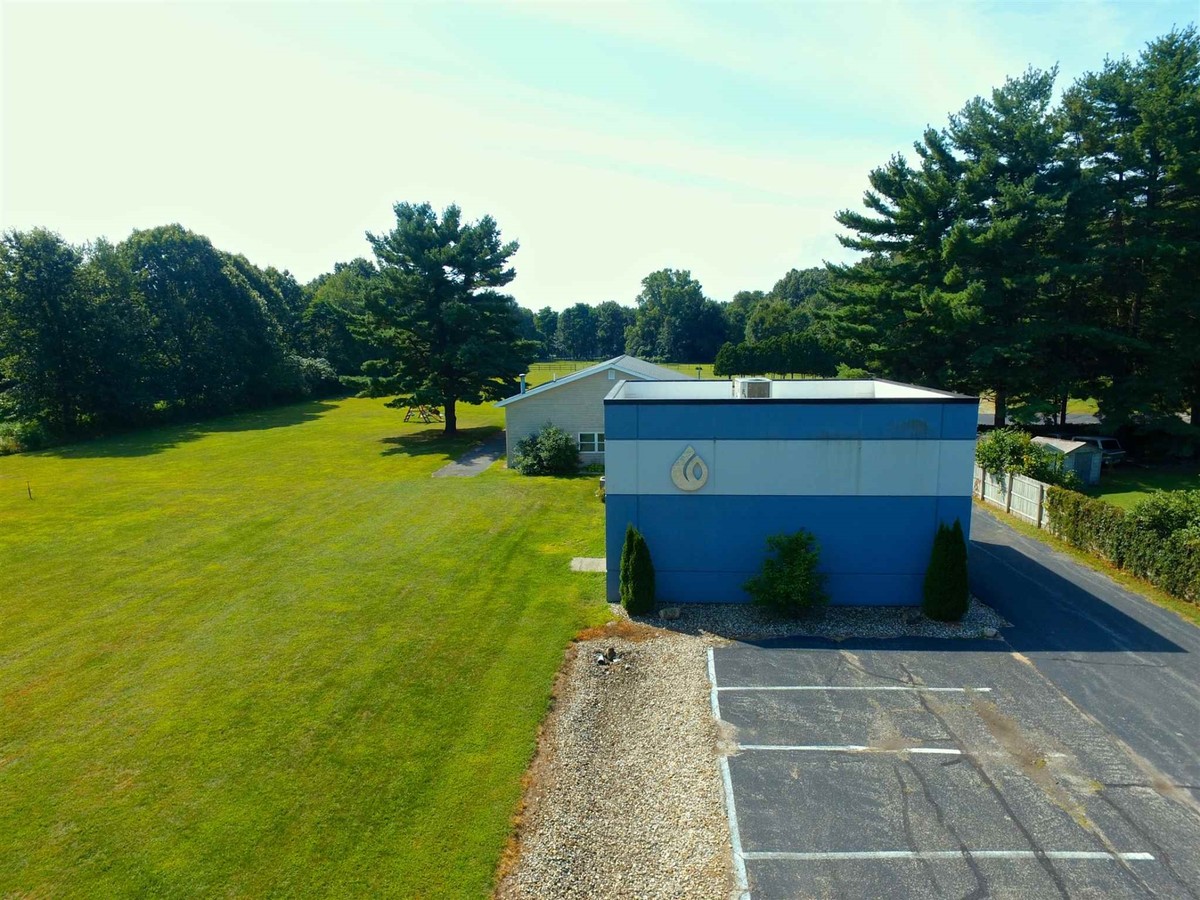
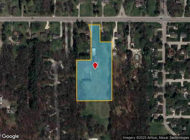
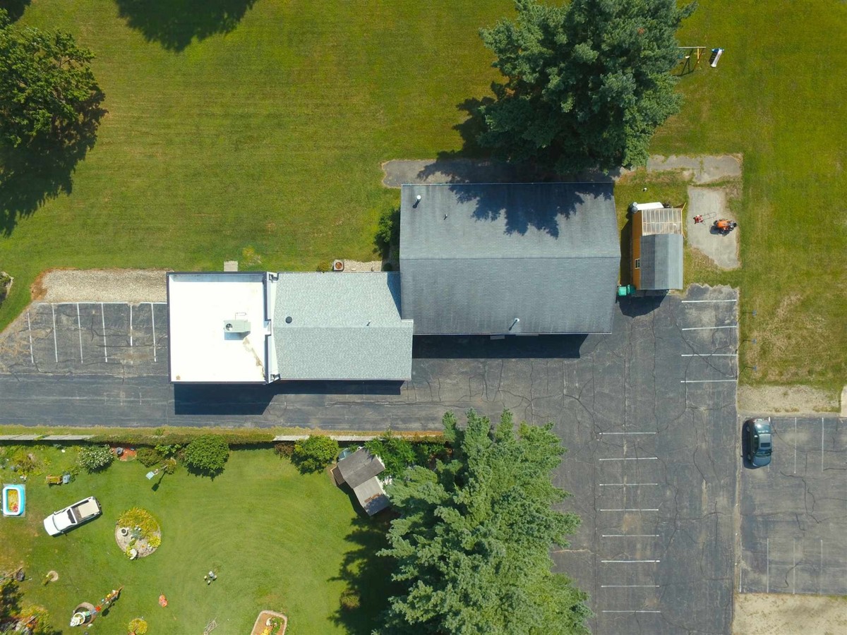
11870 Adams Rd
South Bend-Mishawaka, IN-MI
Pilgrim Institute
71-05-17-102-012.000-011
LOT 2 PILGRIM INSTITUTE SECOND MINOR SUB 00-01 SET UP NEW REPLAT PER TRANS 10837 12-16-99
Religious
St Joseph
X
Indiana
18039C0015D
2
2021
4 AC
2023
Outlying St Joseph County
011406
South Bend/Mishawaka
4,576 SF
DEMOGRAPHICS near 11870 Adams Rd
1 Mile
3 Mile
5 Mile
2024 Total Population
3,265
17,828
49,280
2029 Population
3,188
17,604
48,636
Pop Growth 2024-2029
(2.36%)
(1.26%)
(1.31%)
Average Age
39
39
40
2024 Total Households
1,127
6,016
18,130
HH Growth 2024-2029
(2.40%)
(1.35%)
(1.32%)
Median Household Inc
$116,745
$108,887
$95,386
Avg Household Size
2.90
2.90
2.70
2024 Avg HH Vehicles
3.00
2.00
2.00
Median Home Value
$242,099
$263,378
$243,472
Median Year Built
1985
1990
1988
Nearby Places
- Restaurants
- Banks
- Shops
- Fitness
- Groceries
PUBLIC TRANSPORTATION
AIRPORT
South Bend International
DRIVE
WALK
Distance
South Bend International
35 min
19.6 mi
Freight Ports
Port Milwaukee
DRIVE
WALK
Distance
Port Milwaukee
226 min
187.2 mi
SALE & LEASE HISTORY
LISTING DATE
SALE/LEASE

Aug 26, 2019
For Sale
Nearby Properties
Address
Land Use
TOTAL SIZE
Lot Size
Zoning
Address
Land Use
TOTAL SIZE
Lot Size
Zoning
276,540 SF
13.81 AC
Address
Land Use
TOTAL SIZE
Lot Size
Zoning
239,363 SF
8.26 AC
Address
Land Use
TOTAL SIZE
Lot Size
Zoning
146,337 SF
20.82 AC
Address
Land Use
TOTAL SIZE
Lot Size
Zoning
83,856 SF
54.56 AC
ZO01
Address
Land Use
TOTAL SIZE
Lot Size
Zoning
67,537 SF
7.74 AC
Address
Land Use
TOTAL SIZE
Lot Size
Zoning
108,400 SF
9.38 AC
Address
Land Use
TOTAL SIZE
Lot Size
Zoning
90,310 SF
9.60 AC
Address
Land Use
TOTAL SIZE
Lot Size
Zoning
36,438 SF
14.61 AC
Address
Land Use
TOTAL SIZE
Lot Size
Zoning
208.06 AC
Address
Land Use
TOTAL SIZE
Lot Size
Zoning
30,724 SF
7.55 AC
Address
Land Use
TOTAL SIZE
Lot Size
Zoning
12,096 SF
6.01 AC
Address
Land Use
TOTAL SIZE
Lot Size
Zoning
9.60 AC
Address
Land Use
TOTAL SIZE
Lot Size
Zoning
200,554 SF
24.33 AC
Address
Land Use
TOTAL SIZE
Lot Size
Zoning
17,148 SF
5.24 AC
Address
Land Use
TOTAL SIZE
Lot Size
Zoning
7.07 AC
Address
Land Use
TOTAL SIZE
Lot Size
Zoning
9,840 SF
38.89 AC
Address
Land Use
TOTAL SIZE
Lot Size
Zoning
1.48 AC
Address
Land Use
TOTAL SIZE
Lot Size
Zoning
27,310 SF
2.42 AC
ZO01
Address
Land Use
TOTAL SIZE
Lot Size
Zoning
67,724 SF
40.51 AC
Address
Land Use
TOTAL SIZE
Lot Size
Zoning
8.30 AC
Address
Land Use
TOTAL SIZE
Lot Size
Zoning
31,200 SF
2 AC
Address
Land Use
TOTAL SIZE
Lot Size
Zoning
16,581 SF
1.59 AC
Address
Land Use
TOTAL SIZE
Lot Size
Zoning
12,484 SF
40.98 AC
Address
Land Use
TOTAL SIZE
Lot Size
Zoning
10,456 SF
2.01 AC
Address
Land Use
TOTAL SIZE
Lot Size
Zoning
47.67 AC
Address
Land Use
TOTAL SIZE
Lot Size
Zoning
14,666 SF
2.34 AC
Address
Land Use
TOTAL SIZE
Lot Size
Zoning
14,859 SF
2.11 AC
Address
Land Use
TOTAL SIZE
Lot Size
Zoning
20,528 SF
1.46 AC
Address
Land Use
TOTAL SIZE
Lot Size
Zoning
18,462 SF
2.15 AC
Address
Land Use
TOTAL SIZE
Lot Size
Zoning
13,560 SF
2.78 AC
The World's #1 Commercial Real Estate Marketplace
Connect with us
© 2025 CoStar Group
The information above has been obtained from sources believed reliable. While we do not doubt its accuracy we have not verified it and make no guarantee, warranty or representation about it. It is your responsibility to independently confirm its accuracy and completeness. Any projections, opinions, assumptions, or estimates used are for example only and do not represent the current or future performance of the property. The value of this transaction to you depends on tax and other factors which should be evaluated by your tax, financial, and legal advisors. You and your advisors should conduct a careful, independent investigation of the property to determine to your satisfaction the suitability of the property for your needs.