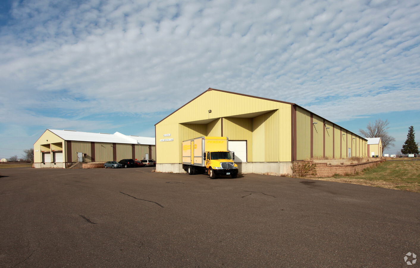
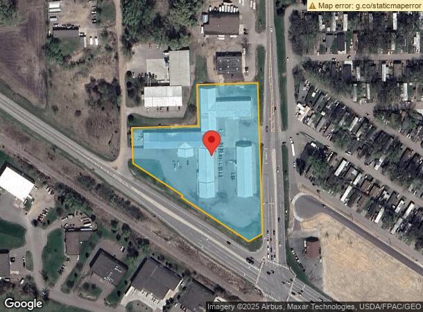
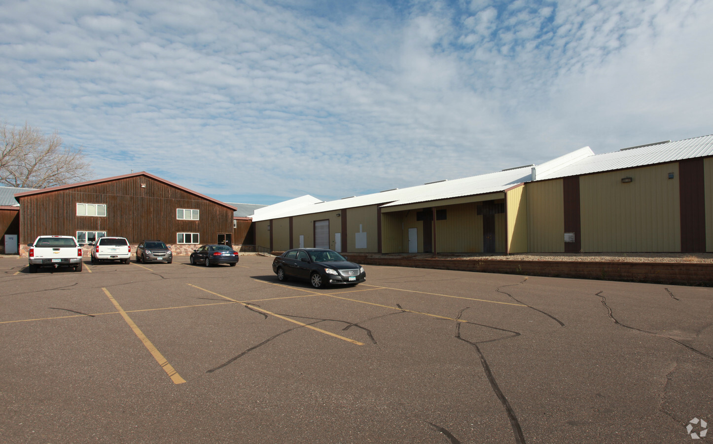
Property Record
11885 Brockton Ln N, Maple Grove, MN 55369
NEARBY LISTINGS FOR SALE OR LEASE
Property Detail
11885 Brockton Ln N
Minneapolis-St. Paul-Bloomington, MN-WI
M And M Addn
25-120-23-41-0017
LOT 002 BLOCK 001 A M AND M ADDN IRREGULAR
Industrialgeneral
Hennepin
X
Minnesota
27053C0045F
2
2024
4.63 AC
2023
Northwest
0269092106
Minneapolis/St Paul
DEMOGRAPHICS near 11885 Brockton Ln N
1 Mile
3 Mile
5 Mile
2024 Total Population
1,363
13,430
44,762
2029 Population
1,363
13,354
45,056
Pop Growth 2024-2029
0.00%
(0.57%)
+ 0.66%
Average Age
38
38
39
2024 Total Households
486
4,736
15,754
HH Growth 2024-2029
(0.21%)
(0.80%)
+ 0.36%
Median Household Inc
$161,628
$132,926
$124,715
Avg Household Size
2.80
2.80
2.80
2024 Avg HH Vehicles
2.00
2.00
2.00
Median Home Value
$456,149
$413,673
$392,213
Median Year Built
2010
2002
1997
Nearby Places
- Restaurants
- Banks
- Shops
- Fitness
- Groceries
PUBLIC TRANSPORTATION
AIRPORT
Minneapolis-St Paul International/Wold-Chamberlain
DRIVE
WALK
Distance
Minneapolis-St Paul International/Wold-Chamberlain
47 min
35.0 mi
Freight Ports
Port Milwaukee
DRIVE
WALK
Distance
Port Milwaukee
398 min
360.1 mi
Nearby Properties
Address
Land Use
TOTAL SIZE
Lot Size
Zoning
Address
Land Use
TOTAL SIZE
Lot Size
Zoning
30.13 AC
Address
Land Use
TOTAL SIZE
Lot Size
Zoning
Address
Land Use
TOTAL SIZE
Lot Size
Zoning
22.24 AC
Address
Land Use
TOTAL SIZE
Lot Size
Zoning
8.10 AC
Address
Land Use
TOTAL SIZE
Lot Size
Zoning
3.32 AC
Address
Land Use
TOTAL SIZE
Lot Size
Zoning
62.34 AC
Address
Land Use
TOTAL SIZE
Lot Size
Zoning
24.34 AC
Address
Land Use
TOTAL SIZE
Lot Size
Zoning
21.02 AC
Address
Land Use
TOTAL SIZE
Lot Size
Zoning
16.17 AC
Address
Land Use
TOTAL SIZE
Lot Size
Zoning
15.20 AC
Address
Land Use
TOTAL SIZE
Lot Size
Zoning
17.13 AC
Address
Land Use
TOTAL SIZE
Lot Size
Zoning
15.15 AC
Address
Land Use
TOTAL SIZE
Lot Size
Zoning
20.09 AC
Address
Land Use
TOTAL SIZE
Lot Size
Zoning
19.03 AC
Address
Land Use
TOTAL SIZE
Lot Size
Zoning
16.57 AC
Address
Land Use
TOTAL SIZE
Lot Size
Zoning
12.98 AC
Address
Land Use
TOTAL SIZE
Lot Size
Zoning
13.21 AC
Address
Land Use
TOTAL SIZE
Lot Size
Zoning
10.26 AC
Address
Land Use
TOTAL SIZE
Lot Size
Zoning
12.39 AC
Address
Land Use
TOTAL SIZE
Lot Size
Zoning
11.44 AC
Address
Land Use
TOTAL SIZE
Lot Size
Zoning
Address
Land Use
TOTAL SIZE
Lot Size
Zoning
Address
Land Use
TOTAL SIZE
Lot Size
Zoning
11.74 AC
Address
Land Use
TOTAL SIZE
Lot Size
Zoning
Address
Land Use
TOTAL SIZE
Lot Size
Zoning
41.53 AC
Address
Land Use
TOTAL SIZE
Lot Size
Zoning
Address
Land Use
TOTAL SIZE
Lot Size
Zoning
11.33 AC
Address
Land Use
TOTAL SIZE
Lot Size
Zoning
Address
Land Use
TOTAL SIZE
Lot Size
Zoning
Address
Land Use
TOTAL SIZE
Lot Size
Zoning
The World's #1 Commercial Real Estate Marketplace
Connect with us
© 2025 CoStar Group
The information above has been obtained from sources believed reliable. While we do not doubt its accuracy we have not verified it and make no guarantee, warranty or representation about it. It is your responsibility to independently confirm its accuracy and completeness. Any projections, opinions, assumptions, or estimates used are for example only and do not represent the current or future performance of the property. The value of this transaction to you depends on tax and other factors which should be evaluated by your tax, financial, and legal advisors. You and your advisors should conduct a careful, independent investigation of the property to determine to your satisfaction the suitability of the property for your needs.