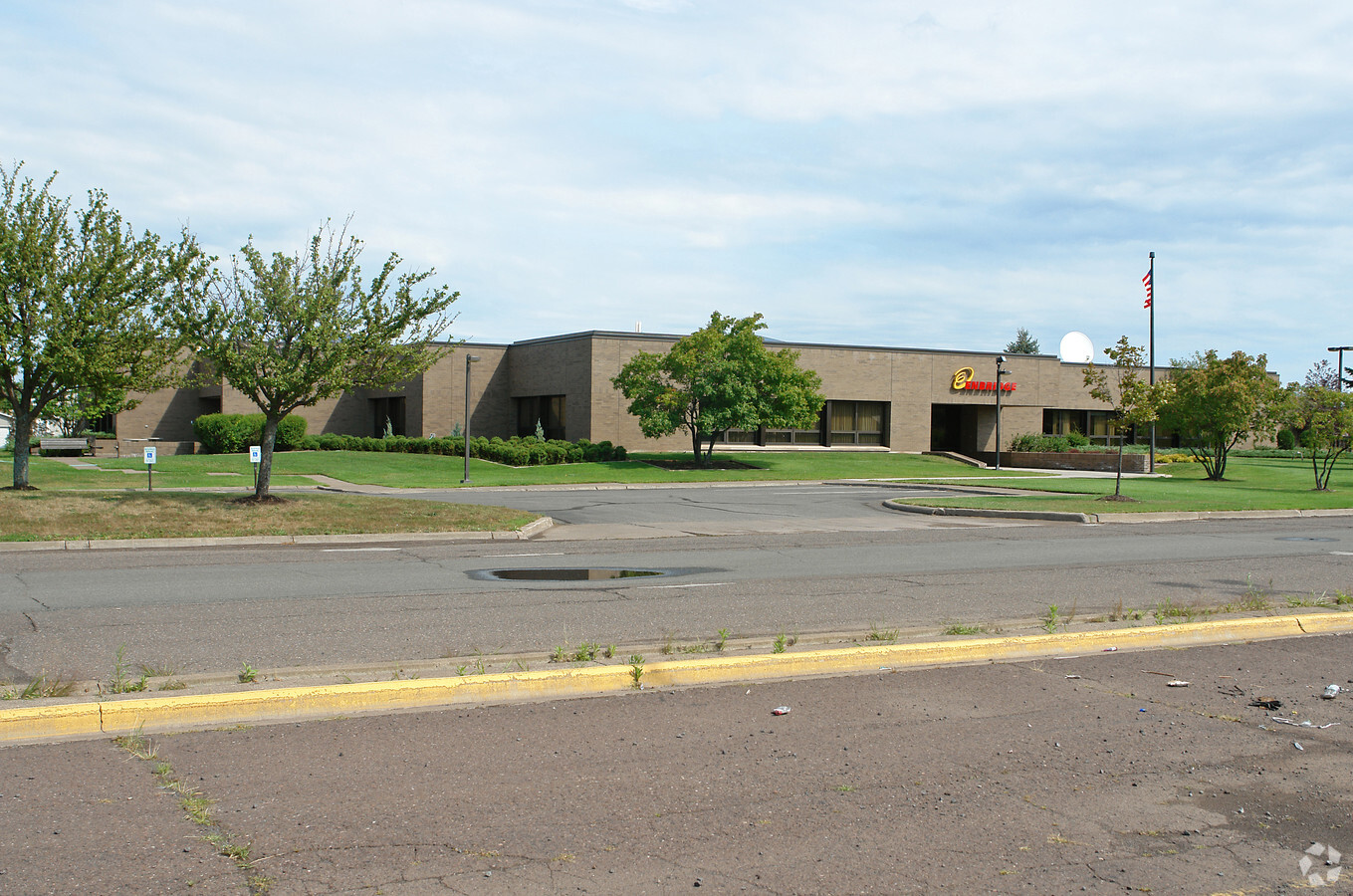
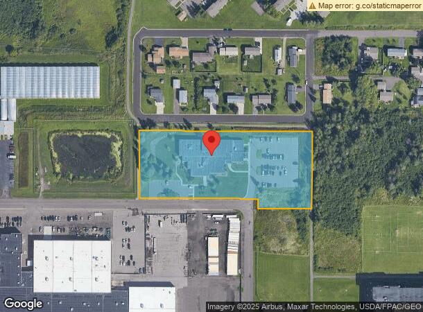
Property Record
119 N 25Th St E, Superior, WI 54880
NEARBY LISTINGS FOR SALE OR LEASE
-
-
View all Superior listings for sale on LoopNet.com
Property Detail
119 N 25Th St E
Duluth, MN-WI
STEEL CENTER ADDITION LOTS 1 THRU 48, BL 1 & RASPBERRY AVE VAC & ALLEY VAC & POUGHKEEPSIE AVE VACATED. SEE 2-05821, 2-05855,
02-802-05773-00
Douglas
Commercialnec
Wisconsin
X
1-48
55031C0079D
9.16 AC
2023
Superior
2023
Duluth
020400
DEMOGRAPHICS near 119 N 25Th St E
1 Mile
3 Mile
5 Mile
2024 Total Population
4,813
22,377
32,313
2029 Population
4,744
22,125
31,956
Pop Growth 2024-2029
(1.43%)
(1.13%)
(1.10%)
Average Age
40
40
40
2024 Total Households
1,929
9,891
14,457
HH Growth 2024-2029
(1.50%)
(1.17%)
(1.15%)
Median Household Inc
$65,850
$50,422
$50,190
Avg Household Size
2.20
2.10
2.10
2024 Avg HH Vehicles
2.00
2.00
2.00
Median Home Value
$152,969
$148,299
$150,518
Median Year Built
1958
1955
1952
Nearby Places
- Restaurants
- Banks
- Shops
- Fitness
- Groceries
PUBLIC TRANSPORTATION
AIRPORT
Duluth International
DRIVE
WALK
Distance
Duluth International
30 min
14.9 mi
Freight Ports
Port Milwaukee
DRIVE
WALK
Distance
Port Milwaukee
443 min
392.6 mi
Nearby Properties
Address
Land Use
TOTAL SIZE
Lot Size
Zoning
Address
Land Use
TOTAL SIZE
Lot Size
Zoning
50.82 AC
M2
Address
Land Use
TOTAL SIZE
Lot Size
Zoning
2.81 AC
PDD
Address
Land Use
TOTAL SIZE
Lot Size
Zoning
21.96 AC
Address
Land Use
TOTAL SIZE
Lot Size
Zoning
28.37 AC
W1
Address
Land Use
TOTAL SIZE
Lot Size
Zoning
27.99 AC
C2
Address
Land Use
TOTAL SIZE
Lot Size
Zoning
1.36 AC
C2
Address
Land Use
TOTAL SIZE
Lot Size
Zoning
4.17 AC
C2
Address
Land Use
TOTAL SIZE
Lot Size
Zoning
6.94 AC
Address
Land Use
TOTAL SIZE
Lot Size
Zoning
135.91 AC
M2
Address
Land Use
TOTAL SIZE
Lot Size
Zoning
20.01 AC
Address
Land Use
TOTAL SIZE
Lot Size
Zoning
2 AC
R3
Address
Land Use
TOTAL SIZE
Lot Size
Zoning
8.50 AC
W1
Address
Land Use
TOTAL SIZE
Lot Size
Zoning
9.84 AC
C2
Address
Land Use
TOTAL SIZE
Lot Size
Zoning
0.68 AC
R3
Address
Land Use
TOTAL SIZE
Lot Size
Zoning
2.44 AC
C2
Address
Land Use
TOTAL SIZE
Lot Size
Zoning
1.34 AC
Address
Land Use
TOTAL SIZE
Lot Size
Zoning
7.05 AC
M2
Address
Land Use
TOTAL SIZE
Lot Size
Zoning
1.97 AC
PDD
Address
Land Use
TOTAL SIZE
Lot Size
Zoning
Address
Land Use
TOTAL SIZE
Lot Size
Zoning
24.54 AC
W1
Address
Land Use
TOTAL SIZE
Lot Size
Zoning
6.01 AC
M2
Address
Land Use
TOTAL SIZE
Lot Size
Zoning
3.54 AC
W1
Address
Land Use
TOTAL SIZE
Lot Size
Zoning
6.20 AC
C4
Address
Land Use
TOTAL SIZE
Lot Size
Zoning
11.43 AC
R3
Address
Land Use
TOTAL SIZE
Lot Size
Zoning
2.58 AC
R2A
Address
Land Use
TOTAL SIZE
Lot Size
Zoning
1.41 AC
C4
Address
Land Use
TOTAL SIZE
Lot Size
Zoning
1.70 AC
C2
Address
Land Use
TOTAL SIZE
Lot Size
Zoning
2.41 AC
C1
Address
Land Use
TOTAL SIZE
Lot Size
Zoning
2.28 AC
M2
Address
Land Use
TOTAL SIZE
Lot Size
Zoning
3,252 SF
66.01 AC
The World's #1 Commercial Real Estate Marketplace
Connect with us
© 2025 CoStar Group
The information above has been obtained from sources believed reliable. While we do not doubt its accuracy we have not verified it and make no guarantee, warranty or representation about it. It is your responsibility to independently confirm its accuracy and completeness. Any projections, opinions, assumptions, or estimates used are for example only and do not represent the current or future performance of the property. The value of this transaction to you depends on tax and other factors which should be evaluated by your tax, financial, and legal advisors. You and your advisors should conduct a careful, independent investigation of the property to determine to your satisfaction the suitability of the property for your needs.