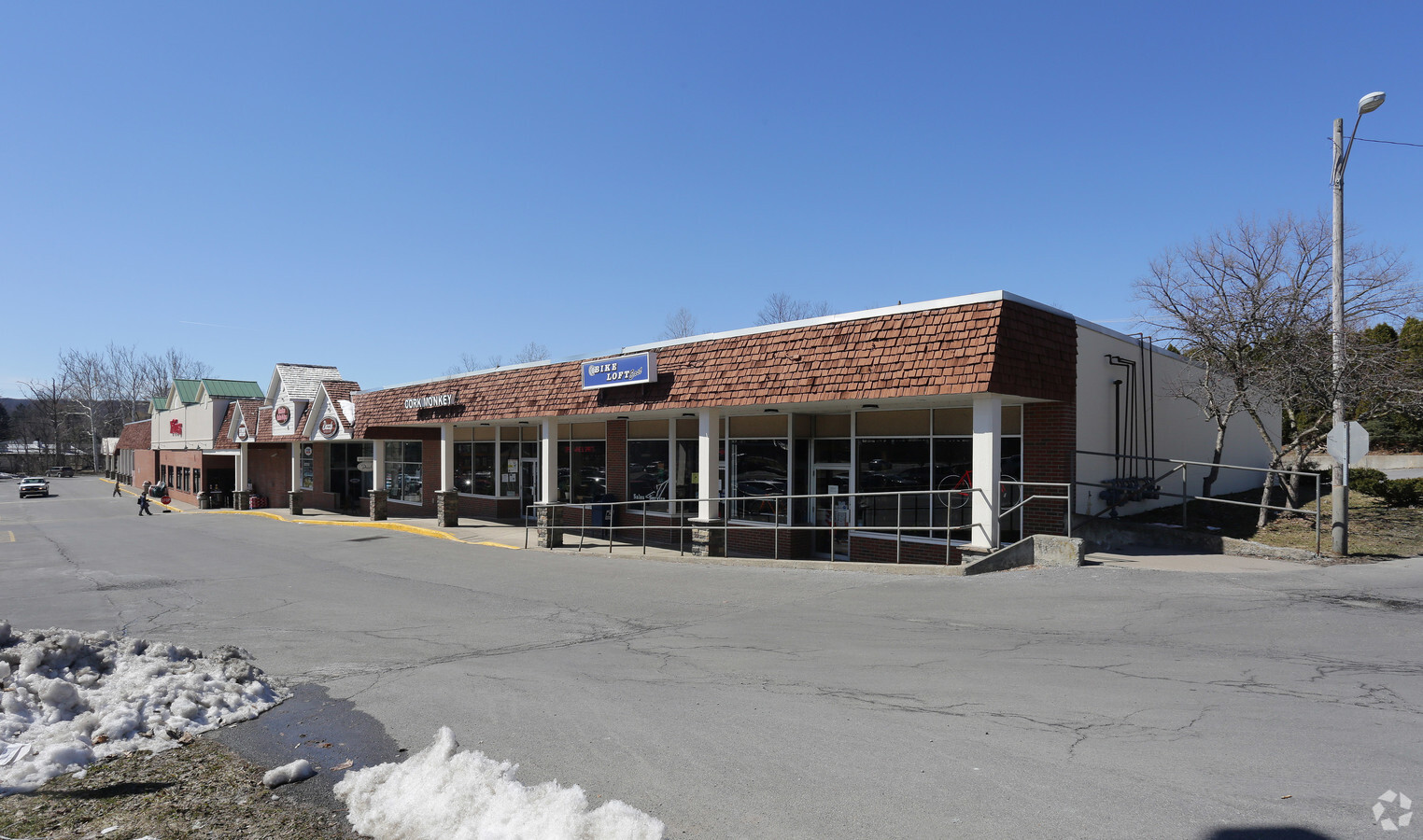
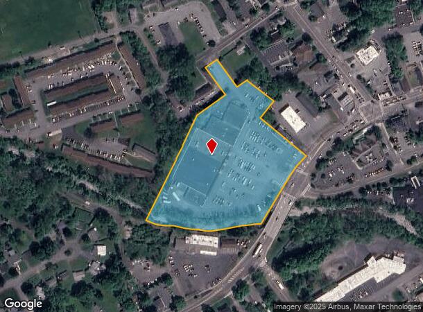
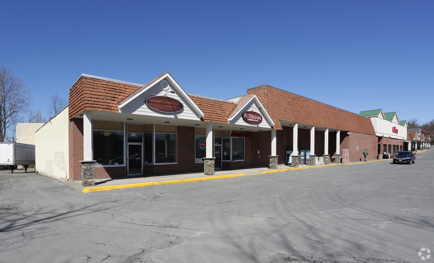
Property Record
119 W Seneca St, Manlius, NY 13104

NEARBY LISTINGS FOR SALE OR LEASE
Property Detail
119 W Seneca St
313803-030-000-0001-019-001-0000
Onondaga
Stripcommercialcenter
New York
AE
19.001
36067C0263F
5.63 AC
2024
SE Outer Onondaga County
2023
Syracuse
015201
Syracuse, NY
60,621 SF
DEMOGRAPHICS near 119 W Seneca St
1 Mile
3 Mile
5 Mile
2024 Total Population
6,407
23,028
37,264
2029 Population
6,266
22,472
36,331
Pop Growth 2024-2029
(2.20%)
(2.41%)
(2.50%)
Average Age
43
43
44
2024 Total Households
2,647
9,187
14,950
HH Growth 2024-2029
(2.49%)
(2.61%)
(2.71%)
Median Household Inc
$100,039
$115,357
$111,494
Avg Household Size
2.40
2.50
2.40
2024 Avg HH Vehicles
2.00
2.00
2.00
Median Home Value
$271,262
$277,614
$260,993
Median Year Built
1971
1974
1972
Nearby Places
- Restaurants
- Banks
- Shops
- Fitness
- Groceries
PUBLIC TRANSPORTATION
AIRPORT
Syracuse Hancock International
DRIVE
WALK
Distance
Syracuse Hancock International
28 min
18.1 mi
Freight Ports
Albany, NY Port
DRIVE
WALK
Distance
Albany, NY Port
169 min
137.0 mi
SALE & LEASE HISTORY
LISTING DATE
SALE/LEASE

Sep 25, 2016
For Lease
May 16, 2022
For Lease
Mar 03, 2023
For Lease
Nearby Properties
Address
Land Use
TOTAL SIZE
Lot Size
Zoning
Address
Land Use
TOTAL SIZE
Lot Size
Zoning
293,638 SF
58.90 AC
R1
Address
Land Use
TOTAL SIZE
Lot Size
Zoning
219,526 SF
38.98 AC
RA
Address
Land Use
TOTAL SIZE
Lot Size
Zoning
6.24 AC
RA
Address
Land Use
TOTAL SIZE
Lot Size
Zoning
4,722 SF
35.39 AC
R5
Address
Land Use
TOTAL SIZE
Lot Size
Zoning
115,150 SF
13.32 AC
RS
Address
Land Use
TOTAL SIZE
Lot Size
Zoning
15,240 SF
12.46 AC
R1
Address
Land Use
TOTAL SIZE
Lot Size
Zoning
26,508 SF
4.38 AC
C
Address
Land Use
TOTAL SIZE
Lot Size
Zoning
6,936 SF
13.18 AC
R2
Address
Land Use
TOTAL SIZE
Lot Size
Zoning
116,748 SF
7.67 AC
R1
Address
Land Use
TOTAL SIZE
Lot Size
Zoning
101,950 SF
7.32 AC
R2
Address
Land Use
TOTAL SIZE
Lot Size
Zoning
128,733 SF
9.76 AC
RS
Address
Land Use
TOTAL SIZE
Lot Size
Zoning
103,965 SF
6.03 AC
R2
Address
Land Use
TOTAL SIZE
Lot Size
Zoning
32,094 SF
1.70 AC
B2
Address
Land Use
TOTAL SIZE
Lot Size
Zoning
401,546 SF
24 AC
C
Address
Land Use
TOTAL SIZE
Lot Size
Zoning
60,300 SF
3.70 AC
IND
Address
Land Use
TOTAL SIZE
Lot Size
Zoning
5,376 SF
8.91 AC
R2
Address
Land Use
TOTAL SIZE
Lot Size
Zoning
43,620 SF
33.82 AC
R1
Address
Land Use
TOTAL SIZE
Lot Size
Zoning
59,066 SF
3.46 AC
R2
Address
Land Use
TOTAL SIZE
Lot Size
Zoning
13,225 SF
1.48 AC
R2
Address
Land Use
TOTAL SIZE
Lot Size
Zoning
74,424 SF
35.70 AC
R1
Address
Land Use
TOTAL SIZE
Lot Size
Zoning
52,145 SF
4.36 AC
RS
Address
Land Use
TOTAL SIZE
Lot Size
Zoning
27,864 SF
4.20 AC
CA
Address
Land Use
TOTAL SIZE
Lot Size
Zoning
12,787 SF
1.52 AC
C
Address
Land Use
TOTAL SIZE
Lot Size
Zoning
18,244 SF
5.67 AC
R4
Address
Land Use
TOTAL SIZE
Lot Size
Zoning
28,037 SF
40.68 AC
C
Address
Land Use
TOTAL SIZE
Lot Size
Zoning
9,616 SF
6.40 AC
R5
Address
Land Use
TOTAL SIZE
Lot Size
Zoning
41,640 SF
8.50 AC
R4
Address
Land Use
TOTAL SIZE
Lot Size
Zoning
45,285 SF
5.33 AC
C1
Address
Land Use
TOTAL SIZE
Lot Size
Zoning
36,072 SF
2.27 AC
C
The World's #1 Commercial Real Estate Marketplace
Connect with us
© 2025 CoStar Group
The information above has been obtained from sources believed reliable. While we do not doubt its accuracy we have not verified it and make no guarantee, warranty or representation about it. It is your responsibility to independently confirm its accuracy and completeness. Any projections, opinions, assumptions, or estimates used are for example only and do not represent the current or future performance of the property. The value of this transaction to you depends on tax and other factors which should be evaluated by your tax, financial, and legal advisors. You and your advisors should conduct a careful, independent investigation of the property to determine to your satisfaction the suitability of the property for your needs.