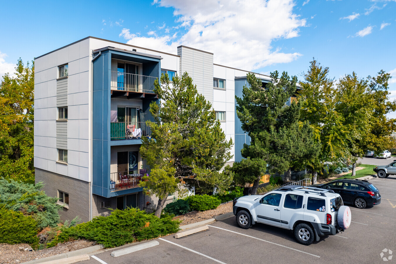
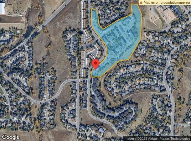
Property Record
12 S Holman Way, Golden, CO 80401

NEARBY LISTINGS FOR SALE OR LEASE
-
-
View all Golden listings for sale on LoopNet.com
Property Detail
12 S Holman Way
Denver-Aurora-Lakewood, CO
Cliffs At 6Th Avenue Flg 1
49-073-02-201
SECTION 07 TOWNSHIP 04 RANGE 69 SUBDIVISIONCD 131850 SUBDIVISIONNAME CLIFFS AT 6TH AVENUE FLG 1 LOT 0001 SIZE: 701648 VALUE: 16.108
Multifamilydwelling
Jefferson
X
Colorado
08059C0283F
1
2021
16.11 AC
2024
Sixth Ave West
011721
Denver
270,527 SF
DEMOGRAPHICS near 12 S Holman Way
1 Mile
3 Mile
5 Mile
2024 Total Population
7,926
65,883
163,508
2029 Population
7,889
65,329
162,143
Pop Growth 2024-2029
(0.47%)
(0.84%)
(0.83%)
Average Age
40
41
41
2024 Total Households
3,425
28,519
68,983
HH Growth 2024-2029
(0.35%)
(0.83%)
(0.87%)
Median Household Inc
$98,364
$88,179
$87,537
Avg Household Size
2.30
2.20
2.20
2024 Avg HH Vehicles
2.00
2.00
2.00
Median Home Value
$638,542
$540,476
$593,606
Median Year Built
1978
1976
1975
Nearby Places
- Restaurants
- Banks
- Shops
- Fitness
- Groceries
PUBLIC TRANSPORTATION
COMMUTER RAIL
Wheat Ridge - Ward Station Track 1 (Union Station to Wheat Ridge Ward Station - Regional Transportation District)
DRIVE
WALK
Distance
Wheat Ridge - Ward Station Track 1 (Union Station to Wheat Ridge Ward Station - Regional Transportation District)
13 min
7.2 mi
Arvada Ridge Station Track 1 (Union Station to Wheat Ridge Ward Station - Regional Transportation District)
DRIVE
WALK
Distance
Arvada Ridge Station Track 1 (Union Station to Wheat Ridge Ward Station - Regional Transportation District)
13 min
8.2 mi
AIRPORT
Denver International
DRIVE
WALK
Distance
Denver International
46 min
35.8 mi
Freight Ports
Tulsa Port Of Catoosa
DRIVE
WALK
Distance
Tulsa Port Of Catoosa
744 min
721.3 mi
Nearby Properties
Address
Land Use
TOTAL SIZE
Lot Size
Zoning
Address
Land Use
TOTAL SIZE
Lot Size
Zoning
943,179 SF
23.96 AC
Address
Land Use
TOTAL SIZE
Lot Size
Zoning
Address
Land Use
TOTAL SIZE
Lot Size
Zoning
367,452 SF
38.94 AC
Address
Land Use
TOTAL SIZE
Lot Size
Zoning
229,819 SF
29.97 AC
Address
Land Use
TOTAL SIZE
Lot Size
Zoning
1,193,158 SF
68.86 AC
Address
Land Use
TOTAL SIZE
Lot Size
Zoning
420,482 SF
66.03 AC
Address
Land Use
TOTAL SIZE
Lot Size
Zoning
352,259 SF
17.94 AC
Address
Land Use
TOTAL SIZE
Lot Size
Zoning
198,081 SF
Address
Land Use
TOTAL SIZE
Lot Size
Zoning
1,044.03 AC
A2
Address
Land Use
TOTAL SIZE
Lot Size
Zoning
Address
Land Use
TOTAL SIZE
Lot Size
Zoning
282,190 SF
6.42 AC
PD
Address
Land Use
TOTAL SIZE
Lot Size
Zoning
322,105 SF
136.23 AC
Address
Land Use
TOTAL SIZE
Lot Size
Zoning
198,147 SF
2.55 AC
Address
Land Use
TOTAL SIZE
Lot Size
Zoning
239,510 SF
6.63 AC
Address
Land Use
TOTAL SIZE
Lot Size
Zoning
738 SF
3.68 AC
Address
Land Use
TOTAL SIZE
Lot Size
Zoning
118,522 SF
7.07 AC
PD
Address
Land Use
TOTAL SIZE
Lot Size
Zoning
173,389 SF
24.80 AC
Address
Land Use
TOTAL SIZE
Lot Size
Zoning
298,767 SF
4.43 AC
Address
Land Use
TOTAL SIZE
Lot Size
Zoning
397,700 SF
14.45 AC
Address
Land Use
TOTAL SIZE
Lot Size
Zoning
284,413 SF
3.82 AC
Address
Land Use
TOTAL SIZE
Lot Size
Zoning
167,420 SF
5.84 AC
Address
Land Use
TOTAL SIZE
Lot Size
Zoning
214,839 SF
8.17 AC
Address
Land Use
TOTAL SIZE
Lot Size
Zoning
299,678 SF
20.79 AC
PD
Address
Land Use
TOTAL SIZE
Lot Size
Zoning
147,609 SF
9.22 AC
Address
Land Use
TOTAL SIZE
Lot Size
Zoning
55,030 SF
4.94 AC
Address
Land Use
TOTAL SIZE
Lot Size
Zoning
391,227 SF
5.77 AC
Address
Land Use
TOTAL SIZE
Lot Size
Zoning
143,603 SF
4.71 AC
Address
Land Use
TOTAL SIZE
Lot Size
Zoning
327,549 SF
128.38 AC
Address
Land Use
TOTAL SIZE
Lot Size
Zoning
324,777 SF
12.63 AC
Address
Land Use
TOTAL SIZE
Lot Size
Zoning
68,773 SF
9.90 AC
The World's #1 Commercial Real Estate Marketplace
Connect with us
© 2025 CoStar Group
The information above has been obtained from sources believed reliable. While we do not doubt its accuracy we have not verified it and make no guarantee, warranty or representation about it. It is your responsibility to independently confirm its accuracy and completeness. Any projections, opinions, assumptions, or estimates used are for example only and do not represent the current or future performance of the property. The value of this transaction to you depends on tax and other factors which should be evaluated by your tax, financial, and legal advisors. You and your advisors should conduct a careful, independent investigation of the property to determine to your satisfaction the suitability of the property for your needs.