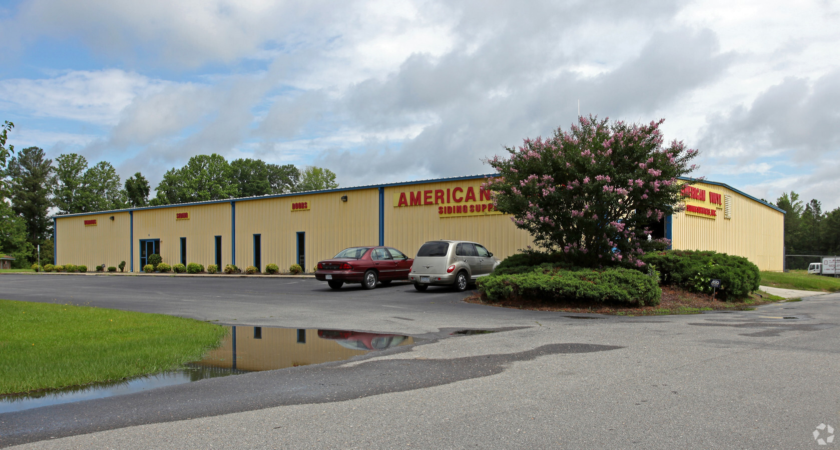
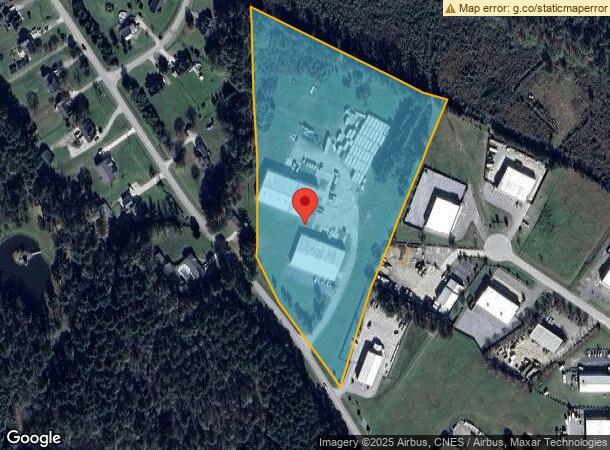
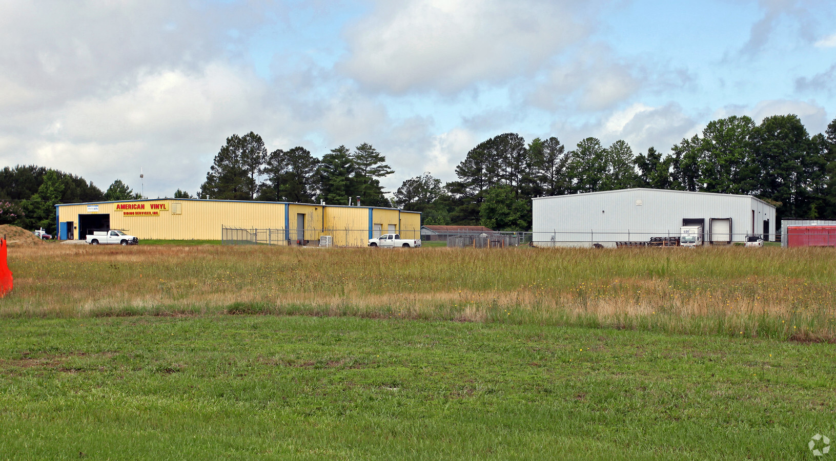
Property Record
120 Rock Pillar Rd, Smithfield, NC 27577
NEARBY LISTINGS FOR SALE OR LEASE
Property Detail
120 Rock Pillar Rd
15J08017A
COLTRAN
Warehouse
Johnston
X
North Carolina
3720167500K
10.01 AC
2024
Johnston County
2024
Raleigh/Durham
040800
Raleigh, NC
15,640 SF
DEMOGRAPHICS near 120 Rock Pillar Rd
1 Mile
3 Mile
5 Mile
2024 Total Population
791
10,536
33,450
2029 Population
944
12,771
40,792
Pop Growth 2024-2029
+ 19.34%
+ 21.21%
+ 21.95%
Average Age
39
40
40
2024 Total Households
282
3,619
12,043
HH Growth 2024-2029
+ 19.15%
+ 21.25%
+ 22.06%
Median Household Inc
$64,615
$59,765
$56,668
Avg Household Size
2.60
2.60
2.60
2024 Avg HH Vehicles
2.00
2.00
2.00
Median Home Value
$259,999
$196,278
$237,828
Median Year Built
1993
1994
1992
Nearby Places
- Restaurants
- Banks
- Shops
- Fitness
- Groceries
PUBLIC TRANSPORTATION
COMMUTER RAIL
Selma (Carolinian - Amtrak, Palmetto - Amtrak)
DRIVE
WALK
Distance
Selma (Carolinian - Amtrak, Palmetto - Amtrak)
16 min
9.1 mi
Freight Ports
Port of Wilmington
DRIVE
WALK
Distance
Port of Wilmington
137 min
111.5 mi
Nearby Properties
Address
Land Use
TOTAL SIZE
Lot Size
Zoning
Address
Land Use
TOTAL SIZE
Lot Size
Zoning
581,400 SF
169.67 AC
COM
Address
Land Use
TOTAL SIZE
Lot Size
Zoning
70,104 SF
47.87 AC
MUP
Address
Land Use
TOTAL SIZE
Lot Size
Zoning
8,887 SF
325.79 AC
RAG
Address
Land Use
TOTAL SIZE
Lot Size
Zoning
173,567 SF
16.12 AC
IND
Address
Land Use
TOTAL SIZE
Lot Size
Zoning
86,155 SF
12.52 AC
IND
Address
Land Use
TOTAL SIZE
Lot Size
Zoning
17,600 SF
RAG
Address
Land Use
TOTAL SIZE
Lot Size
Zoning
62,617 SF
6.01 AC
RAG
Address
Land Use
TOTAL SIZE
Lot Size
Zoning
11,666 SF
15.29 AC
RAG
Address
Land Use
TOTAL SIZE
Lot Size
Zoning
40,360 SF
11.57 AC
RES
Address
Land Use
TOTAL SIZE
Lot Size
Zoning
24,000 SF
5.18 AC
COM
Address
Land Use
TOTAL SIZE
Lot Size
Zoning
30,055 SF
2.37 AC
COM
Address
Land Use
TOTAL SIZE
Lot Size
Zoning
85,600 SF
16 AC
COM
Address
Land Use
TOTAL SIZE
Lot Size
Zoning
32,366 SF
18.71 AC
IND
Address
Land Use
TOTAL SIZE
Lot Size
Zoning
25,580 SF
4.50 AC
IND
Address
Land Use
TOTAL SIZE
Lot Size
Zoning
240 SF
5.37 AC
RES
Address
Land Use
TOTAL SIZE
Lot Size
Zoning
1,590 SF
9.50 AC
COM
Address
Land Use
TOTAL SIZE
Lot Size
Zoning
20,745 SF
6 AC
RAG
Address
Land Use
TOTAL SIZE
Lot Size
Zoning
3,712 SF
3.90 AC
RES
Address
Land Use
TOTAL SIZE
Lot Size
Zoning
69,450 SF
7.40 AC
IND
Address
Land Use
TOTAL SIZE
Lot Size
Zoning
56,161 SF
20.38 AC
IND
Address
Land Use
TOTAL SIZE
Lot Size
Zoning
1,714 SF
3.11 AC
COM
Address
Land Use
TOTAL SIZE
Lot Size
Zoning
11,922 SF
RAG
Address
Land Use
TOTAL SIZE
Lot Size
Zoning
6,226 SF
1.18 AC
COM
Address
Land Use
TOTAL SIZE
Lot Size
Zoning
1,397 SF
431.46 AC
RAG
Address
Land Use
TOTAL SIZE
Lot Size
Zoning
84,840 SF
20.11 AC
IND
Address
Land Use
TOTAL SIZE
Lot Size
Zoning
11,752 SF
5 AC
RAG
Address
Land Use
TOTAL SIZE
Lot Size
Zoning
12,120 SF
10.20 AC
COM
Address
Land Use
TOTAL SIZE
Lot Size
Zoning
14,894 SF
5.95 AC
RAG
Address
Land Use
TOTAL SIZE
Lot Size
Zoning
6,242 SF
2.06 AC
COM
Address
Land Use
TOTAL SIZE
Lot Size
Zoning
11,338 SF
15.61 AC
RAG
The World's #1 Commercial Real Estate Marketplace
Connect with us
© 2025 CoStar Group
The information above has been obtained from sources believed reliable. While we do not doubt its accuracy we have not verified it and make no guarantee, warranty or representation about it. It is your responsibility to independently confirm its accuracy and completeness. Any projections, opinions, assumptions, or estimates used are for example only and do not represent the current or future performance of the property. The value of this transaction to you depends on tax and other factors which should be evaluated by your tax, financial, and legal advisors. You and your advisors should conduct a careful, independent investigation of the property to determine to your satisfaction the suitability of the property for your needs.