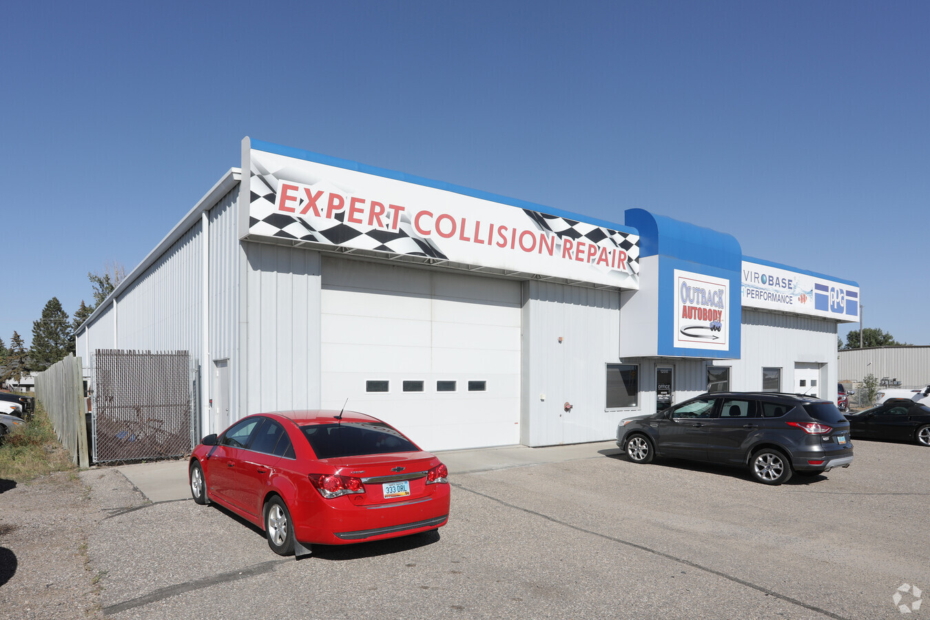
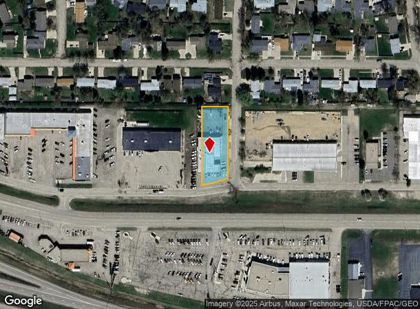
Property Record
1200 20Th Ave Sw, Minot, ND 58701
NEARBY LISTINGS FOR SALE OR LEASE
Property Detail
1200 20Th Ave Sw
Other Market Areas
Floyd Roll
Minot, ND
SUB: MI26106 FLOYD ROLL ADDITION LOT 1
MI-26106-000-001-0
Ward
Realpropertynec
North Dakota
2023
1
2023
0.62 AC
010500
Downtown Minot
10,142 SF
DEMOGRAPHICS near 1200 20Th Ave Sw
1 Mile
3 Mile
5 Mile
2024 Total Population
8,410
38,038
52,462
2029 Population
8,281
37,432
51,683
Pop Growth 2024-2029
(1.53%)
(1.59%)
(1.48%)
Average Age
44
38
38
2024 Total Households
3,945
16,284
22,448
HH Growth 2024-2029
(1.47%)
(1.64%)
(1.53%)
Median Household Inc
$66,015
$68,381
$69,413
Avg Household Size
2.00
2.20
2.20
2024 Avg HH Vehicles
2.00
2.00
2.00
Median Home Value
$244,348
$232,992
$237,619
Median Year Built
1991
1980
1983
Nearby Places
- Restaurants
- Banks
- Shops
- Fitness
- Groceries
PUBLIC TRANSPORTATION
COMMUTER RAIL
Minot Amtrak Station (Empire Builder - Amtrak)
DRIVE
WALK
Distance
Minot Amtrak Station (Empire Builder - Amtrak)
6 min
2.6 mi
AIRPORT
Minot International
DRIVE
WALK
Distance
Minot International
11 min
4.7 mi
Freight Ports
Port Milwaukee
DRIVE
WALK
Distance
Port Milwaukee
943 min
870.5 mi
Nearby Properties
Address
Land Use
TOTAL SIZE
Lot Size
Zoning
Address
Land Use
TOTAL SIZE
Lot Size
Zoning
872,320 SF
43.48 AC
Address
Land Use
TOTAL SIZE
Lot Size
Zoning
142,655 SF
9.54 AC
Address
Land Use
TOTAL SIZE
Lot Size
Zoning
59,312 SF
5.39 AC
Address
Land Use
TOTAL SIZE
Lot Size
Zoning
55,908 SF
5.89 AC
Address
Land Use
TOTAL SIZE
Lot Size
Zoning
29,172 SF
9.19 AC
Address
Land Use
TOTAL SIZE
Lot Size
Zoning
25,722 SF
1.25 AC
Address
Land Use
TOTAL SIZE
Lot Size
Zoning
41,710 SF
2.45 AC
Address
Land Use
TOTAL SIZE
Lot Size
Zoning
14,400 SF
4.46 AC
Address
Land Use
TOTAL SIZE
Lot Size
Zoning
13.96 AC
Address
Land Use
TOTAL SIZE
Lot Size
Zoning
39,667 SF
0.02 AC
Address
Land Use
TOTAL SIZE
Lot Size
Zoning
45,052 SF
3.78 AC
Address
Land Use
TOTAL SIZE
Lot Size
Zoning
21,170 SF
1.08 AC
Address
Land Use
TOTAL SIZE
Lot Size
Zoning
24,471 SF
1.54 AC
Address
Land Use
TOTAL SIZE
Lot Size
Zoning
55,520 SF
2.50 AC
Address
Land Use
TOTAL SIZE
Lot Size
Zoning
8,060 SF
1.02 AC
Address
Land Use
TOTAL SIZE
Lot Size
Zoning
6,868 SF
1.52 AC
Address
Land Use
TOTAL SIZE
Lot Size
Zoning
7,222 SF
3.07 AC
Address
Land Use
TOTAL SIZE
Lot Size
Zoning
14,112 SF
1.71 AC
Address
Land Use
TOTAL SIZE
Lot Size
Zoning
15,360 SF
2.26 AC
Address
Land Use
TOTAL SIZE
Lot Size
Zoning
44.39 AC
Address
Land Use
TOTAL SIZE
Lot Size
Zoning
24,110 SF
5.83 AC
Address
Land Use
TOTAL SIZE
Lot Size
Zoning
36,633 SF
2.07 AC
Address
Land Use
TOTAL SIZE
Lot Size
Zoning
2.62 AC
Address
Land Use
TOTAL SIZE
Lot Size
Zoning
38,721 SF
1.60 AC
Address
Land Use
TOTAL SIZE
Lot Size
Zoning
54,492 SF
3.16 AC
Address
Land Use
TOTAL SIZE
Lot Size
Zoning
Address
Land Use
TOTAL SIZE
Lot Size
Zoning
22,147 SF
3.81 AC
Address
Land Use
TOTAL SIZE
Lot Size
Zoning
7,200 SF
1.10 AC
Address
Land Use
TOTAL SIZE
Lot Size
Zoning
6,120 SF
0.53 AC
Address
Land Use
TOTAL SIZE
Lot Size
Zoning
9,715 SF
0.86 AC
The World's #1 Commercial Real Estate Marketplace
Connect with us
© 2025 CoStar Group
The information above has been obtained from sources believed reliable. While we do not doubt its accuracy we have not verified it and make no guarantee, warranty or representation about it. It is your responsibility to independently confirm its accuracy and completeness. Any projections, opinions, assumptions, or estimates used are for example only and do not represent the current or future performance of the property. The value of this transaction to you depends on tax and other factors which should be evaluated by your tax, financial, and legal advisors. You and your advisors should conduct a careful, independent investigation of the property to determine to your satisfaction the suitability of the property for your needs.