Property Record
1201 Bombay Ln, Roswell, GA 30076


NEARBY LISTINGS FOR SALE OR LEASE
Property Detail
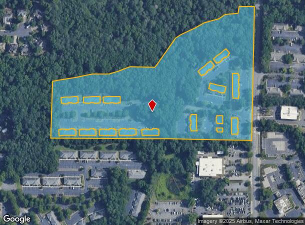
1201 Bombay Ln
Atlanta-Sandy Springs-Roswell, GA
Oakbrook Office Condos
12-2160-0509-101-9
1201 OAKB
Officecondo
Fulton
AE
Georgia
13121C0062F
1201
2023
0.03 AC
2023
N Fulton/Forsyth County
011416
Atlanta
1,136 SF
DEMOGRAPHICS near 1201 Bombay Ln
1 Mile
3 Mile
5 Mile
2024 Total Population
6,761
64,086
159,284
2029 Population
7,012
65,654
162,503
Pop Growth 2024-2029
+ 3.71%
+ 2.45%
+ 2.02%
Average Age
41
40
40
2024 Total Households
2,786
25,162
62,304
HH Growth 2024-2029
+ 3.80%
+ 2.68%
+ 2.17%
Median Household Inc
$128,739
$116,998
$122,230
Avg Household Size
2.40
2.50
2.50
2024 Avg HH Vehicles
2.00
2.00
2.00
Median Home Value
$385,274
$447,744
$481,705
Median Year Built
1990
1992
1990
Nearby Places
- Restaurants
- Banks
- Shops
- Fitness
- Groceries
PUBLIC TRANSPORTATION
AIRPORT
Hartsfield - Jackson Atlanta International
DRIVE
WALK
Distance
Hartsfield - Jackson Atlanta International
47 min
33.1 mi
Freight Ports
Georgia Ports - Savannah
DRIVE
WALK
Distance
Georgia Ports - Savannah
310 min
272.4 mi
SALE & LEASE HISTORY
LISTING DATE
SALE/LEASE

Jul 14, 2023
For Lease
Nearby Properties
Address
Land Use
TOTAL SIZE
Lot Size
Zoning
Address
Land Use
TOTAL SIZE
Lot Size
Zoning
780,641 SF
50.89 AC
OI
Address
Land Use
TOTAL SIZE
Lot Size
Zoning
683,219 SF
48.04 AC
R4C
Address
Land Use
TOTAL SIZE
Lot Size
Zoning
11.82 AC
Address
Land Use
TOTAL SIZE
Lot Size
Zoning
308,887 SF
18.10 AC
C3C
Address
Land Use
TOTAL SIZE
Lot Size
Zoning
415,701 SF
6.75 AC
OI
Address
Land Use
TOTAL SIZE
Lot Size
Zoning
666,599 SF
24.20 AC
PSC
Address
Land Use
TOTAL SIZE
Lot Size
Zoning
384,371 SF
26.51 AC
OI
Address
Land Use
TOTAL SIZE
Lot Size
Zoning
303,485 SF
1.44 AC
C2
Address
Land Use
TOTAL SIZE
Lot Size
Zoning
380,453 SF
10.28 AC
R4
Address
Land Use
TOTAL SIZE
Lot Size
Zoning
312,717 SF
21.22 AC
C3
Address
Land Use
TOTAL SIZE
Lot Size
Zoning
556,340 SF
46.55 AC
R4
Address
Land Use
TOTAL SIZE
Lot Size
Zoning
301,361 SF
70.17 AC
OP
Address
Land Use
TOTAL SIZE
Lot Size
Zoning
367,876 SF
41.40 AC
PSC
Address
Land Use
TOTAL SIZE
Lot Size
Zoning
310,209 SF
33 AC
R4C
Address
Land Use
TOTAL SIZE
Lot Size
Zoning
296,485 SF
38.74 AC
R4
Address
Land Use
TOTAL SIZE
Lot Size
Zoning
308,494 SF
2.64 AC
OI
Address
Land Use
TOTAL SIZE
Lot Size
Zoning
291,971 SF
19.09 AC
R4
Address
Land Use
TOTAL SIZE
Lot Size
Zoning
205,806 SF
2.01 AC
R2
Address
Land Use
TOTAL SIZE
Lot Size
Zoning
306,753 SF
19.77 AC
HMS
Address
Land Use
TOTAL SIZE
Lot Size
Zoning
286,394 SF
39.10 AC
R1
Address
Land Use
TOTAL SIZE
Lot Size
Zoning
402,680 SF
35.81 AC
Address
Land Use
TOTAL SIZE
Lot Size
Zoning
439,040 SF
18.07 AC
CUP
Address
Land Use
TOTAL SIZE
Lot Size
Zoning
278,691 SF
21.21 AC
R4
Address
Land Use
TOTAL SIZE
Lot Size
Zoning
219,890 SF
14.34 AC
R4C
Address
Land Use
TOTAL SIZE
Lot Size
Zoning
510,068 SF
66.75 AC
OPMS
Address
Land Use
TOTAL SIZE
Lot Size
Zoning
386,520 SF
7.12 AC
CUP
Address
Land Use
TOTAL SIZE
Lot Size
Zoning
260,648 SF
34.20 AC
C3C
Address
Land Use
TOTAL SIZE
Lot Size
Zoning
222,916 SF
28.94 AC
R4C
Address
Land Use
TOTAL SIZE
Lot Size
Zoning
264,255 SF
50.27 AC
E2
Address
Land Use
TOTAL SIZE
Lot Size
Zoning
377,080 SF
19.37 AC
E1
The World's #1 Commercial Real Estate Marketplace
Connect with us
© 2025 CoStar Group
The information above has been obtained from sources believed reliable. While we do not doubt its accuracy we have not verified it and make no guarantee, warranty or representation about it. It is your responsibility to independently confirm its accuracy and completeness. Any projections, opinions, assumptions, or estimates used are for example only and do not represent the current or future performance of the property. The value of this transaction to you depends on tax and other factors which should be evaluated by your tax, financial, and legal advisors. You and your advisors should conduct a careful, independent investigation of the property to determine to your satisfaction the suitability of the property for your needs.