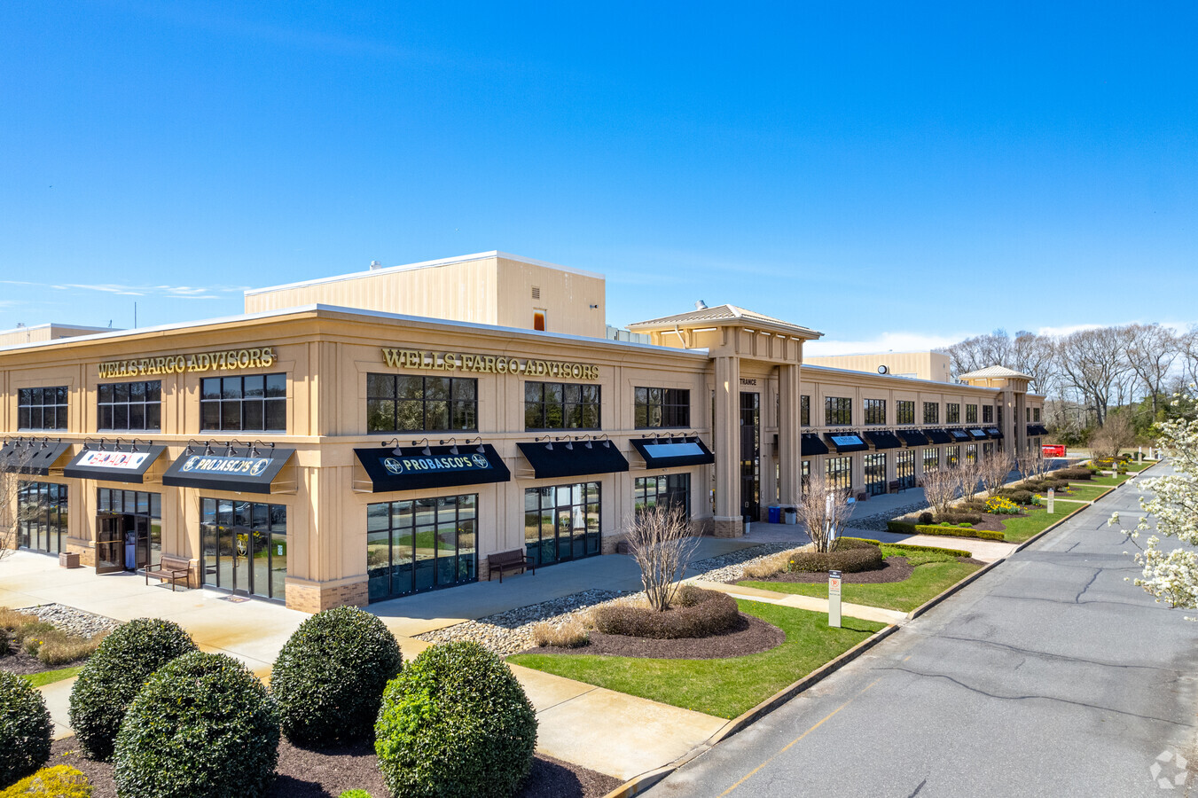
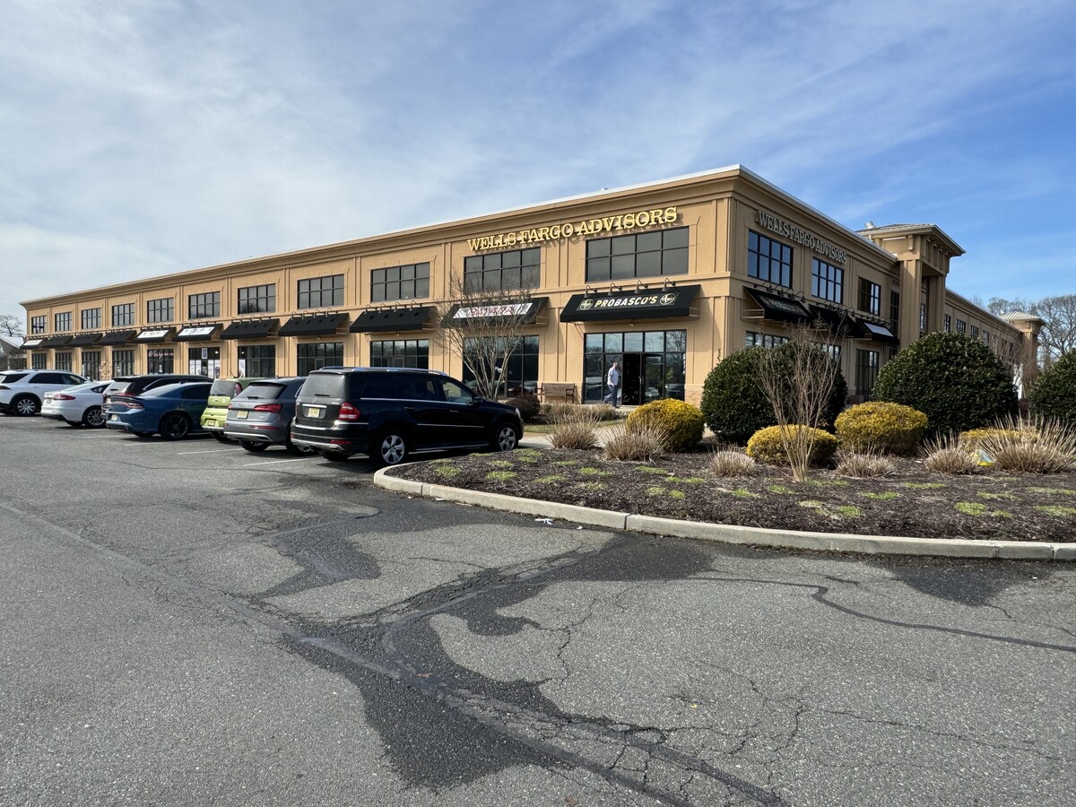
Property Record
1201 New Rd, Linwood, NJ 08221

Current Lease Availabilities
NEARBY LISTINGS FOR SALE OR LEASE
Property Detail
1201 New Rd
Atlantic City-Hammonton, NJ
Cornerstone Condo
14-00001-0000-00049-0000-C01
Atlantic
Vacantlandnec
New Jersey
X
49
34001C0427F
17.37 AC
2024
Atlantic City/Hammonton
2024
Philadelphia
012502
DEMOGRAPHICS near 1201 New Rd
1 Mile
3 Mile
5 Mile
2024 Total Population
6,100
35,829
90,910
2029 Population
6,032
35,289
91,488
Pop Growth 2024-2029
(1.11%)
(1.51%)
+ 0.64%
Average Age
43
42
43
2024 Total Households
2,272
13,715
35,983
HH Growth 2024-2029
(1.58%)
(2.02%)
+ 0.80%
Median Household Inc
$108,540
$89,338
$82,111
Avg Household Size
2.60
2.50
2.40
2024 Avg HH Vehicles
2.00
2.00
2.00
Median Home Value
$300,552
$265,432
$287,230
Median Year Built
1971
1972
1971
Nearby Places
- Restaurants
- Banks
- Shops
- Fitness
- Groceries
PUBLIC TRANSPORTATION
COMMUTER RAIL
Absecon (Atlantic City Line - NJ Transit Commuter Rail (NJ Transit))
DRIVE
WALK
Distance
Absecon (Atlantic City Line - NJ Transit Commuter Rail (NJ Transit))
14 min
7.3 mi
AIRPORT
Atlantic City International
DRIVE
WALK
Distance
Atlantic City International
38 min
12.2 mi
Freight Ports
Broadway Terminal - Pier 5
DRIVE
WALK
Distance
Broadway Terminal - Pier 5
71 min
53.3 mi
Nearby Properties
Address
Land Use
TOTAL SIZE
Lot Size
Zoning
Address
Land Use
TOTAL SIZE
Lot Size
Zoning
4.98 AC
SHOS
Address
Land Use
TOTAL SIZE
Lot Size
Zoning
6,000 SF
28.83 AC
INST
Address
Land Use
TOTAL SIZE
Lot Size
Zoning
16.33 AC
R-MF
Address
Land Use
TOTAL SIZE
Lot Size
Zoning
214.50 AC
R-1
Address
Land Use
TOTAL SIZE
Lot Size
Zoning
3.34 AC
R-1
Address
Land Use
TOTAL SIZE
Lot Size
Zoning
6.75 AC
R-1
Address
Land Use
TOTAL SIZE
Lot Size
Zoning
2.21 AC
SHOS
Address
Land Use
TOTAL SIZE
Lot Size
Zoning
8.41 AC
R-MF
Address
Land Use
TOTAL SIZE
Lot Size
Zoning
9.20 AC
GB
Address
Land Use
TOTAL SIZE
Lot Size
Zoning
4.81 AC
R-MF
Address
Land Use
TOTAL SIZE
Lot Size
Zoning
8.56 AC
R-MF
Address
Land Use
TOTAL SIZE
Lot Size
Zoning
5.02 AC
R-MF
Address
Land Use
TOTAL SIZE
Lot Size
Zoning
4.74 AC
INST
Address
Land Use
TOTAL SIZE
Lot Size
Zoning
2,680 SF
2.32 AC
INST
Address
Land Use
TOTAL SIZE
Lot Size
Zoning
61,193 SF
6.97 AC
GB
Address
Land Use
TOTAL SIZE
Lot Size
Zoning
2.98 AC
R-1
Address
Land Use
TOTAL SIZE
Lot Size
Zoning
Address
Land Use
TOTAL SIZE
Lot Size
Zoning
2.84 AC
BUS
Address
Land Use
TOTAL SIZE
Lot Size
Zoning
19.50 AC
R-C
Address
Land Use
TOTAL SIZE
Lot Size
Zoning
11 AC
BUS
Address
Land Use
TOTAL SIZE
Lot Size
Zoning
6.43 AC
GB
Address
Land Use
TOTAL SIZE
Lot Size
Zoning
52,280 SF
9.96 AC
GB
Address
Land Use
TOTAL SIZE
Lot Size
Zoning
8.48 AC
RG1
Address
Land Use
TOTAL SIZE
Lot Size
Zoning
1.21 AC
SHOS
Address
Land Use
TOTAL SIZE
Lot Size
Zoning
38,090 SF
4.73 AC
O-PB
Address
Land Use
TOTAL SIZE
Lot Size
Zoning
24,484 SF
4 AC
R-1
Address
Land Use
TOTAL SIZE
Lot Size
Zoning
14.01 AC
INST
Address
Land Use
TOTAL SIZE
Lot Size
Zoning
11.31 AC
R-1
Address
Land Use
TOTAL SIZE
Lot Size
Zoning
12.37 AC
R-1
The World's #1 Commercial Real Estate Marketplace
Connect with us
© 2025 CoStar Group
The information above has been obtained from sources believed reliable. While we do not doubt its accuracy we have not verified it and make no guarantee, warranty or representation about it. It is your responsibility to independently confirm its accuracy and completeness. Any projections, opinions, assumptions, or estimates used are for example only and do not represent the current or future performance of the property. The value of this transaction to you depends on tax and other factors which should be evaluated by your tax, financial, and legal advisors. You and your advisors should conduct a careful, independent investigation of the property to determine to your satisfaction the suitability of the property for your needs.