Property Record
1201 Sumneytown Pike, Harleysville, PA 19438
NEARBY LISTINGS FOR SALE OR LEASE
-
-
View all Harleysville listings for sale on LoopNet.com
Property Detail
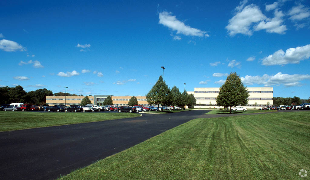
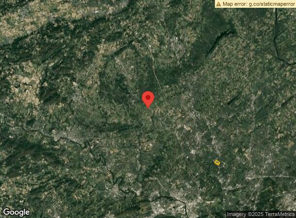
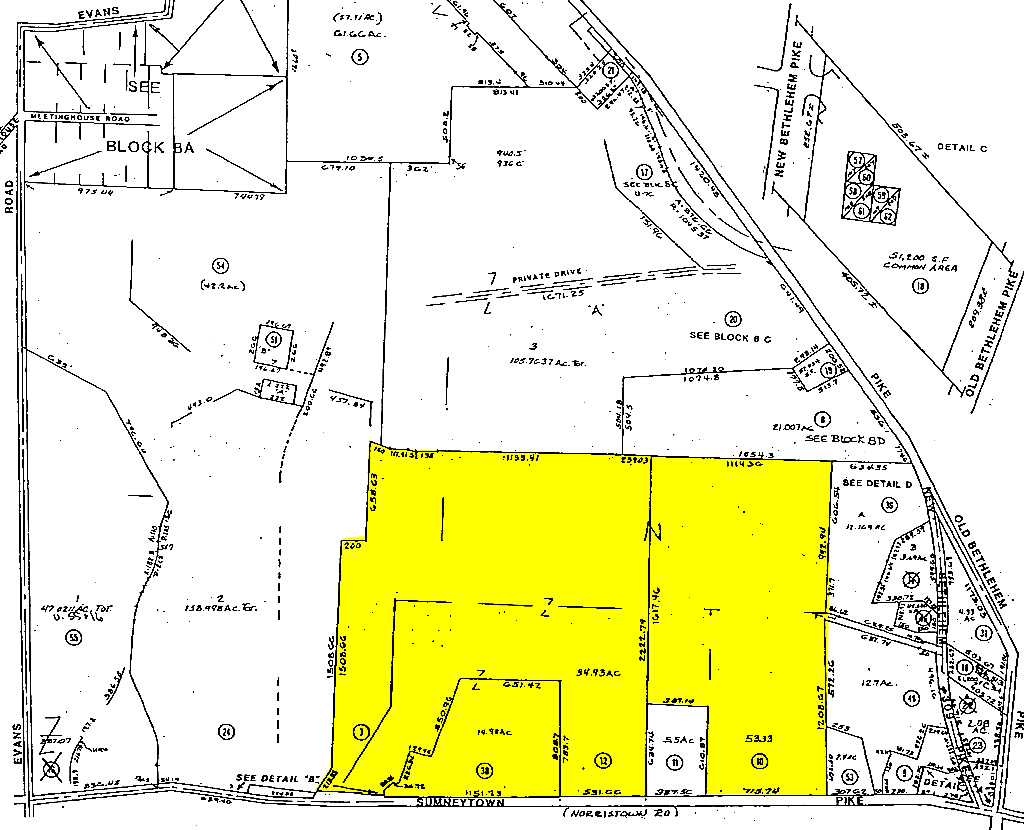
1201 Sumneytown Pike
Philadelphia-Camden-Wilmington, PA-NJ-DE-MD
Plan Showing Parcel Lehigh Valley Cooper
39-00-03952-005
U 10-12-38
Miscellaneous
Montgomery
A
Pennsylvania
42091C0278G
7
2024
154.42 AC
2024
Ft Wash/Spring House
207500
Philadelphia
152,000 SF
DEMOGRAPHICS near 1201 Sumneytown Pike
1 Mile
3 Mile
5 Mile
2024 Total Population
4,281
50,519
148,820
2029 Population
4,348
51,347
151,293
Pop Growth 2024-2029
+ 1.57%
+ 1.64%
+ 1.66%
Average Age
47
44
43
2024 Total Households
1,636
19,485
56,415
HH Growth 2024-2029
+ 1.53%
+ 1.62%
+ 1.59%
Median Household Inc
$155,134
$123,315
$119,913
Avg Household Size
2.40
2.50
2.50
2024 Avg HH Vehicles
2.00
2.00
2.00
Median Home Value
$672,734
$466,710
$443,111
Median Year Built
1982
1978
1980
Nearby Places
- Restaurants
- Banks
- Shops
- Fitness
- Groceries
PUBLIC TRANSPORTATION
AIRPORT
Lehigh Valley International
DRIVE
WALK
Distance
Lehigh Valley International
50 min
34.8 mi
Freight Ports
Port of Philadelphia
DRIVE
WALK
Distance
Port of Philadelphia
51 min
32.3 mi
Nearby Properties
Address
Land Use
TOTAL SIZE
Lot Size
Zoning
Address
Land Use
TOTAL SIZE
Lot Size
Zoning
21,386 SF
1.03 AC
Address
Land Use
TOTAL SIZE
Lot Size
Zoning
246,631 SF
48.78 AC
AO
Address
Land Use
TOTAL SIZE
Lot Size
Zoning
149,259 SF
4.30 AC
R3
Address
Land Use
TOTAL SIZE
Lot Size
Zoning
136,281 SF
4.05 AC
R3
Address
Land Use
TOTAL SIZE
Lot Size
Zoning
52,348 SF
21.30 AC
R5
Address
Land Use
TOTAL SIZE
Lot Size
Zoning
84,887 SF
38.07 AC
INST
Address
Land Use
TOTAL SIZE
Lot Size
Zoning
93,049 SF
20.88 AC
CB
Address
Land Use
TOTAL SIZE
Lot Size
Zoning
61,855 SF
13.26 AC
IN
Address
Land Use
TOTAL SIZE
Lot Size
Zoning
41,578 SF
16.89 AC
R3
Address
Land Use
TOTAL SIZE
Lot Size
Zoning
94,353 SF
7.15 AC
C
Address
Land Use
TOTAL SIZE
Lot Size
Zoning
40,300 SF
1.05 AC
Address
Land Use
TOTAL SIZE
Lot Size
Zoning
57,397 SF
25.55 AC
R1A
Address
Land Use
TOTAL SIZE
Lot Size
Zoning
62,666 SF
2.46 AC
R3
Address
Land Use
TOTAL SIZE
Lot Size
Zoning
88,050 SF
8.68 AC
R4
Address
Land Use
TOTAL SIZE
Lot Size
Zoning
25,354 SF
13.62 AC
INST
Address
Land Use
TOTAL SIZE
Lot Size
Zoning
20,781 SF
4.80 AC
R2
Address
Land Use
TOTAL SIZE
Lot Size
Zoning
2,875 SF
3.40 AC
R2
Address
Land Use
TOTAL SIZE
Lot Size
Zoning
28,558 SF
3.71 AC
R4
Address
Land Use
TOTAL SIZE
Lot Size
Zoning
50,337 SF
4.71 AC
VC
Address
Land Use
TOTAL SIZE
Lot Size
Zoning
46,865 SF
16.10 AC
R130
Address
Land Use
TOTAL SIZE
Lot Size
Zoning
12,619 SF
39.93 AC
R3
Address
Land Use
TOTAL SIZE
Lot Size
Zoning
13,896 SF
27.83 AC
IN
Address
Land Use
TOTAL SIZE
Lot Size
Zoning
19,200 SF
2.32 AC
R3
Address
Land Use
TOTAL SIZE
Lot Size
Zoning
16,490 SF
0.38 AC
Address
Land Use
TOTAL SIZE
Lot Size
Zoning
13,459 SF
10.27 AC
I
Address
Land Use
TOTAL SIZE
Lot Size
Zoning
25,912 SF
7.14 AC
VC
Address
Land Use
TOTAL SIZE
Lot Size
Zoning
22,441 SF
7.64 AC
IN
Address
Land Use
TOTAL SIZE
Lot Size
Zoning
14,380 SF
20.65 AC
IR
Address
Land Use
TOTAL SIZE
Lot Size
Zoning
43,448 SF
7.44 AC
RR
The World's #1 Commercial Real Estate Marketplace
Connect with us
© 2025 CoStar Group
The information above has been obtained from sources believed reliable. While we do not doubt its accuracy we have not verified it and make no guarantee, warranty or representation about it. It is your responsibility to independently confirm its accuracy and completeness. Any projections, opinions, assumptions, or estimates used are for example only and do not represent the current or future performance of the property. The value of this transaction to you depends on tax and other factors which should be evaluated by your tax, financial, and legal advisors. You and your advisors should conduct a careful, independent investigation of the property to determine to your satisfaction the suitability of the property for your needs.