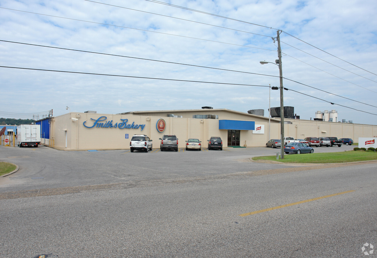
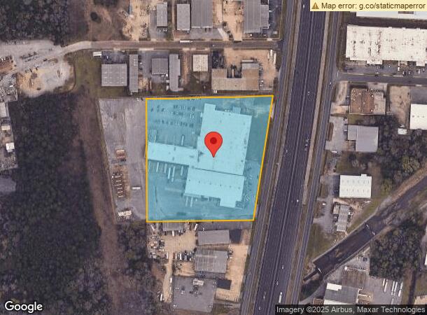
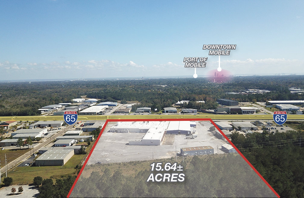
Property Record
1201 W I65 Service Rd N, Mobile, AL 36618
NEARBY LISTINGS FOR SALE OR LEASE
Property Detail
1201 W I65 Service Rd N
Mobile, AL
Smiths Bakery-Harris S/D
29-03-07-2-000-023
THAT PT OF LOT 1 OF SMITHS BAKERY-HARRIS S/D MBK 76 PG 95 DESC AS FOLL: BEG AT TH NE COR OF LOT 1 TH RUN SW-LY 645 FT(S) TH
Manufacturinglight
Mobile
X
Alabama
01097C0553L
1
2024
8.23 AC
2024
West Mobile
003402
Mobile
69,338 SF
DEMOGRAPHICS near 1201 W I65 Service Rd N
1 Mile
3 Mile
5 Mile
2024 Total Population
3,104
59,134
156,179
2029 Population
3,093
59,397
156,356
Pop Growth 2024-2029
(0.35%)
+ 0.44%
+ 0.11%
Average Age
39
40
39
2024 Total Households
1,174
24,203
63,762
HH Growth 2024-2029
(0.34%)
+ 0.46%
+ 0.08%
Median Household Inc
$36,091
$42,314
$40,654
Avg Household Size
2.50
2.30
2.30
2024 Avg HH Vehicles
2.00
2.00
2.00
Median Home Value
$134,058
$114,872
$129,252
Median Year Built
1968
1967
1969
Nearby Places
- Restaurants
- Banks
- Shops
- Fitness
- Groceries
PUBLIC TRANSPORTATION
AIRPORT
Mobile Regional
DRIVE
WALK
Distance
Mobile Regional
22 min
10.9 mi
Freight Ports
Port of Mobile
DRIVE
WALK
Distance
Port of Mobile
12 min
9.5 mi
SALE & LEASE HISTORY
LISTING DATE
SALE/LEASE

Oct 23, 2018
For Lease
Nov 09, 2020
For Lease
Mar 21, 2018
For Sale
Nearby Properties
Address
Land Use
TOTAL SIZE
Lot Size
Zoning
Address
Land Use
TOTAL SIZE
Lot Size
Zoning
296,060 SF
42.93 AC
Address
Land Use
TOTAL SIZE
Lot Size
Zoning
171,670 SF
20.19 AC
Address
Land Use
TOTAL SIZE
Lot Size
Zoning
339,141 SF
7.18 AC
Address
Land Use
TOTAL SIZE
Lot Size
Zoning
148,656 SF
112.96 AC
Address
Land Use
TOTAL SIZE
Lot Size
Zoning
141,209 SF
10.20 AC
Address
Land Use
TOTAL SIZE
Lot Size
Zoning
118,712 SF
9.90 AC
Address
Land Use
TOTAL SIZE
Lot Size
Zoning
169,511 SF
44.42 AC
Address
Land Use
TOTAL SIZE
Lot Size
Zoning
359,478 SF
3.69 AC
Address
Land Use
TOTAL SIZE
Lot Size
Zoning
139,460 SF
27.51 AC
Address
Land Use
TOTAL SIZE
Lot Size
Zoning
30,504 SF
16.45 AC
Address
Land Use
TOTAL SIZE
Lot Size
Zoning
91,391 SF
14.93 AC
Address
Land Use
TOTAL SIZE
Lot Size
Zoning
228,018 SF
4.80 AC
Address
Land Use
TOTAL SIZE
Lot Size
Zoning
102,380 SF
12.24 AC
Address
Land Use
TOTAL SIZE
Lot Size
Zoning
9,104 SF
13.52 AC
Address
Land Use
TOTAL SIZE
Lot Size
Zoning
208,683 SF
11.68 AC
Address
Land Use
TOTAL SIZE
Lot Size
Zoning
15,960 SF
11.06 AC
Address
Land Use
TOTAL SIZE
Lot Size
Zoning
143,067 SF
9.62 AC
Address
Land Use
TOTAL SIZE
Lot Size
Zoning
12.97 AC
Address
Land Use
TOTAL SIZE
Lot Size
Zoning
103,308 SF
34 AC
Address
Land Use
TOTAL SIZE
Lot Size
Zoning
30,395 SF
44.92 AC
Address
Land Use
TOTAL SIZE
Lot Size
Zoning
99,551 SF
8.16 AC
Address
Land Use
TOTAL SIZE
Lot Size
Zoning
142,431 SF
10.12 AC
Address
Land Use
TOTAL SIZE
Lot Size
Zoning
5,000 SF
95.29 AC
Address
Land Use
TOTAL SIZE
Lot Size
Zoning
10,816 SF
2.91 AC
Address
Land Use
TOTAL SIZE
Lot Size
Zoning
87,349 SF
3.32 AC
Address
Land Use
TOTAL SIZE
Lot Size
Zoning
54,596 SF
3.99 AC
Address
Land Use
TOTAL SIZE
Lot Size
Zoning
7,986 SF
156.65 AC
Address
Land Use
TOTAL SIZE
Lot Size
Zoning
202,036 SF
13.39 AC
Address
Land Use
TOTAL SIZE
Lot Size
Zoning
14,623 SF
19 AC
Address
Land Use
TOTAL SIZE
Lot Size
Zoning
50,954 SF
36.60 AC
The World's #1 Commercial Real Estate Marketplace
Connect with us
© 2025 CoStar Group
The information above has been obtained from sources believed reliable. While we do not doubt its accuracy we have not verified it and make no guarantee, warranty or representation about it. It is your responsibility to independently confirm its accuracy and completeness. Any projections, opinions, assumptions, or estimates used are for example only and do not represent the current or future performance of the property. The value of this transaction to you depends on tax and other factors which should be evaluated by your tax, financial, and legal advisors. You and your advisors should conduct a careful, independent investigation of the property to determine to your satisfaction the suitability of the property for your needs.