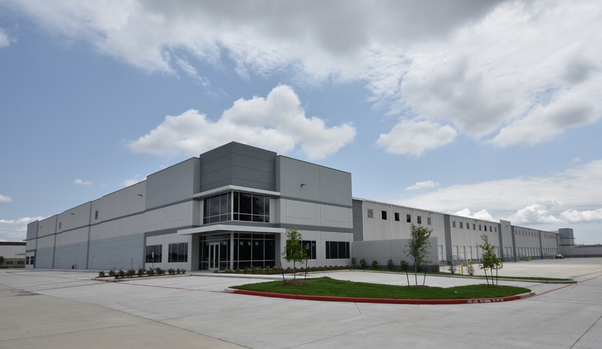
Property Record
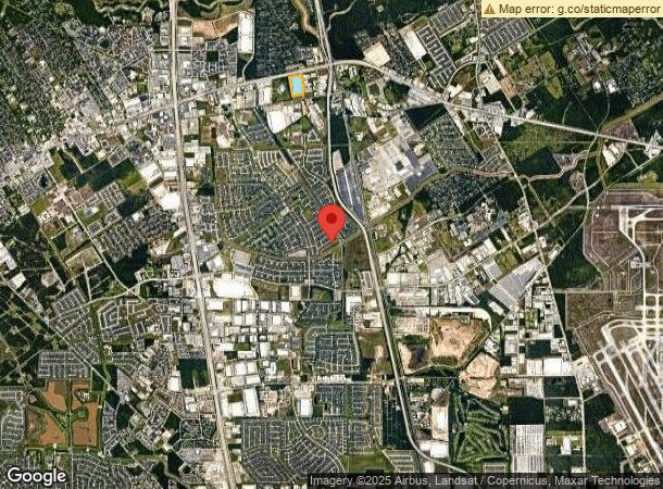
1202 Fm 1960 Rd, Houston, TX 77073
NEARBY LISTINGS FOR SALE OR LEASE
Property Detail
1202 Fm 1960 Rd
1361590020001
Hardy Center North Par R/P
Warehouse
RES A BLK 1 HARDY CENTER NORTH PAR R/P
X
Harris
48339C0700F
Texas
2023
13.40 AC
2023
North Hardy Toll Road
240705
Houston
204,870 SF
Houston-The Woodlands-Sugar Land, TX
DEMOGRAPHICS near 1202 Fm 1960 Rd
1 Mile
3 Mile
5 Mile
2024 Total Population
12,320
96,394
236,743
2029 Population
12,729
98,413
242,094
Pop Growth 2024-2029
+ 3.32%
+ 2.09%
+ 2.26%
Average Age
33
34
35
2024 Total Households
4,330
33,491
81,310
HH Growth 2024-2029
+ 3.37%
+ 2.19%
+ 2.30%
Median Household Inc
$44,407
$52,690
$59,077
Avg Household Size
2.80
2.80
2.80
2024 Avg HH Vehicles
2.00
2.00
2.00
Median Home Value
$156,644
$171,495
$194,581
Median Year Built
1990
1992
1994
Nearby Places
- Restaurants
- Banks
- Shops
- Fitness
- Groceries
PUBLIC TRANSPORTATION
AIRPORT
George Bush Intcntl/Houston
DRIVE
WALK
Distance
George Bush Intcntl/Houston
13 min
9.4 mi
William P Hobby
DRIVE
WALK
Distance
William P Hobby
47 min
31.4 mi
Freight Ports
Port of Houston
DRIVE
WALK
Distance
Port of Houston
36 min
25.1 mi
SALE & LEASE HISTORY
LISTING DATE
SALE/LEASE

May 18, 2021
For Sale
May 01, 2023
For Sale
Jun 23, 2022
For Lease
Nearby Properties
Address
Land Use
TOTAL SIZE
Lot Size
Zoning
Address
Land Use
TOTAL SIZE
Lot Size
Zoning
790,262 SF
50.60 AC
Address
Land Use
TOTAL SIZE
Lot Size
Zoning
848,575 SF
11.37 AC
Address
Land Use
TOTAL SIZE
Lot Size
Zoning
764,495 SF
54.15 AC
Address
Land Use
TOTAL SIZE
Lot Size
Zoning
749,224 SF
50.74 AC
Address
Land Use
TOTAL SIZE
Lot Size
Zoning
657,500 SF
36.24 AC
Address
Land Use
TOTAL SIZE
Lot Size
Zoning
417,597 SF
16.98 AC
Address
Land Use
TOTAL SIZE
Lot Size
Zoning
472,399 SF
20.63 AC
Address
Land Use
TOTAL SIZE
Lot Size
Zoning
378,316 SF
17.34 AC
Address
Land Use
TOTAL SIZE
Lot Size
Zoning
485,125 SF
28.55 AC
Address
Land Use
TOTAL SIZE
Lot Size
Zoning
326,920 SF
22.26 AC
Address
Land Use
TOTAL SIZE
Lot Size
Zoning
280,283 SF
16.56 AC
Address
Land Use
TOTAL SIZE
Lot Size
Zoning
350,423 SF
122.83 AC
Address
Land Use
TOTAL SIZE
Lot Size
Zoning
366,954 SF
18.88 AC
Address
Land Use
TOTAL SIZE
Lot Size
Zoning
291,504 SF
17.16 AC
Address
Land Use
TOTAL SIZE
Lot Size
Zoning
394,784 SF
22.47 AC
Address
Land Use
TOTAL SIZE
Lot Size
Zoning
463,081 SF
25.65 AC
Address
Land Use
TOTAL SIZE
Lot Size
Zoning
283,283 SF
15.14 AC
Address
Land Use
TOTAL SIZE
Lot Size
Zoning
276,324 SF
33.79 AC
Address
Land Use
TOTAL SIZE
Lot Size
Zoning
409,480 SF
27.32 AC
Address
Land Use
TOTAL SIZE
Lot Size
Zoning
454,632 SF
18.69 AC
Address
Land Use
TOTAL SIZE
Lot Size
Zoning
318,000 SF
18.53 AC
Address
Land Use
TOTAL SIZE
Lot Size
Zoning
57,551 SF
49.71 AC
Address
Land Use
TOTAL SIZE
Lot Size
Zoning
339,804 SF
14.21 AC
Address
Land Use
TOTAL SIZE
Lot Size
Zoning
404,248 SF
16.31 AC
Address
Land Use
TOTAL SIZE
Lot Size
Zoning
249,134 SF
11.84 AC
Address
Land Use
TOTAL SIZE
Lot Size
Zoning
362,720 SF
20.23 AC
Address
Land Use
TOTAL SIZE
Lot Size
Zoning
329,643 SF
19.99 AC
Address
Land Use
TOTAL SIZE
Lot Size
Zoning
188,587 SF
9.85 AC
Address
Land Use
TOTAL SIZE
Lot Size
Zoning
287,251 SF
18.12 AC
Address
Land Use
TOTAL SIZE
Lot Size
Zoning
174,349 SF
9.94 AC
The World's #1 Commercial Real Estate Marketplace
Connect with us
© 2025 CoStar Group
The information above has been obtained from sources believed reliable. While we do not doubt its accuracy we have not verified it and make no guarantee, warranty or representation about it. It is your responsibility to independently confirm its accuracy and completeness. Any projections, opinions, assumptions, or estimates used are for example only and do not represent the current or future performance of the property. The value of this transaction to you depends on tax and other factors which should be evaluated by your tax, financial, and legal advisors. You and your advisors should conduct a careful, independent investigation of the property to determine to your satisfaction the suitability of the property for your needs.