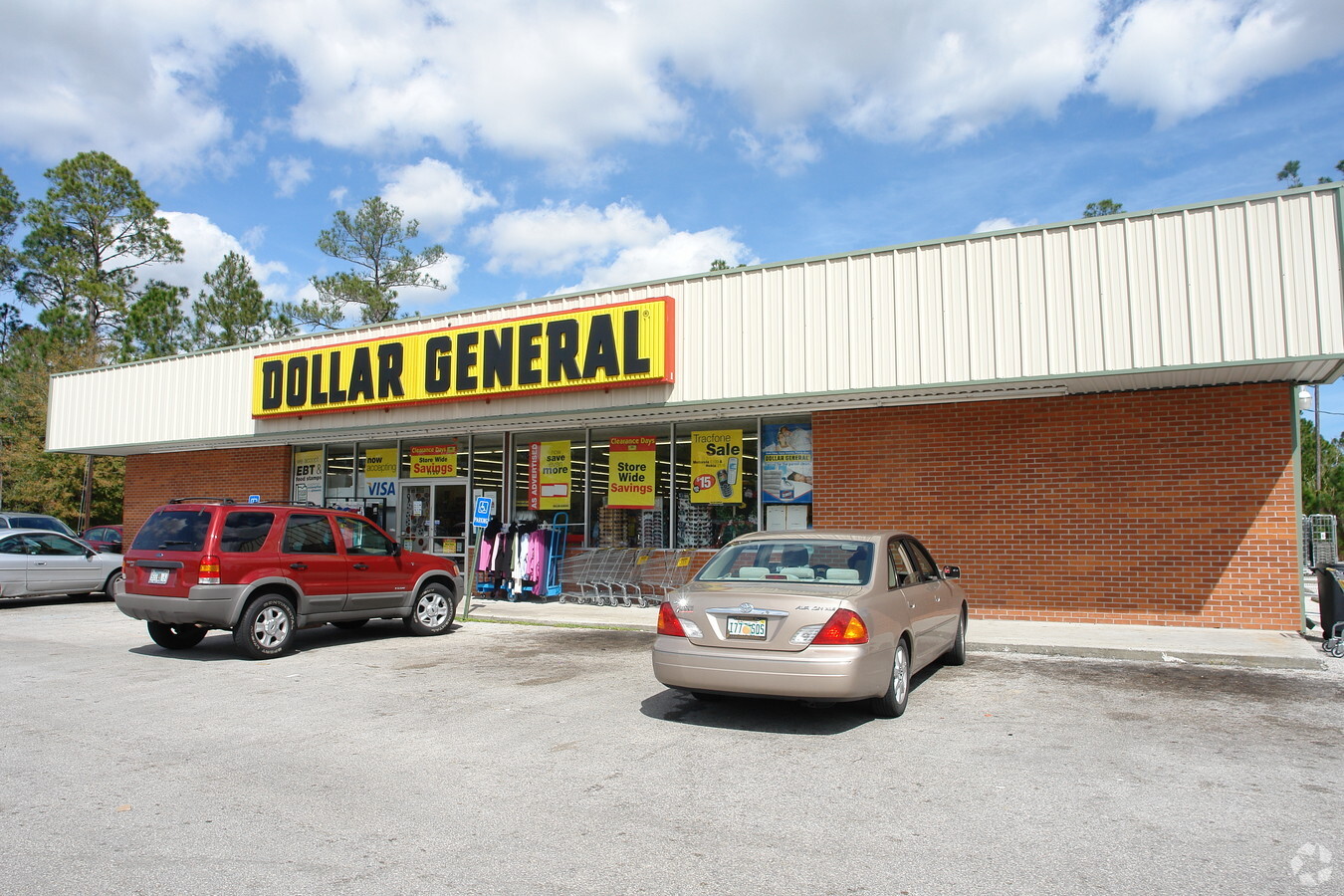
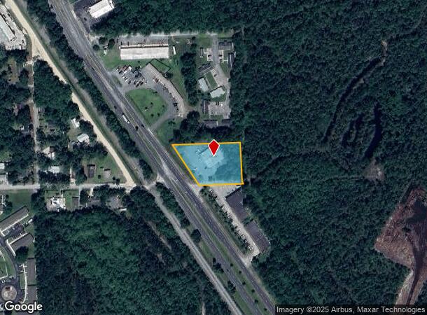
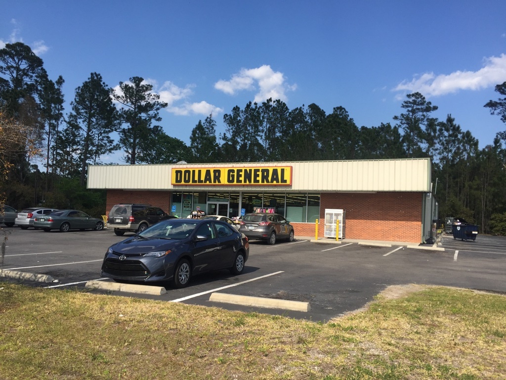
Property Record
1208 S State St, Bunnell, FL 32110
NEARBY LISTINGS FOR SALE OR LEASE
Property Detail
1208 S State St
Deltona-Daytona Beach-Ormond Beach, FL
Lake Terrace
14-12-30-3750-000A0-0000
LAKE TERRACE - BLOCK A - ALL EXCEPT R/W OF U.S. HWY NO. 1 OR 49 PG 508 OR BOOK 193 PAGE 457 (DC) OR 420 PG 65 OR 423 PG 847 (UND 1/2INT TO THOMPSONS) OR 631 PG 145-FJ OR 631 PG 922-FJ THOMPSONS 1/2 INT & DYE 1/2 INT OR 636 PG 1225 OR 1788/979 OR 1803
Storemultistory
Flagler
A
Florida
12035C0228E
1-15
2023
1.31 AC
2023
Daytona Area
060206
Other Market Areas
8,000 SF
DEMOGRAPHICS near 1208 S State St
1 Mile
3 Mile
5 Mile
2024 Total Population
1,545
12,663
44,405
2029 Population
1,852
15,451
54,424
Pop Growth 2024-2029
+ 19.87%
+ 22.02%
+ 22.56%
Average Age
42
46
44
2024 Total Households
533
5,128
17,353
HH Growth 2024-2029
+ 18.95%
+ 21.31%
+ 21.85%
Median Household Inc
$29,112
$58,618
$61,707
Avg Household Size
2.40
2.40
2.50
2024 Avg HH Vehicles
1.00
2.00
2.00
Median Home Value
$173,636
$286,392
$256,334
Median Year Built
1983
2003
2004
Nearby Places
- Restaurants
- Banks
- Shops
- Fitness
- Groceries
PUBLIC TRANSPORTATION
AIRPORT
Daytona Beach International
DRIVE
WALK
Distance
Daytona Beach International
34 min
25.6 mi
Freight Ports
Jacksonville Port
DRIVE
WALK
Distance
Jacksonville Port
87 min
71.1 mi
SALE & LEASE HISTORY
LISTING DATE
SALE/LEASE

May 18, 2020
For Sale
Aug 03, 2018
For Sale
Nearby Properties
Address
Land Use
TOTAL SIZE
Lot Size
Zoning
Address
Land Use
TOTAL SIZE
Lot Size
Zoning
4,984 SF
85.53 AC
PSP
Address
Land Use
TOTAL SIZE
Lot Size
Zoning
320,259 SF
83.19 AC
P
Address
Land Use
TOTAL SIZE
Lot Size
Zoning
149,217 SF
891.40 AC
I-C
Address
Land Use
TOTAL SIZE
Lot Size
Zoning
280,742 SF
16.06 AC
MPD
Address
Land Use
TOTAL SIZE
Lot Size
Zoning
138,991 SF
18.66 AC
P
Address
Land Use
TOTAL SIZE
Lot Size
Zoning
121,173 SF
10 AC
AC
Address
Land Use
TOTAL SIZE
Lot Size
Zoning
220,314 SF
17.41 AC
MPD
Address
Land Use
TOTAL SIZE
Lot Size
Zoning
68,684 SF
9.68 AC
MPD
Address
Land Use
TOTAL SIZE
Lot Size
Zoning
20,990 SF
18.10 AC
Address
Land Use
TOTAL SIZE
Lot Size
Zoning
59,889 SF
0.75 AC
R-3A
Address
Land Use
TOTAL SIZE
Lot Size
Zoning
67,008 SF
5.34 AC
B-1
Address
Land Use
TOTAL SIZE
Lot Size
Zoning
89,590 SF
9.90 AC
B-1
Address
Land Use
TOTAL SIZE
Lot Size
Zoning
4,158 SF
3.73 AC
P
Address
Land Use
TOTAL SIZE
Lot Size
Zoning
41,710 SF
11.97 AC
L-1
Address
Land Use
TOTAL SIZE
Lot Size
Zoning
74,470 SF
11.98 AC
MPD
Address
Land Use
TOTAL SIZE
Lot Size
Zoning
18,852 SF
3.23 AC
COM-2
Address
Land Use
TOTAL SIZE
Lot Size
Zoning
43,990 SF
4.84 AC
P
Address
Land Use
TOTAL SIZE
Lot Size
Zoning
38,420 SF
4.83 AC
C-2(F)
Address
Land Use
TOTAL SIZE
Lot Size
Zoning
60,582 SF
2.20 AC
MPD
Address
Land Use
TOTAL SIZE
Lot Size
Zoning
17,901 SF
1.72 AC
COM-2
Address
Land Use
TOTAL SIZE
Lot Size
Zoning
10,310 SF
1.54 AC
Address
Land Use
TOTAL SIZE
Lot Size
Zoning
49,785 SF
1.35 AC
B-2
Address
Land Use
TOTAL SIZE
Lot Size
Zoning
31,452 SF
7.83 AC
B-1
Address
Land Use
TOTAL SIZE
Lot Size
Zoning
41,293 SF
4.92 AC
B-1
Address
Land Use
TOTAL SIZE
Lot Size
Zoning
6,086 SF
1.57 AC
COM-2
Address
Land Use
TOTAL SIZE
Lot Size
Zoning
29,371 SF
18.32 AC
B-1
Address
Land Use
TOTAL SIZE
Lot Size
Zoning
53,744 SF
75.79 AC
AC
Address
Land Use
TOTAL SIZE
Lot Size
Zoning
36,576 SF
18.38 AC
I-C
Address
Land Use
TOTAL SIZE
Lot Size
Zoning
14,850 SF
2.08 AC
COM-2
The World's #1 Commercial Real Estate Marketplace
Connect with us
© 2025 CoStar Group
The information above has been obtained from sources believed reliable. While we do not doubt its accuracy we have not verified it and make no guarantee, warranty or representation about it. It is your responsibility to independently confirm its accuracy and completeness. Any projections, opinions, assumptions, or estimates used are for example only and do not represent the current or future performance of the property. The value of this transaction to you depends on tax and other factors which should be evaluated by your tax, financial, and legal advisors. You and your advisors should conduct a careful, independent investigation of the property to determine to your satisfaction the suitability of the property for your needs.