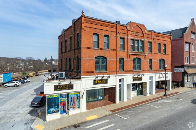
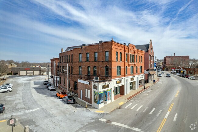
Property Record
121 Main St, Webster, MA 01570

Property Detail
121 Main St
Storebuilding
Worcester
GB-4 W
Massachusetts
B and X Area of moderate flood hazard, usually the area between the limits of the 100-year and 500-year floods.
0.25 AC
2025
Outlying Worcester
2025
Boston
754300
Worcester, MA
25,688 SF
WEBS-000001-F000000-000007
NEARBY LISTINGS FOR SALE OR LEASE
DEMOGRAPHICS near 121 Main St
1 mile
3 mile
5 mile
2025 Total Population
11,722
26,339
45,274
2030 Population
11,829
26,866
46,287
Pop Growth 2025-2030
+ 0.91%
+ 2.00%
+ 2.24%
Average Age
40
42
43
2025 Total Households
5,136
10,967
18,257
HH Growth 2025-2030
+ 1.01%
+ 2.07%
+ 2.31%
Median Household Inc
$58,579
$73,714
$86,193
Avg Household Size
2.20
2.30
2.40
2025 Avg HH Vehicles
1.00
2.00
2.00
Median Home Value
$334,772
$381,697
$375,535
Median Year Built
1950
1962
1968
Nearby Places
Map Layers
Map Styles
 Street
 Aerial
Layers
 Traffic
 Biking
Places
Listings with unknown addresses are not visible on the map
- Restaurants
- Banks
- Shops
- Fitness
- Groceries
PUBLIC TRANSPORTATION
AIRPORT
Worcester Regional
Drive
Walk
Distance
Worcester Regional
33 min
19.1 mi
Freight Ports
Port of Davisville, RI
Drive
Walk
Distance
Port of Davisville, RI
77 min
60.4 mi
The World's #1 Commercial Real Estate Marketplace
Connect with us
© 2026 CoStar Group
The information above has been obtained from sources believed reliable. While we do not doubt its accuracy we have not verified it and make no guarantee, warranty or representation about it. It is your responsibility to independently confirm its accuracy and completeness. Any projections, opinions, assumptions, or estimates used are for example only and do not represent the current or future performance of the property. The value of this transaction to you depends on tax and other factors which should be evaluated by your tax, financial, and legal advisors. You and your advisors should conduct a careful, independent investigation of the property to determine to your satisfaction the suitability of the property for your needs.