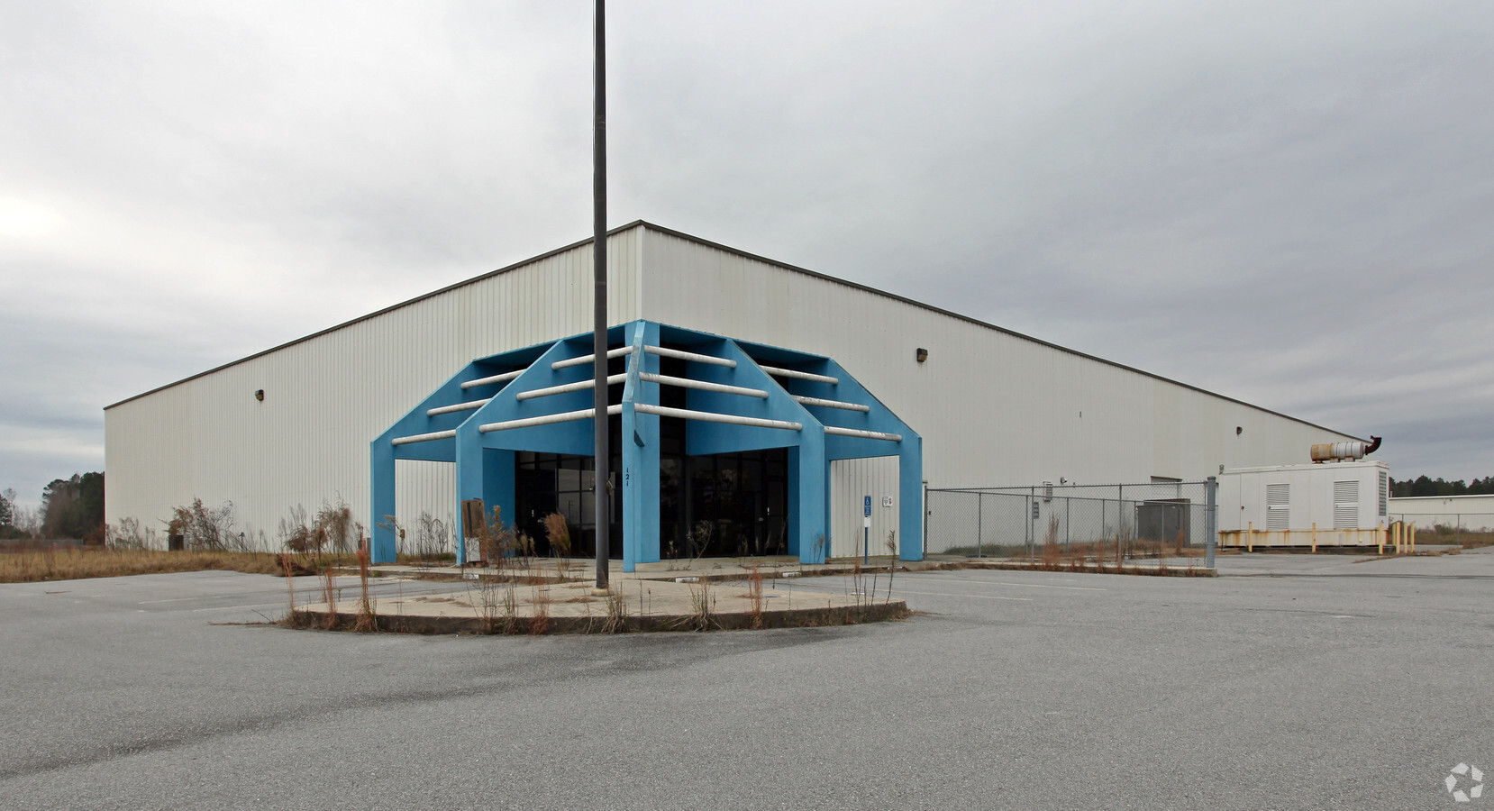
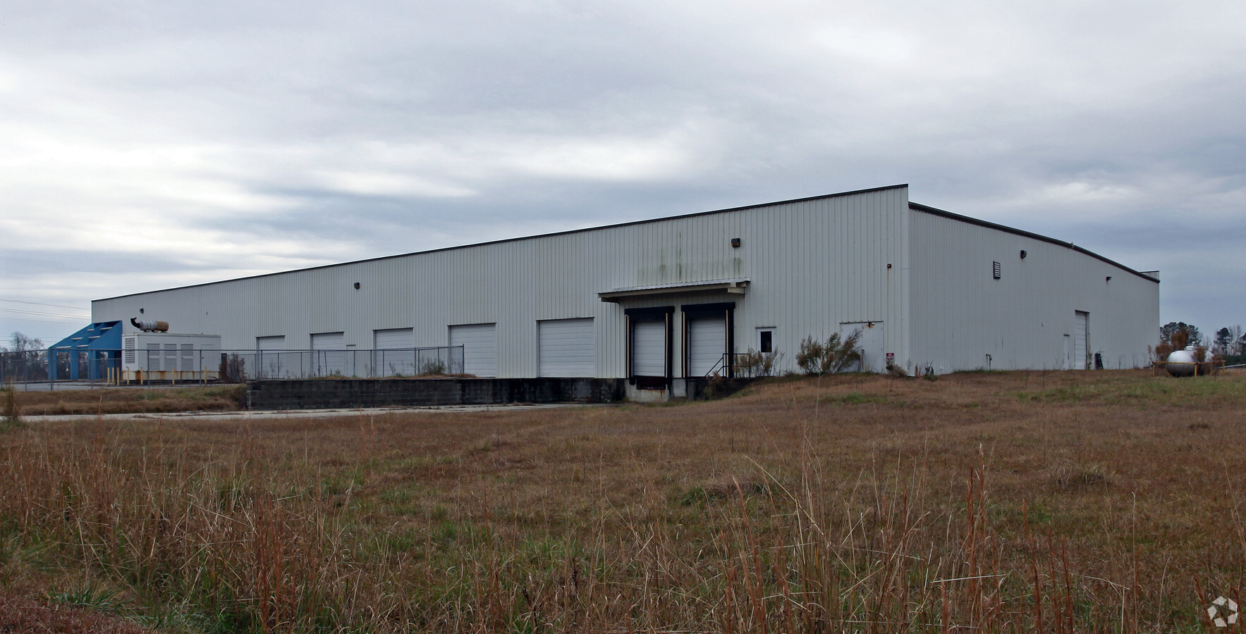
Property Record
121 Elliot Dixon Dr, Ayden, NC 28513
NEARBY LISTINGS FOR SALE OR LEASE
-
-
View all Ayden listings for sale on LoopNet.com
Property Detail
121 Elliot Dixon Dr
Greenville, NC
Levi G Worthington Et Ox
047979
SOUTH PITT INDUSTRIAL PAR
Warehouse
Pitt
X
North Carolina
3720466200J
5,5b
2024
3.91 AC
2024
North Carolina Northeast Area
001401
Other Market Areas
45,177 SF
DEMOGRAPHICS near 121 Elliot Dixon Dr
1 Mile
3 Mile
5 Mile
2024 Total Population
1,004
7,699
14,440
2029 Population
1,068
8,103
15,136
Pop Growth 2024-2029
+ 6.37%
+ 5.25%
+ 4.82%
Average Age
44
42
41
2024 Total Households
409
3,226
5,859
HH Growth 2024-2029
+ 6.85%
+ 5.61%
+ 5.12%
Median Household Inc
$24,696
$43,301
$53,921
Avg Household Size
2.30
2.30
2.40
2024 Avg HH Vehicles
2.00
2.00
2.00
Median Home Value
$112,941
$149,373
$157,422
Median Year Built
1989
1986
1991
Nearby Places
- Restaurants
- Banks
- Shops
- Fitness
- Groceries
PUBLIC TRANSPORTATION
AIRPORT
Pitt-Greenville
DRIVE
WALK
Distance
Pitt-Greenville
26 min
19.5 mi
Freight Ports
Port of Morehead City
DRIVE
WALK
Distance
Port of Morehead City
127 min
82.8 mi
Nearby Properties
Address
Land Use
TOTAL SIZE
Lot Size
Zoning
Address
Land Use
TOTAL SIZE
Lot Size
Zoning
117,336 SF
36.19 AC
RA
Address
Land Use
TOTAL SIZE
Lot Size
Zoning
9,169 SF
13.45 AC
MF
Address
Land Use
TOTAL SIZE
Lot Size
Zoning
64,547 SF
28.84 AC
MO
Address
Land Use
TOTAL SIZE
Lot Size
Zoning
121,344 SF
12.80 AC
LI
Address
Land Use
TOTAL SIZE
Lot Size
Zoning
15,376 SF
8.13 AC
CD
Address
Land Use
TOTAL SIZE
Lot Size
Zoning
36,225 SF
26.22 AC
OR
Address
Land Use
TOTAL SIZE
Lot Size
Zoning
88,540 SF
20 AC
LI
Address
Land Use
TOTAL SIZE
Lot Size
Zoning
60,660 SF
8.64 AC
GB
Address
Land Use
TOTAL SIZE
Lot Size
Zoning
50,441 SF
5.44 AC
B2
Address
Land Use
TOTAL SIZE
Lot Size
Zoning
38,998 SF
1.20 AC
CD
Address
Land Use
TOTAL SIZE
Lot Size
Zoning
64,906 SF
31.48 AC
R10
Address
Land Use
TOTAL SIZE
Lot Size
Zoning
48,761 SF
6.85 AC
R6
Address
Land Use
TOTAL SIZE
Lot Size
Zoning
34,564 SF
11.40 AC
R8
Address
Land Use
TOTAL SIZE
Lot Size
Zoning
1,941 SF
17.60 AC
MF
Address
Land Use
TOTAL SIZE
Lot Size
Zoning
108.24 AC
RA20
Address
Land Use
TOTAL SIZE
Lot Size
Zoning
288 SF
9.16 AC
MF
Address
Land Use
TOTAL SIZE
Lot Size
Zoning
14,864 SF
3.26 AC
B2
Address
Land Use
TOTAL SIZE
Lot Size
Zoning
37,312 SF
3.83 AC
B2
Address
Land Use
TOTAL SIZE
Lot Size
Zoning
212,796 SF
16.57 AC
ID
Address
Land Use
TOTAL SIZE
Lot Size
Zoning
11,200 SF
1.80 AC
B2
Address
Land Use
TOTAL SIZE
Lot Size
Zoning
3,540 SF
7.27 AC
R8
Address
Land Use
TOTAL SIZE
Lot Size
Zoning
7,180 SF
4.14 AC
B2
Address
Land Use
TOTAL SIZE
Lot Size
Zoning
44,015 SF
4.59 AC
B2
Address
Land Use
TOTAL SIZE
Lot Size
Zoning
15,529 SF
5.48 AC
LI
Address
Land Use
TOTAL SIZE
Lot Size
Zoning
784.65 AC
RA
Address
Land Use
TOTAL SIZE
Lot Size
Zoning
17,584 SF
0.70 AC
B1
Address
Land Use
TOTAL SIZE
Lot Size
Zoning
53.33 AC
RA20
Address
Land Use
TOTAL SIZE
Lot Size
Zoning
6,456 SF
1.50 AC
B2
Address
Land Use
TOTAL SIZE
Lot Size
Zoning
13,680 SF
3.19 AC
B2
Address
Land Use
TOTAL SIZE
Lot Size
Zoning
23,920 SF
7.40 AC
LI
The World's #1 Commercial Real Estate Marketplace
Connect with us
© 2025 CoStar Group
The information above has been obtained from sources believed reliable. While we do not doubt its accuracy we have not verified it and make no guarantee, warranty or representation about it. It is your responsibility to independently confirm its accuracy and completeness. Any projections, opinions, assumptions, or estimates used are for example only and do not represent the current or future performance of the property. The value of this transaction to you depends on tax and other factors which should be evaluated by your tax, financial, and legal advisors. You and your advisors should conduct a careful, independent investigation of the property to determine to your satisfaction the suitability of the property for your needs.