Property Record
1210 Bolton Rd Nw, Atlanta, GA 30331
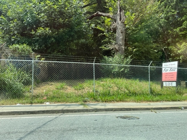

This Property Is For Sale
NEARBY LISTINGS FOR SALE OR LEASE
Property Detail
1210 Bolton Rd Nw
Atlanta-Sandy Springs-Roswell, GA
Ham & Williams
17-0261-0002-005-5
VACANT
Residentialacreage
Fulton
X
Georgia
13121C0236F
2
2023
0.47 AC
2023
Cumberland/Galleria
008602
Atlanta
DEMOGRAPHICS near 1210 Bolton Rd Nw
1 Mile
3 Mile
5 Mile
2024 Total Population
3,930
64,793
187,932
2029 Population
4,117
67,898
195,463
Pop Growth 2024-2029
+ 4.76%
+ 4.79%
+ 4.01%
Average Age
39
37
38
2024 Total Households
1,587
25,851
78,742
HH Growth 2024-2029
+ 4.91%
+ 4.82%
+ 4.10%
Median Household Inc
$43,353
$57,522
$69,302
Avg Household Size
2.40
2.40
2.30
2024 Avg HH Vehicles
1.00
1.00
1.00
Median Home Value
$244,711
$301,311
$335,079
Median Year Built
1973
1983
1986
Nearby Places
- Restaurants
- Banks
- Shops
- Fitness
- Groceries
PUBLIC TRANSPORTATION
COMMUTER RAIL
Atlanta (Crescent - Amtrak)
DRIVE
WALK
Distance
Atlanta (Crescent - Amtrak)
16 min
9.3 mi
AIRPORT
Hartsfield - Jackson Atlanta International
DRIVE
WALK
Distance
Hartsfield - Jackson Atlanta International
25 min
16.7 mi
Freight Ports
Georgia Ports - Savannah
DRIVE
WALK
Distance
Georgia Ports - Savannah
288 min
256.0 mi
Nearby Properties
Address
Land Use
TOTAL SIZE
Lot Size
Zoning
Address
Land Use
TOTAL SIZE
Lot Size
Zoning
1,151,446 SF
I2
Address
Land Use
TOTAL SIZE
Lot Size
Zoning
439,167 SF
41.13 AC
RM-12
Address
Land Use
TOTAL SIZE
Lot Size
Zoning
Address
Land Use
TOTAL SIZE
Lot Size
Zoning
499,198 SF
9.49 AC
RG3
Address
Land Use
TOTAL SIZE
Lot Size
Zoning
3.25 AC
MU
Address
Land Use
TOTAL SIZE
Lot Size
Zoning
354,710 SF
22.86 AC
R5
Address
Land Use
TOTAL SIZE
Lot Size
Zoning
285.03 AC
I2
Address
Land Use
TOTAL SIZE
Lot Size
Zoning
694,436 SF
36.80 AC
HI
Address
Land Use
TOTAL SIZE
Lot Size
Zoning
553,853 SF
3.70 AC
RG4
Address
Land Use
TOTAL SIZE
Lot Size
Zoning
70,908 SF
9.77 AC
RG3
Address
Land Use
TOTAL SIZE
Lot Size
Zoning
211,506 SF
20.63 AC
CRC
Address
Land Use
TOTAL SIZE
Lot Size
Zoning
77.56 AC
RG3
Address
Land Use
TOTAL SIZE
Lot Size
Zoning
152,348 SF
12.76 AC
RM-12
Address
Land Use
TOTAL SIZE
Lot Size
Zoning
202,430 SF
7.31 AC
C1
Address
Land Use
TOTAL SIZE
Lot Size
Zoning
167,201 SF
7.32 AC
C1
Address
Land Use
TOTAL SIZE
Lot Size
Zoning
191,540 SF
7.74 AC
RG3
Address
Land Use
TOTAL SIZE
Lot Size
Zoning
538,535 SF
32.40 AC
I2
Address
Land Use
TOTAL SIZE
Lot Size
Zoning
415,834 SF
17.62 AC
I2
Address
Land Use
TOTAL SIZE
Lot Size
Zoning
420,810 SF
23.48 AC
I1
Address
Land Use
TOTAL SIZE
Lot Size
Zoning
211,476 SF
17.43 AC
C1
Address
Land Use
TOTAL SIZE
Lot Size
Zoning
154,450 SF
9.64 AC
RG3
Address
Land Use
TOTAL SIZE
Lot Size
Zoning
190,124 SF
0.07 AC
RG3
Address
Land Use
TOTAL SIZE
Lot Size
Zoning
286,400 SF
17.29 AC
I2
Address
Land Use
TOTAL SIZE
Lot Size
Zoning
Address
Land Use
TOTAL SIZE
Lot Size
Zoning
124,395 SF
10.43 AC
I2
Address
Land Use
TOTAL SIZE
Lot Size
Zoning
312,284 SF
13.07 AC
RG3
Address
Land Use
TOTAL SIZE
Lot Size
Zoning
35.15 AC
RG3
Address
Land Use
TOTAL SIZE
Lot Size
Zoning
94,000 SF
5.77 AC
RG3
Address
Land Use
TOTAL SIZE
Lot Size
Zoning
81,828 SF
13.99 AC
GC
Address
Land Use
TOTAL SIZE
Lot Size
Zoning
170,610 SF
10.29 AC
I2
The World's #1 Commercial Real Estate Marketplace
Connect with us
© 2025 CoStar Group
The information above has been obtained from sources believed reliable. While we do not doubt its accuracy we have not verified it and make no guarantee, warranty or representation about it. It is your responsibility to independently confirm its accuracy and completeness. Any projections, opinions, assumptions, or estimates used are for example only and do not represent the current or future performance of the property. The value of this transaction to you depends on tax and other factors which should be evaluated by your tax, financial, and legal advisors. You and your advisors should conduct a careful, independent investigation of the property to determine to your satisfaction the suitability of the property for your needs.