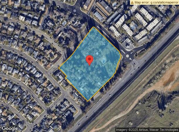
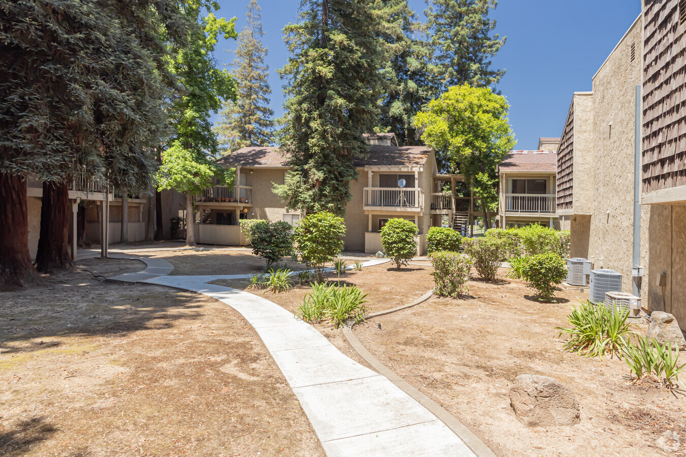
Property Record
1210 E 22Nd St, Marysville, CA 95901

NEARBY LISTINGS FOR SALE OR LEASE
Property Detail
1210 E 22Nd St
Yuba City, CA
Tract #79-271 Oakbrook Villa
008-320-020-000
L-1 TR-79-271
Apartment
Yuba
X
California
06115C0340D
1
2023
8.06 AC
2023
Yuba County
040202
Sacramento
87,248 SF
DEMOGRAPHICS near 1210 E 22Nd St
1 Mile
3 Mile
5 Mile
2024 Total Population
7,805
32,773
98,860
2029 Population
8,590
35,747
103,221
Pop Growth 2024-2029
+ 10.06%
+ 9.07%
+ 4.41%
Average Age
37
36
37
2024 Total Households
2,899
11,498
33,439
HH Growth 2024-2029
+ 10.49%
+ 9.36%
+ 4.50%
Median Household Inc
$51,137
$52,378
$57,180
Avg Household Size
2.60
2.70
2.90
2024 Avg HH Vehicles
2.00
2.00
2.00
Median Home Value
$250,220
$254,214
$315,224
Median Year Built
1972
1975
1978
Nearby Places
- Restaurants
- Banks
- Shops
- Fitness
- Groceries
Nearby Properties
Address
Land Use
TOTAL SIZE
Lot Size
Zoning
Address
Land Use
TOTAL SIZE
Lot Size
Zoning
18,410 SF
0.77 AC
C-3
Address
Land Use
TOTAL SIZE
Lot Size
Zoning
30,734 SF
1.38 AC
C-3
Address
Land Use
TOTAL SIZE
Lot Size
Zoning
98,830 SF
0.40 AC
C-3
Address
Land Use
TOTAL SIZE
Lot Size
Zoning
120,622 SF
2.25 AC
Address
Land Use
TOTAL SIZE
Lot Size
Zoning
2,052 SF
1,157.17 AC
AE-40
Address
Land Use
TOTAL SIZE
Lot Size
Zoning
107,749 SF
9.33 AC
C
Address
Land Use
TOTAL SIZE
Lot Size
Zoning
203,353 SF
11.49 AC
C
Address
Land Use
TOTAL SIZE
Lot Size
Zoning
50,270 SF
4.16 AC
CO
Address
Land Use
TOTAL SIZE
Lot Size
Zoning
66,913 SF
18.23 AC
AE-40
Address
Land Use
TOTAL SIZE
Lot Size
Zoning
48,117 SF
1.81 AC
R1
Address
Land Use
TOTAL SIZE
Lot Size
Zoning
79,817 SF
1.64 AC
M-1
Address
Land Use
TOTAL SIZE
Lot Size
Zoning
47,686 SF
2 AC
R2
Address
Land Use
TOTAL SIZE
Lot Size
Zoning
27,000 SF
1.64 AC
R3
Address
Land Use
TOTAL SIZE
Lot Size
Zoning
41,920 SF
2.41 AC
R-4
Address
Land Use
TOTAL SIZE
Lot Size
Zoning
105,352 SF
4.90 AC
PD
Address
Land Use
TOTAL SIZE
Lot Size
Zoning
36,760 SF
3.06 AC
Address
Land Use
TOTAL SIZE
Lot Size
Zoning
119,880 SF
6.53 AC
PD
Address
Land Use
TOTAL SIZE
Lot Size
Zoning
2.57 AC
R-4
Address
Land Use
TOTAL SIZE
Lot Size
Zoning
53,952 SF
4.14 AC
R-02
Address
Land Use
TOTAL SIZE
Lot Size
Zoning
18,675 SF
2.98 AC
C3
Address
Land Use
TOTAL SIZE
Lot Size
Zoning
28,943 SF
2.45 AC
C-3
Address
Land Use
TOTAL SIZE
Lot Size
Zoning
30,812 SF
0.74 AC
C-3
Address
Land Use
TOTAL SIZE
Lot Size
Zoning
40,045 SF
1.38 AC
C
Address
Land Use
TOTAL SIZE
Lot Size
Zoning
281.79 AC
AE-40
Address
Land Use
TOTAL SIZE
Lot Size
Zoning
417,732 SF
13.44 AC
C
Address
Land Use
TOTAL SIZE
Lot Size
Zoning
32,776 SF
2 AC
R3
Address
Land Use
TOTAL SIZE
Lot Size
Zoning
26,986 SF
1.67 AC
C
Address
Land Use
TOTAL SIZE
Lot Size
Zoning
41,003 SF
2.98 AC
R-02
Address
Land Use
TOTAL SIZE
Lot Size
Zoning
20,057 SF
1.42 AC
CO
The World's #1 Commercial Real Estate Marketplace
Connect with us
© 2025 CoStar Group
The information above has been obtained from sources believed reliable. While we do not doubt its accuracy we have not verified it and make no guarantee, warranty or representation about it. It is your responsibility to independently confirm its accuracy and completeness. Any projections, opinions, assumptions, or estimates used are for example only and do not represent the current or future performance of the property. The value of this transaction to you depends on tax and other factors which should be evaluated by your tax, financial, and legal advisors. You and your advisors should conduct a careful, independent investigation of the property to determine to your satisfaction the suitability of the property for your needs.