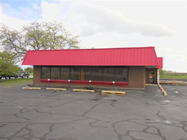
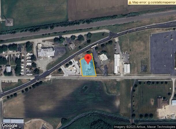
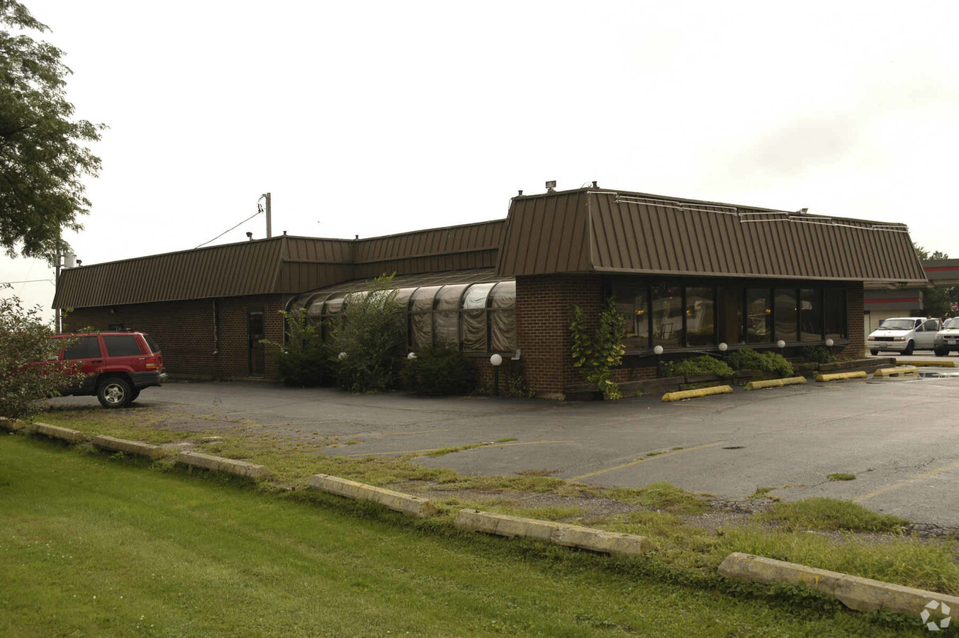
Property Record
1210 E Church St, Sandwich, IL 60548

NEARBY LISTINGS FOR SALE OR LEASE
Property Detail
1210 E Church St
19-25-478-002
PT OF SE 1/4 OF SE 1/4 LYING S OF RTE 34 PER DOC 83-06727 - SEC 25 - TWP 37N - R5E
Commercialnec
DeKalb
X
Illinois
17099C0150F
0.75 AC
2022
Western East/West Corr
2023
Chicago
002100
Chicago-Naperville-Elgin, IL-IN-WI
DEMOGRAPHICS near 1210 E Church St
1 Mile
3 Mile
5 Mile
2024 Total Population
3,602
9,714
24,878
2029 Population
3,563
9,731
25,768
Pop Growth 2024-2029
(1.08%)
+ 0.18%
+ 3.58%
Average Age
40
42
40
2024 Total Households
1,394
3,800
9,232
HH Growth 2024-2029
(1.15%)
(0.05%)
+ 3.18%
Median Household Inc
$77,273
$76,518
$75,184
Avg Household Size
2.50
2.50
2.60
2024 Avg HH Vehicles
2.00
2.00
2.00
Median Home Value
$177,602
$201,605
$211,708
Median Year Built
1970
1977
1977
Nearby Places
- Restaurants
- Banks
- Shops
- Fitness
- Groceries
PUBLIC TRANSPORTATION
COMMUTER RAIL
Plano Amtrak Station (Carl Sandburg - Amtrak, Illinois Zephyr - Amtrak)
DRIVE
WALK
Distance
Plano Amtrak Station (Carl Sandburg - Amtrak, Illinois Zephyr - Amtrak)
7 min
3.7 mi
Freight Ports
Port Milwaukee
DRIVE
WALK
Distance
Port Milwaukee
165 min
129.9 mi
SALE & LEASE HISTORY
LISTING DATE
SALE/LEASE

Sep 24, 2016
For Sale
Nearby Properties
Address
Land Use
TOTAL SIZE
Lot Size
Zoning
Address
Land Use
TOTAL SIZE
Lot Size
Zoning
32.38 AC
Address
Land Use
TOTAL SIZE
Lot Size
Zoning
21.48 AC
Address
Land Use
TOTAL SIZE
Lot Size
Zoning
41.78 AC
Address
Land Use
TOTAL SIZE
Lot Size
Zoning
0.51 AC
Address
Land Use
TOTAL SIZE
Lot Size
Zoning
11.72 AC
Address
Land Use
TOTAL SIZE
Lot Size
Zoning
Address
Land Use
TOTAL SIZE
Lot Size
Zoning
1.74 AC
Address
Land Use
TOTAL SIZE
Lot Size
Zoning
52.13 AC
Address
Land Use
TOTAL SIZE
Lot Size
Zoning
40 AC
Address
Land Use
TOTAL SIZE
Lot Size
Zoning
94,382 SF
3.04 AC
Address
Land Use
TOTAL SIZE
Lot Size
Zoning
1.26 AC
Address
Land Use
TOTAL SIZE
Lot Size
Zoning
416 SF
9.91 AC
Address
Land Use
TOTAL SIZE
Lot Size
Zoning
1,904 SF
27.27 AC
Address
Land Use
TOTAL SIZE
Lot Size
Zoning
0.95 AC
Address
Land Use
TOTAL SIZE
Lot Size
Zoning
19.53 AC
A1
Address
Land Use
TOTAL SIZE
Lot Size
Zoning
16,296 SF
1.17 AC
Address
Land Use
TOTAL SIZE
Lot Size
Zoning
2.69 AC
Address
Land Use
TOTAL SIZE
Lot Size
Zoning
16,593 SF
1.38 AC
Address
Land Use
TOTAL SIZE
Lot Size
Zoning
1.55 AC
Address
Land Use
TOTAL SIZE
Lot Size
Zoning
2.18 AC
Address
Land Use
TOTAL SIZE
Lot Size
Zoning
70,912 SF
7.15 AC
Address
Land Use
TOTAL SIZE
Lot Size
Zoning
17,608 SF
1.94 AC
Address
Land Use
TOTAL SIZE
Lot Size
Zoning
2.37 AC
Address
Land Use
TOTAL SIZE
Lot Size
Zoning
1.26 AC
Address
Land Use
TOTAL SIZE
Lot Size
Zoning
4.11 AC
Address
Land Use
TOTAL SIZE
Lot Size
Zoning
2.66 AC
Address
Land Use
TOTAL SIZE
Lot Size
Zoning
1.01 AC
Address
Land Use
TOTAL SIZE
Lot Size
Zoning
10,048 SF
1.35 AC
Address
Land Use
TOTAL SIZE
Lot Size
Zoning
2.67 AC
The World's #1 Commercial Real Estate Marketplace
Connect with us
© 2025 CoStar Group
The information above has been obtained from sources believed reliable. While we do not doubt its accuracy we have not verified it and make no guarantee, warranty or representation about it. It is your responsibility to independently confirm its accuracy and completeness. Any projections, opinions, assumptions, or estimates used are for example only and do not represent the current or future performance of the property. The value of this transaction to you depends on tax and other factors which should be evaluated by your tax, financial, and legal advisors. You and your advisors should conduct a careful, independent investigation of the property to determine to your satisfaction the suitability of the property for your needs.