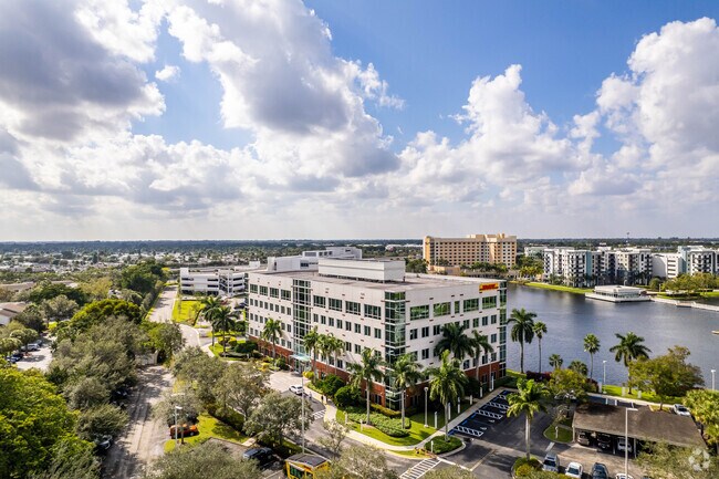
Property Record
1210 S Pine Island Rd, Plantation, FL 33324


NEARBY LISTINGS FOR SALE OR LEASE
Property Detail
1210 S Pine Island Rd
50-41-16-29-0015
Jacaranda Parcel 840 136-21 B
Officebuilding
JACARANDA PARCEL 840 136-21 B PORTIONS OF TRACT 840 KNOWN AS CORNERSTONE II AS DESC IN SWD OR 31006/432 AND TOGETHER WITH POR DESC IN INST# 114589549,AND LESS POR DESC IN INST# 114589548 AKA:CORNERSTONE II
AE
Broward
12011C0535J
Florida
2024
4.48 AC
2025
Plantation
061004
South Florida
112,510 SF
Fort Lauderdale-Pompano Beach-Deerfield Beach, FL
DEMOGRAPHICS near 1210 S Pine Island Rd
1 Mile
3 Mile
5 Mile
2024 Total Population
13,380
114,778
357,821
2029 Population
13,656
113,945
355,007
Pop Growth 2024-2029
+ 2.06%
(0.73%)
(0.79%)
Average Age
43
40
40
2024 Total Households
6,022
45,389
132,498
HH Growth 2024-2029
+ 1.83%
(1.13%)
(1.10%)
Median Household Inc
$70,169
$79,354
$65,340
Avg Household Size
2.20
2.40
2.60
2024 Avg HH Vehicles
2.00
2.00
2.00
Median Home Value
$248,957
$378,440
$331,012
Median Year Built
1982
1983
1979
Nearby Places
Map Layers
Map Styles
 Street
 Aerial
- Restaurants
- Banks
- Shops
- Fitness
- Groceries
PUBLIC TRANSPORTATION
COMMUTER RAIL
Fort Lauderdale (Tri-County Commuter - South Florida Regional Transportation Authority (Tri-Rail))
DRIVE
WALK
Distance
Fort Lauderdale (Tri-County Commuter - South Florida Regional Transportation Authority (Tri-Rail))
16 min
7.4 mi
DRIVE
WALK
Distance
18 min
8.7 mi
AIRPORT
Fort Lauderdale/Hollywood International
DRIVE
WALK
Distance
Fort Lauderdale/Hollywood International
17 min
8.6 mi
Miami International
DRIVE
WALK
Distance
Miami International
45 min
32.9 mi
SALE & LEASE HISTORY
LISTING DATE
SALE/LEASE

Nov 07, 2022
For Sale
Nearby Properties
Address
Land Use
TOTAL SIZE
Lot Size
Zoning
Address
Land Use
TOTAL SIZE
Lot Size
Zoning
4,069,966 SF
161.58 AC
RAC-AV
Address
Land Use
TOTAL SIZE
Lot Size
Zoning
589,748 SF
27.34 AC
RAC-RTE
Address
Land Use
TOTAL SIZE
Lot Size
Zoning
663,255 SF
3.15 AC
RAC-CC
Address
Land Use
TOTAL SIZE
Lot Size
Zoning
632,250 SF
34.15 AC
PRD-11.6Q
Address
Land Use
TOTAL SIZE
Lot Size
Zoning
1,357,572 SF
126.23 AC
RAC-ED
Address
Land Use
TOTAL SIZE
Lot Size
Zoning
458,854 SF
30.97 AC
PRD-15Q **
Address
Land Use
TOTAL SIZE
Lot Size
Zoning
550,907 SF
26.92 AC
RAC-RTE
Address
Land Use
TOTAL SIZE
Lot Size
Zoning
627,368 SF
4.33 AC
PRD-21Q
Address
Land Use
TOTAL SIZE
Lot Size
Zoning
507,890 SF
39.49 AC
M-PM
Address
Land Use
TOTAL SIZE
Lot Size
Zoning
475,897 SF
14.91 AC
RAC-RTE
Address
Land Use
TOTAL SIZE
Lot Size
Zoning
413,123 SF
63.50 AC
B-3
Address
Land Use
TOTAL SIZE
Lot Size
Zoning
438,123 SF
47.44 AC
RM-22
Address
Land Use
TOTAL SIZE
Lot Size
Zoning
409,340 SF
15.49 AC
RAC-RTE
Address
Land Use
TOTAL SIZE
Lot Size
Zoning
613,363 SF
6.24 AC
B-7Q
Address
Land Use
TOTAL SIZE
Lot Size
Zoning
517,961 SF
3.92 AC
M-PM
Address
Land Use
TOTAL SIZE
Lot Size
Zoning
337,553 SF
39.13 AC
RM-10
Address
Land Use
TOTAL SIZE
Lot Size
Zoning
497,004 SF
4.46 AC
M-PM
Address
Land Use
TOTAL SIZE
Lot Size
Zoning
456,384 SF
81.33 AC
RAC-ED
Address
Land Use
TOTAL SIZE
Lot Size
Zoning
524,015 SF
6.43 AC
B-7Q
Address
Land Use
TOTAL SIZE
Lot Size
Zoning
471,109 SF
5.57 AC
M-PM
Address
Land Use
TOTAL SIZE
Lot Size
Zoning
576,167 SF
27 AC
RAC-RTE
Address
Land Use
TOTAL SIZE
Lot Size
Zoning
527,086 SF
2.34 AC
M-PM
Address
Land Use
TOTAL SIZE
Lot Size
Zoning
334,723 SF
7.47 AC
RAC-AV
Address
Land Use
TOTAL SIZE
Lot Size
Zoning
350,663 SF
16.86 AC
RAC-RTE
Address
Land Use
TOTAL SIZE
Lot Size
Zoning
356,053 SF
8.12 AC
RAC-RTE
Address
Land Use
TOTAL SIZE
Lot Size
Zoning
320,919 SF
27.70 AC
M-PM
Address
Land Use
TOTAL SIZE
Lot Size
Zoning
439,908 SF
13.54 AC
OP-P
Address
Land Use
TOTAL SIZE
Lot Size
Zoning
505,730 SF
18.07 AC
RAC-AV
Address
Land Use
TOTAL SIZE
Lot Size
Zoning
256,568 SF
22.61 AC
PRD-12.15Q
Address
Land Use
TOTAL SIZE
Lot Size
Zoning
312,067 SF
20.94 AC
PRD-15Q
The World's #1 Commercial Real Estate Marketplace
Connect with us
© 2026 CoStar Group
The information above has been obtained from sources believed reliable. While we do not doubt its accuracy we have not verified it and make no guarantee, warranty or representation about it. It is your responsibility to independently confirm its accuracy and completeness. Any projections, opinions, assumptions, or estimates used are for example only and do not represent the current or future performance of the property. The value of this transaction to you depends on tax and other factors which should be evaluated by your tax, financial, and legal advisors. You and your advisors should conduct a careful, independent investigation of the property to determine to your satisfaction the suitability of the property for your needs.