Property Record
12137 Mcgee Rd, Covington, LA 70435
NEARBY LISTINGS FOR SALE OR LEASE
Property Detail
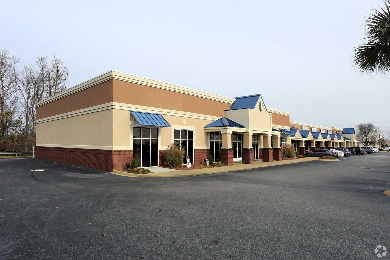
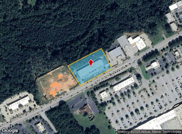
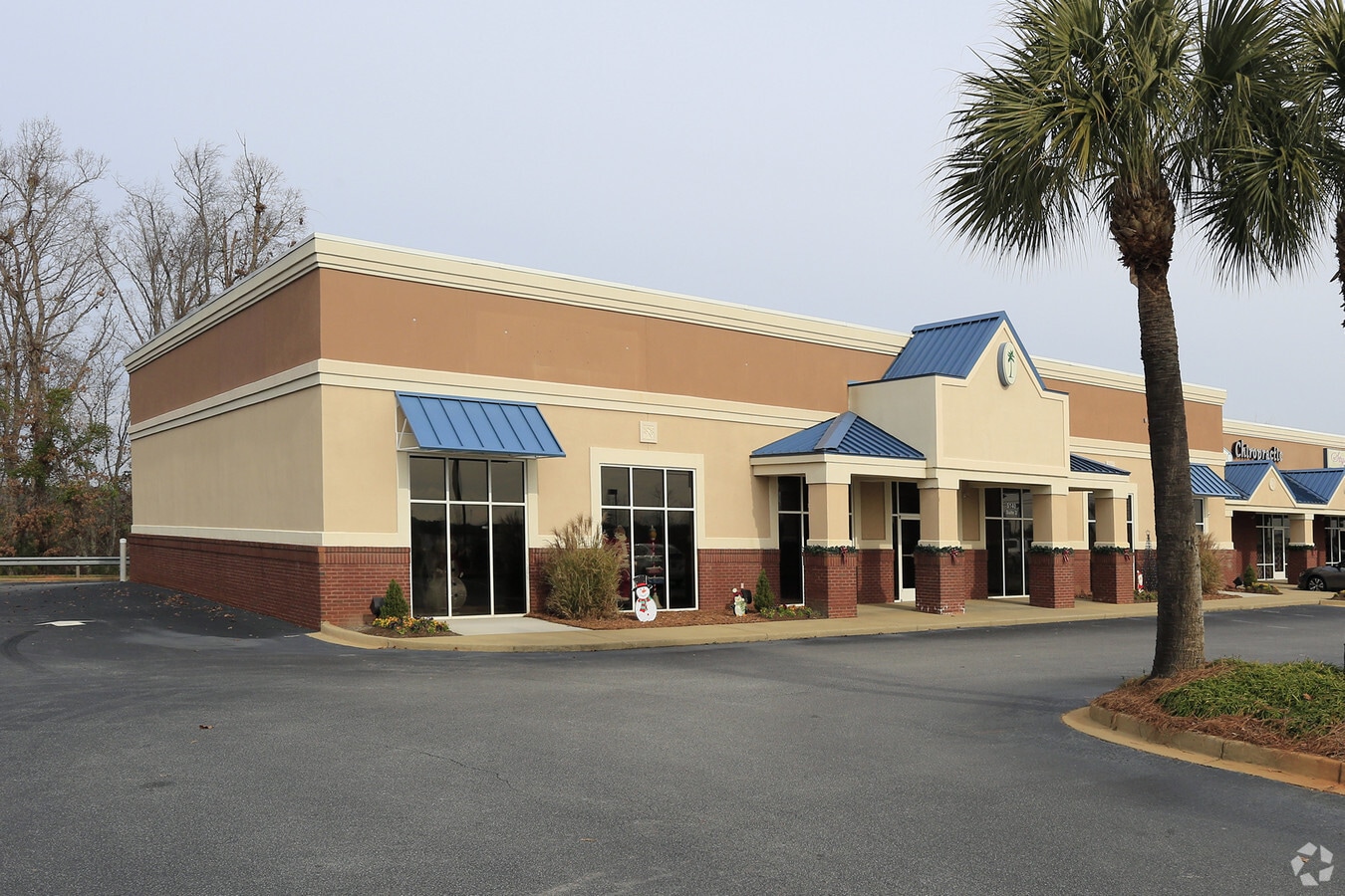
12137 Mcgee Rd
004496-01-017
PARCEL B-1
Stripcommercialcenter
Lexington
X
South Carolina
45063C0139J
2.29 AC
2024
Lexington
2023
Columbia
021038
Columbia, SC
18,635 SF
DEMOGRAPHICS near 12137 Mcgee Rd
1 Mile
3 Mile
5 Mile
2024 Total Population
4,252
33,069
97,548
2029 Population
4,596
35,905
106,210
Pop Growth 2024-2029
+ 8.09%
+ 8.58%
+ 8.88%
Average Age
38
39
41
2024 Total Households
1,632
12,668
39,470
HH Growth 2024-2029
+ 8.27%
+ 8.78%
+ 9.10%
Median Household Inc
$105,851
$85,481
$72,084
Avg Household Size
2.60
2.60
2.40
2024 Avg HH Vehicles
2.00
2.00
2.00
Median Home Value
$272,896
$246,763
$196,794
Median Year Built
2000
1999
1992
Nearby Places
- Restaurants
- Banks
- Shops
- Fitness
- Groceries
PUBLIC TRANSPORTATION
AIRPORT
Columbia Metropolitan
Drive
Walk
Distance
Columbia Metropolitan
16 min
10.6 mi
Freight Ports
Georgia Ports - Savannah
Drive
Walk
Distance
Georgia Ports - Savannah
1 min
130.1 mi
SALE & LEASE HISTORY
LISTING DATE
SALE/LEASE

Dec 21, 2018
For Lease
Nearby Properties
Address
Land Use
TOTAL SIZE
Lot Size
Zoning
Address
Land Use
TOTAL SIZE
Lot Size
Zoning
1,485 SF
19.51 AC
GC
Address
Land Use
TOTAL SIZE
Lot Size
Zoning
63,658 SF
17.56 AC
GC
Address
Land Use
TOTAL SIZE
Lot Size
Zoning
3,383 SF
20.65 AC
Address
Land Use
TOTAL SIZE
Lot Size
Zoning
3,406 SF
19.99 AC
HDR
Address
Land Use
TOTAL SIZE
Lot Size
Zoning
204,927 SF
24.82 AC
GC
Address
Land Use
TOTAL SIZE
Lot Size
Zoning
58.81 AC
RD
Address
Land Use
TOTAL SIZE
Lot Size
Zoning
58,664 SF
6.01 AC
Address
Land Use
TOTAL SIZE
Lot Size
Zoning
122,239 SF
13.30 AC
GC
Address
Land Use
TOTAL SIZE
Lot Size
Zoning
64,281 SF
11.71 AC
GC
Address
Land Use
TOTAL SIZE
Lot Size
Zoning
85,261 SF
9.04 AC
GC
Address
Land Use
TOTAL SIZE
Lot Size
Zoning
55,378 SF
24 AC
GC
Address
Land Use
TOTAL SIZE
Lot Size
Zoning
3,079 SF
15.93 AC
HDR
Address
Land Use
TOTAL SIZE
Lot Size
Zoning
85,600 SF
22.08 AC
Address
Land Use
TOTAL SIZE
Lot Size
Zoning
136,940 SF
20.36 AC
GC
Address
Land Use
TOTAL SIZE
Lot Size
Zoning
51,759 SF
10.18 AC
GC
Address
Land Use
TOTAL SIZE
Lot Size
Zoning
126,000 SF
8.89 AC
Address
Land Use
TOTAL SIZE
Lot Size
Zoning
130,357 SF
10.91 AC
Address
Land Use
TOTAL SIZE
Lot Size
Zoning
85,508 SF
9.22 AC
GC
Address
Land Use
TOTAL SIZE
Lot Size
Zoning
39,700 SF
73.29 AC
ID
Address
Land Use
TOTAL SIZE
Lot Size
Zoning
66,043 SF
2.70 AC
ID
Address
Land Use
TOTAL SIZE
Lot Size
Zoning
39,713 SF
11.70 AC
GC
Address
Land Use
TOTAL SIZE
Lot Size
Zoning
69,285 SF
7.28 AC
GC
Address
Land Use
TOTAL SIZE
Lot Size
Zoning
37,404 SF
9.32 AC
Address
Land Use
TOTAL SIZE
Lot Size
Zoning
51,657 SF
3.48 AC
ID
Address
Land Use
TOTAL SIZE
Lot Size
Zoning
33,218 SF
4.40 AC
GC
Address
Land Use
TOTAL SIZE
Lot Size
Zoning
14,820 SF
2.56 AC
Address
Land Use
TOTAL SIZE
Lot Size
Zoning
1,572 SF
21.04 AC
GC
Address
Land Use
TOTAL SIZE
Lot Size
Zoning
35,109 SF
11.06 AC
GC
Address
Land Use
TOTAL SIZE
Lot Size
Zoning
1,296 SF
32.15 AC
ID
Address
Land Use
TOTAL SIZE
Lot Size
Zoning
14,390 SF
6.86 AC
Start a new search to find other properties for sale or lease
Connect with us
© 2024 CoStar Group
The information above has been obtained from sources believed reliable. While we do not doubt its accuracy we have not verified it and make no guarantee, warranty or representation about it. It is your responsibility to independently confirm its accuracy and completeness. Any projections, opinions, assumptions, or estimates used are for example only and do not represent the current or future performance of the property. The value of this transaction to you depends on tax and other factors which should be evaluated by your tax, financial, and legal advisors. You and your advisors should conduct a careful, independent investigation of the property to determine to your satisfaction the suitability of the property for your needs.