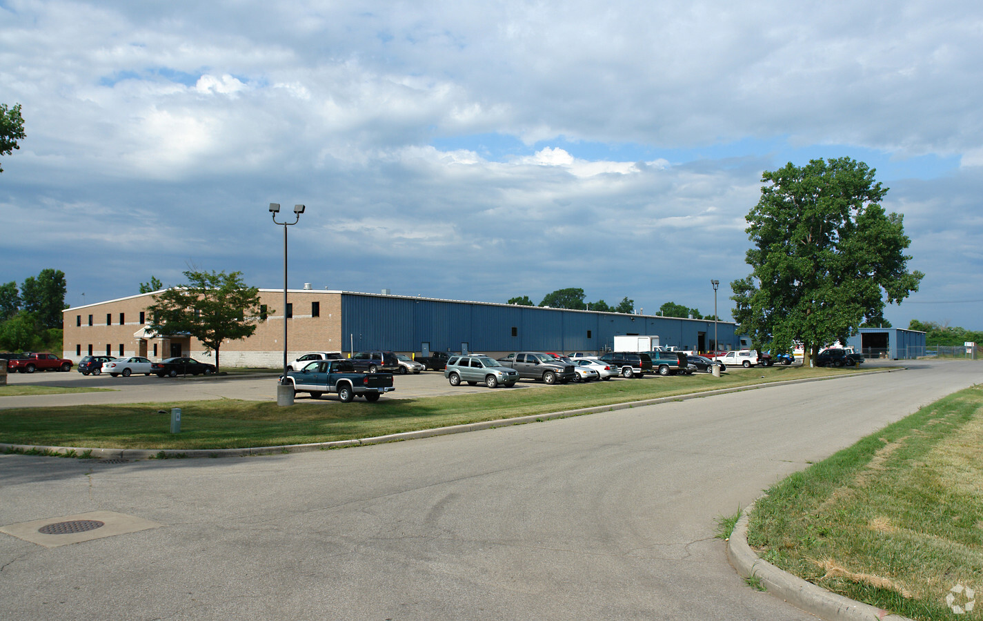
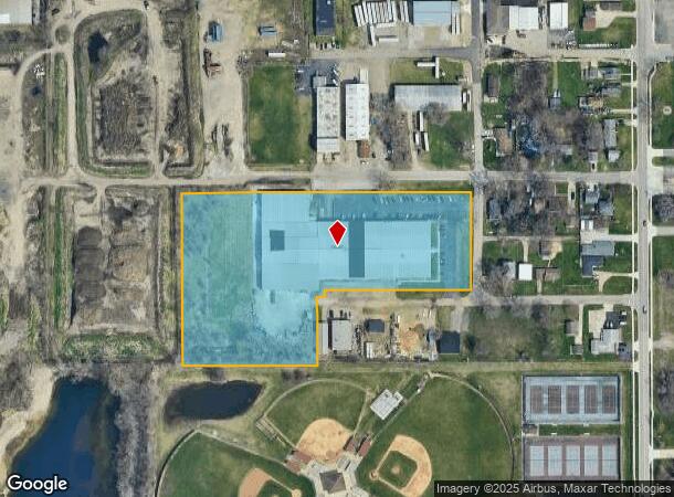
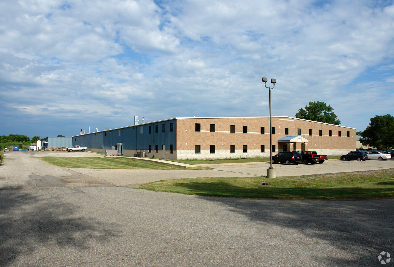
Property Record
1217 E 7Th St, Mishawaka, IN 46544
NEARBY LISTINGS FOR SALE OR LEASE
Property Detail
1217 E 7Th St
South Bend-Mishawaka, IN-MI
J D Enterprises 7Th Street Sub
71-09-15-433-001.000-023
LOT 1 J D ENTERPRISES 7TH STREET SUB & VAC NW COR 8TH STREET 20X20 17/18VAC ORD#2015-45 01-04-2016 NP #6387 9-19-11
Lightindustrial
St Joseph
X
Indiana
18141C0218D
1
2022
2.11 AC
2023
Mishawaka
010300
South Bend/Mishawaka
86,354 SF
DEMOGRAPHICS near 1217 E 7Th St
1 Mile
3 Mile
5 Mile
2024 Total Population
9,968
57,298
134,763
2029 Population
9,915
57,038
134,536
Pop Growth 2024-2029
(0.53%)
(0.45%)
(0.17%)
Average Age
38
39
38
2024 Total Households
4,131
25,153
54,955
HH Growth 2024-2029
(0.56%)
(0.40%)
(0.12%)
Median Household Inc
$51,632
$53,046
$56,177
Avg Household Size
2.40
2.20
2.20
2024 Avg HH Vehicles
2.00
2.00
2.00
Median Home Value
$128,434
$135,978
$149,516
Median Year Built
1958
1965
1966
Nearby Places
- Restaurants
- Banks
- Shops
- Fitness
- Groceries
PUBLIC TRANSPORTATION
COMMUTER RAIL
South Bend Amtrak Station (Capitol Limited - Amtrak, Lake Shore Limited - Amtrak)
DRIVE
WALK
Distance
South Bend Amtrak Station (Capitol Limited - Amtrak, Lake Shore Limited - Amtrak)
15 min
8.3 mi
AIRPORT
South Bend International
DRIVE
WALK
Distance
South Bend International
28 min
12.3 mi
Freight Ports
Port Milwaukee
DRIVE
WALK
Distance
Port Milwaukee
228 min
190.4 mi
Nearby Properties
Address
Land Use
TOTAL SIZE
Lot Size
Zoning
Address
Land Use
TOTAL SIZE
Lot Size
Zoning
1,010,047 SF
73 AC
Address
Land Use
TOTAL SIZE
Lot Size
Zoning
397,501 SF
3.50 AC
Address
Land Use
TOTAL SIZE
Lot Size
Zoning
653,141 SF
32.18 AC
Address
Land Use
TOTAL SIZE
Lot Size
Zoning
338,816 SF
33.65 AC
Address
Land Use
TOTAL SIZE
Lot Size
Zoning
617,383 SF
51.29 AC
Address
Land Use
TOTAL SIZE
Lot Size
Zoning
805,623 SF
47.27 AC
Address
Land Use
TOTAL SIZE
Lot Size
Zoning
107,258 SF
1.62 AC
Address
Land Use
TOTAL SIZE
Lot Size
Zoning
112,424 SF
5 AC
Address
Land Use
TOTAL SIZE
Lot Size
Zoning
48,034 SF
6.40 AC
Address
Land Use
TOTAL SIZE
Lot Size
Zoning
623,232 SF
74.18 AC
Address
Land Use
TOTAL SIZE
Lot Size
Zoning
353.40 AC
Address
Land Use
TOTAL SIZE
Lot Size
Zoning
216,257 SF
35.24 AC
Address
Land Use
TOTAL SIZE
Lot Size
Zoning
122,419 SF
9.03 AC
Address
Land Use
TOTAL SIZE
Lot Size
Zoning
156,130 SF
7.77 AC
Address
Land Use
TOTAL SIZE
Lot Size
Zoning
134,785 SF
14.16 AC
Address
Land Use
TOTAL SIZE
Lot Size
Zoning
100,191 SF
11.72 AC
Address
Land Use
TOTAL SIZE
Lot Size
Zoning
149,821 SF
11.73 AC
Address
Land Use
TOTAL SIZE
Lot Size
Zoning
335,390 SF
18.20 AC
Address
Land Use
TOTAL SIZE
Lot Size
Zoning
389,851 SF
23.89 AC
Address
Land Use
TOTAL SIZE
Lot Size
Zoning
211,773 SF
35.16 AC
Address
Land Use
TOTAL SIZE
Lot Size
Zoning
270,962 SF
27.20 AC
Address
Land Use
TOTAL SIZE
Lot Size
Zoning
245,765 SF
18.94 AC
Address
Land Use
TOTAL SIZE
Lot Size
Zoning
177,518 SF
35.64 AC
Address
Land Use
TOTAL SIZE
Lot Size
Zoning
144,362 SF
14.32 AC
Address
Land Use
TOTAL SIZE
Lot Size
Zoning
249,072 SF
18.98 AC
Address
Land Use
TOTAL SIZE
Lot Size
Zoning
120,513 SF
7.92 AC
Address
Land Use
TOTAL SIZE
Lot Size
Zoning
45,120 SF
20.26 AC
Address
Land Use
TOTAL SIZE
Lot Size
Zoning
102,057 SF
2 AC
Address
Land Use
TOTAL SIZE
Lot Size
Zoning
105,917 SF
5.90 AC
Address
Land Use
TOTAL SIZE
Lot Size
Zoning
47,225 SF
7.90 AC
The World's #1 Commercial Real Estate Marketplace
Connect with us
© 2025 CoStar Group
The information above has been obtained from sources believed reliable. While we do not doubt its accuracy we have not verified it and make no guarantee, warranty or representation about it. It is your responsibility to independently confirm its accuracy and completeness. Any projections, opinions, assumptions, or estimates used are for example only and do not represent the current or future performance of the property. The value of this transaction to you depends on tax and other factors which should be evaluated by your tax, financial, and legal advisors. You and your advisors should conduct a careful, independent investigation of the property to determine to your satisfaction the suitability of the property for your needs.