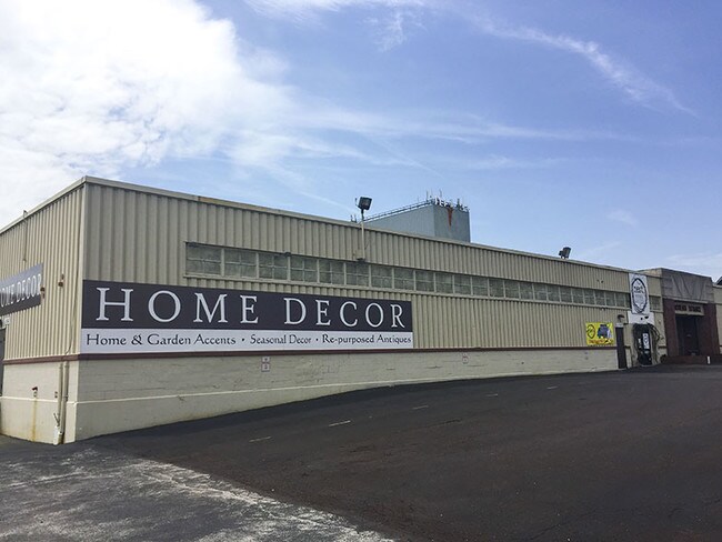
Property Record
122 Mill Rd, Schwenksville, PA 19473


NEARBY LISTINGS FOR SALE OR LEASE
Property Detail
122 Mill Rd
Philadelphia-Camden-Wilmington, PA-NJ-DE-MD
422 Business Center
61-00-03682-145
ASSESSOR BLOCK-UNIT NUMBER 71-36
Industrialcondominium
Montgomery
X
Pennsylvania
42029C0065G
3a
2024
1.50 AC
2025
East Montgomery Cty
206600
Philadelphia
33,692 SF
DEMOGRAPHICS near 122 Mill Rd
1 Mile
3 Mile
5 Mile
2024 Total Population
2,465
38,432
138,558
2029 Population
2,482
39,131
142,269
Pop Growth 2024-2029
+ 0.69%
+ 1.82%
+ 2.68%
Average Age
36
42
41
2024 Total Households
927
14,986
55,419
HH Growth 2024-2029
+ 0.76%
+ 1.75%
+ 2.83%
Median Household Inc
$90,849
$114,437
$111,227
Avg Household Size
2.60
2.40
2.40
2024 Avg HH Vehicles
2.00
2.00
2.00
Median Home Value
$384,814
$418,857
$397,680
Median Year Built
1986
1986
1979
Nearby Places
Map Layers
Map Styles
 Street
 Aerial
- Restaurants
- Banks
- Shops
- Fitness
- Groceries
PUBLIC TRANSPORTATION
COMMUTER RAIL
Main Street (Norristown) (R6 - Southeastern Pennsylvania Transportation Authority Regional Rail (SEPTA Regional Rail))
DRIVE
WALK
Distance
Main Street (Norristown) (R6 - Southeastern Pennsylvania Transportation Authority Regional Rail (SEPTA Regional Rail))
15 min
6.7 mi
AIRPORT
Philadelphia International
DRIVE
WALK
Distance
Philadelphia International
52 min
33.1 mi
Freight Ports
South Jersey Port
DRIVE
WALK
Distance
South Jersey Port
46 min
29.2 mi
Nearby Properties
Address
Land Use
TOTAL SIZE
Lot Size
Zoning
Address
Land Use
TOTAL SIZE
Lot Size
Zoning
1,113,725 SF
196.05 AC
IO
Address
Land Use
TOTAL SIZE
Lot Size
Zoning
989,814 SF
8.87 AC
IO
Address
Land Use
TOTAL SIZE
Lot Size
Zoning
50,149 SF
26.72 AC
I/L1
Address
Land Use
TOTAL SIZE
Lot Size
Zoning
58,212 SF
20.89 AC
M2
Address
Land Use
TOTAL SIZE
Lot Size
Zoning
1,145,005 SF
149.21 AC
IO
Address
Land Use
TOTAL SIZE
Lot Size
Zoning
124,789 SF
155.99 AC
INO
Address
Land Use
TOTAL SIZE
Lot Size
Zoning
972,935 SF
20.51 AC
INO
Address
Land Use
TOTAL SIZE
Lot Size
Zoning
617,174 SF
25.32 AC
HR
Address
Land Use
TOTAL SIZE
Lot Size
Zoning
454,933 SF
17.85 AC
SM
Address
Land Use
TOTAL SIZE
Lot Size
Zoning
502,080 SF
11.36 AC
RA
Address
Land Use
TOTAL SIZE
Lot Size
Zoning
348,190 SF
68 AC
R1
Address
Land Use
TOTAL SIZE
Lot Size
Zoning
503,942 SF
11.26 AC
RA
Address
Land Use
TOTAL SIZE
Lot Size
Zoning
1,470,449 SF
80.02 AC
R1
Address
Land Use
TOTAL SIZE
Lot Size
Zoning
400,875 SF
32.32 AC
IO
Address
Land Use
TOTAL SIZE
Lot Size
Zoning
381,927 SF
5.10 AC
SM
Address
Land Use
TOTAL SIZE
Lot Size
Zoning
396,137 SF
2.26 AC
HR
Address
Land Use
TOTAL SIZE
Lot Size
Zoning
435,884 SF
26.70 AC
R5
Address
Land Use
TOTAL SIZE
Lot Size
Zoning
273,724 SF
8.05 AC
INO
Address
Land Use
TOTAL SIZE
Lot Size
Zoning
204,483 SF
25.02 AC
IO
Address
Land Use
TOTAL SIZE
Lot Size
Zoning
811,455 SF
18.15 AC
M1
Address
Land Use
TOTAL SIZE
Lot Size
Zoning
2,112 SF
5.06 AC
LI/O
Address
Land Use
TOTAL SIZE
Lot Size
Zoning
1,305,221 SF
21.99 AC
M1
Address
Land Use
TOTAL SIZE
Lot Size
Zoning
208,680 SF
4.54 AC
LCI
Address
Land Use
TOTAL SIZE
Lot Size
Zoning
305,760 SF
22.50 AC
R2
Address
Land Use
TOTAL SIZE
Lot Size
Zoning
303,000 SF
13.63 AC
AR1
Address
Land Use
TOTAL SIZE
Lot Size
Zoning
276,284 SF
3.87 AC
INO
Address
Land Use
TOTAL SIZE
Lot Size
Zoning
230,132 SF
25.44 AC
SM
Address
Land Use
TOTAL SIZE
Lot Size
Zoning
225,716 SF
46.49 AC
R1
Address
Land Use
TOTAL SIZE
Lot Size
Zoning
261,192 SF
5.08 AC
AR1
Address
Land Use
TOTAL SIZE
Lot Size
Zoning
127,778 SF
13.43 AC
IP
The World's #1 Commercial Real Estate Marketplace
Connect with us
© 2025 CoStar Group
The information above has been obtained from sources believed reliable. While we do not doubt its accuracy we have not verified it and make no guarantee, warranty or representation about it. It is your responsibility to independently confirm its accuracy and completeness. Any projections, opinions, assumptions, or estimates used are for example only and do not represent the current or future performance of the property. The value of this transaction to you depends on tax and other factors which should be evaluated by your tax, financial, and legal advisors. You and your advisors should conduct a careful, independent investigation of the property to determine to your satisfaction the suitability of the property for your needs.