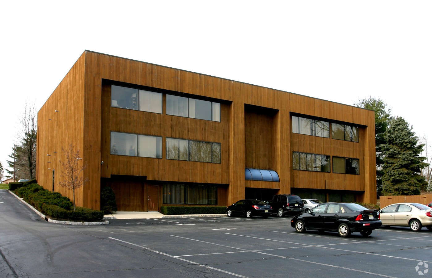
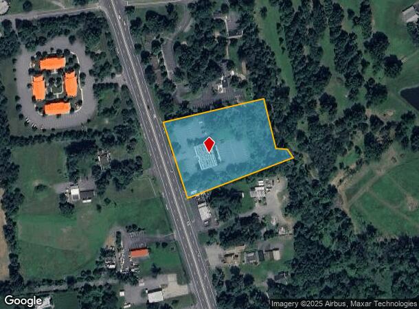
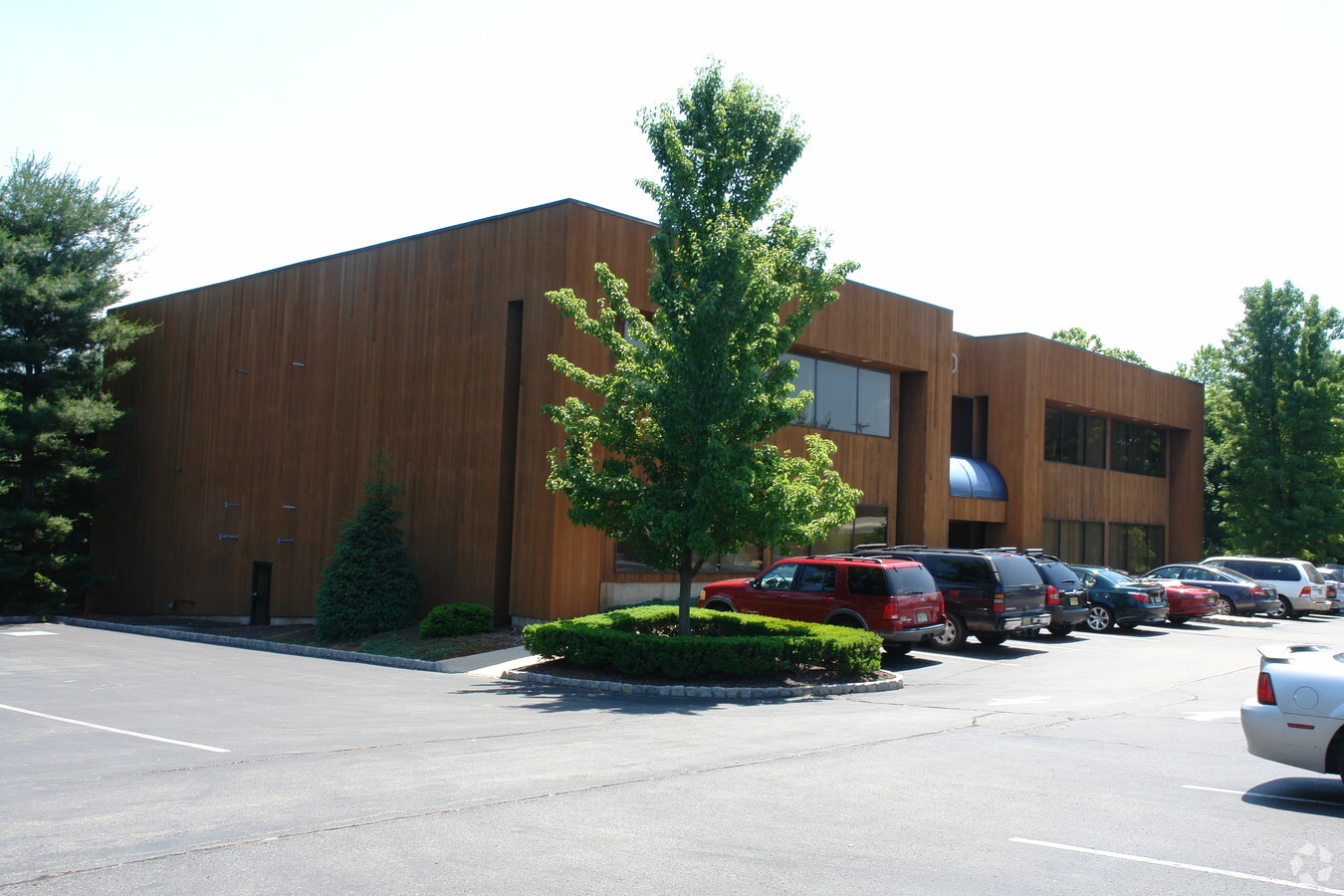
Property Record
1220 State Route 31, Lebanon, NJ 08833
Current Lease Availabilities
NEARBY LISTINGS FOR SALE OR LEASE
Property Detail
1220 State Route 31
06-00024-0000-00007
ADDITIONAL LOTS: 18000SF NET AREA
Officebuilding
Hunterdon
X
New Jersey
34019C0255F
7
2023
2.81 AC
2024
Hunterdon
010802
Northern New Jersey
22,358 SF
Newark, NJ-PA
DEMOGRAPHICS near 1220 State Route 31
1 Mile
3 Mile
5 Mile
2024 Total Population
1,591
10,373
32,384
2029 Population
1,608
10,499
32,795
Pop Growth 2024-2029
+ 1.07%
+ 1.21%
+ 1.27%
Average Age
43
44
44
2024 Total Households
535
3,956
11,891
HH Growth 2024-2029
+ 1.12%
+ 1.31%
+ 1.46%
Median Household Inc
$166,666
$144,647
$134,377
Avg Household Size
2.90
2.60
2.60
2024 Avg HH Vehicles
3.00
2.00
2.00
Median Home Value
$550,725
$499,587
$469,506
Median Year Built
1979
1983
1980
Nearby Places
- Restaurants
- Banks
- Shops
- Fitness
- Groceries
PUBLIC TRANSPORTATION
COMMUTER RAIL
Annandale (Raritan Valley Line - NJ Transit Commuter Rail (NJ Transit))
Drive
Walk
Distance
Annandale (Raritan Valley Line - NJ Transit Commuter Rail (NJ Transit))
6 min
3.4 mi
Lebanon (Raritan Valley Line - NJ Transit Commuter Rail (NJ Transit))
Drive
Walk
Distance
Lebanon (Raritan Valley Line - NJ Transit Commuter Rail (NJ Transit))
8 min
4.9 mi
Freight Ports
New York Container Terminal
Drive
Walk
Distance
New York Container Terminal
1 min
36.3 mi
Nearby Properties
Address
Land Use
TOTAL SIZE
Lot Size
Zoning
Address
Land Use
TOTAL SIZE
Lot Size
Zoning
84.62 AC
ROM1
Address
Land Use
TOTAL SIZE
Lot Size
Zoning
49.26 AC
RR4S
Address
Land Use
TOTAL SIZE
Lot Size
Zoning
5.52 AC
ROM1
Address
Land Use
TOTAL SIZE
Lot Size
Zoning
9408
37 AC
ROM1
Address
Land Use
TOTAL SIZE
Lot Size
Zoning
10.20 AC
OB1
Address
Land Use
TOTAL SIZE
Lot Size
Zoning
1620
15.85 AC
C2
Address
Land Use
TOTAL SIZE
Lot Size
Zoning
11584
4.17 AC
C1
Address
Land Use
TOTAL SIZE
Lot Size
Zoning
244
29.92 AC
RR4S
Address
Land Use
TOTAL SIZE
Lot Size
Zoning
10.44 AC
PUD
Address
Land Use
TOTAL SIZE
Lot Size
Zoning
3.21 AC
C1
Address
Land Use
TOTAL SIZE
Lot Size
Zoning
7.65 AC
R-3
Address
Land Use
TOTAL SIZE
Lot Size
Zoning
2087
4.12 AC
ROM2
Address
Land Use
TOTAL SIZE
Lot Size
Zoning
6618
43.45 AC
RC
Address
Land Use
TOTAL SIZE
Lot Size
Zoning
169.33 AC
RC
Address
Land Use
TOTAL SIZE
Lot Size
Zoning
5.80 AC
OB1
Address
Land Use
TOTAL SIZE
Lot Size
Zoning
98.91 AC
ROM1
Address
Land Use
TOTAL SIZE
Lot Size
Zoning
24.14 AC
AR-7
Address
Land Use
TOTAL SIZE
Lot Size
Zoning
15876
1.94 AC
ROM1
Address
Land Use
TOTAL SIZE
Lot Size
Zoning
3.20 AC
OB2
Address
Land Use
TOTAL SIZE
Lot Size
Zoning
3683
4.84 AC
C1
Address
Land Use
TOTAL SIZE
Lot Size
Zoning
8148
7.75 AC
R-1
Address
Land Use
TOTAL SIZE
Lot Size
Zoning
11460
2 AC
RR50
Address
Land Use
TOTAL SIZE
Lot Size
Zoning
8330
0.58 AC
C1
Address
Land Use
TOTAL SIZE
Lot Size
Zoning
3375
1.74 AC
OB1
Address
Land Use
TOTAL SIZE
Lot Size
Zoning
7.11 AC
RR4S
Address
Land Use
TOTAL SIZE
Lot Size
Zoning
3.05 AC
C1
Address
Land Use
TOTAL SIZE
Lot Size
Zoning
2.77 AC
OB1
Address
Land Use
TOTAL SIZE
Lot Size
Zoning
10352
85.65 AC
RC
Address
Land Use
TOTAL SIZE
Lot Size
Zoning
2.69 AC
C1
Start a new search to find other properties for sale or lease
Connect with us
© 2024 CoStar Group
The information above has been obtained from sources believed reliable. While we do not doubt its accuracy we have not verified it and make no guarantee, warranty or representation about it. It is your responsibility to independently confirm its accuracy and completeness. Any projections, opinions, assumptions, or estimates used are for example only and do not represent the current or future performance of the property. The value of this transaction to you depends on tax and other factors which should be evaluated by your tax, financial, and legal advisors. You and your advisors should conduct a careful, independent investigation of the property to determine to your satisfaction the suitability of the property for your needs.