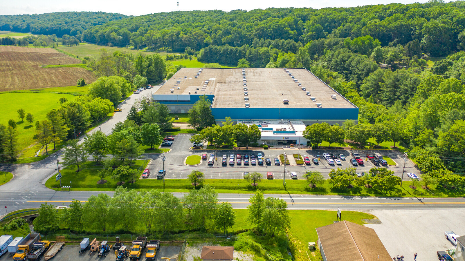
Property Record
12201 Long Green Pike, Glen Arm, MD 21057
NEARBY LISTINGS FOR SALE OR LEASE
-
-
View all Glen Arm listings for sale on LoopNet.com
Property Detail
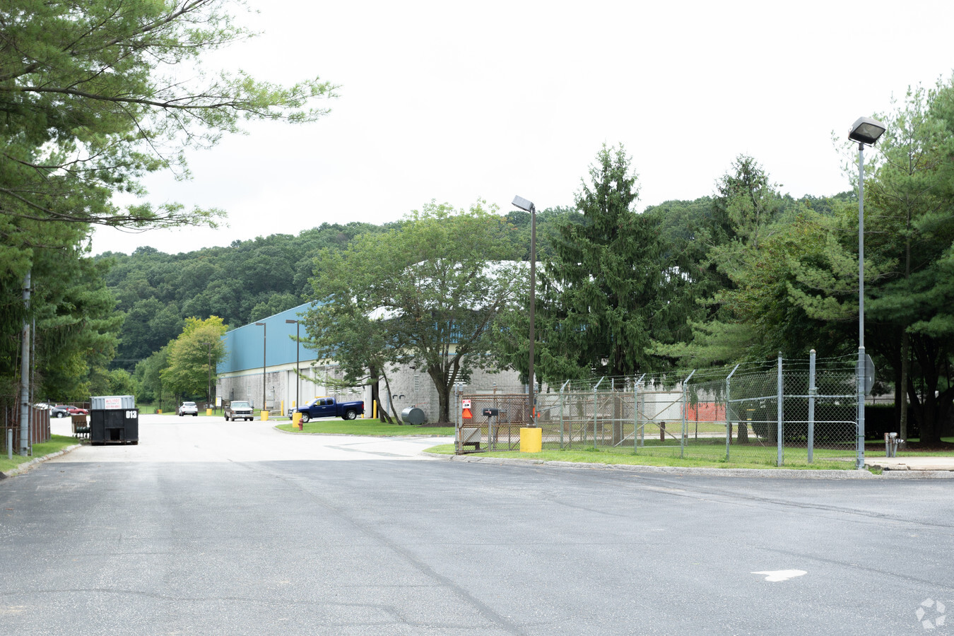
12201 Long Green Pike
Baltimore-Columbia-Towson, MD
Dietz Grumman Paumanock
11-1900002702
7.9641 AC PT TRACT F DIETZ GRUMMAN PAUMANOCK
Lightindustrial
Baltimore
X
Maryland
2400100280G
e,f
2024
7.96 AC
2024
Baltimore County East
411202
Baltimore
177,333 SF
DEMOGRAPHICS near 12201 Long Green Pike
1 Mile
3 Mile
5 Mile
2024 Total Population
399
11,932
81,643
2029 Population
399
11,738
80,362
Pop Growth 2024-2029
0.00%
(1.63%)
(1.57%)
Average Age
47
44
43
2024 Total Households
147
4,482
31,973
HH Growth 2024-2029
0.00%
(1.74%)
(1.65%)
Median Household Inc
$119,354
$127,202
$97,869
Avg Household Size
2.50
2.60
2.50
2024 Avg HH Vehicles
3.00
2.00
2.00
Median Home Value
$562,500
$403,864
$353,197
Median Year Built
1967
1979
1980
Nearby Places
- Restaurants
- Banks
- Shops
- Fitness
- Groceries
PUBLIC TRANSPORTATION
AIRPORT
Baltimore/Washington International Thurgood Marshall
DRIVE
WALK
Distance
Baltimore/Washington International Thurgood Marshall
49 min
28.5 mi
Freight Ports
Port of Baltimore
DRIVE
WALK
Distance
Port of Baltimore
37 min
19.9 mi
Nearby Properties
Address
Land Use
TOTAL SIZE
Lot Size
Zoning
Address
Land Use
TOTAL SIZE
Lot Size
Zoning
240,982 SF
65.48 AC
Address
Land Use
TOTAL SIZE
Lot Size
Zoning
219.28 AC
Address
Land Use
TOTAL SIZE
Lot Size
Zoning
45,034 SF
17.95 AC
Address
Land Use
TOTAL SIZE
Lot Size
Zoning
55,669 SF
6.30 AC
DR5.5
Address
Land Use
TOTAL SIZE
Lot Size
Zoning
31,119 SF
10 AC
Address
Land Use
TOTAL SIZE
Lot Size
Zoning
28,726 SF
2.39 AC
Address
Land Use
TOTAL SIZE
Lot Size
Zoning
33,298 SF
4.75 AC
RC2
Address
Land Use
TOTAL SIZE
Lot Size
Zoning
219,233 SF
9.45 AC
ML-CR
Address
Land Use
TOTAL SIZE
Lot Size
Zoning
19,594 SF
20.71 AC
Address
Land Use
TOTAL SIZE
Lot Size
Zoning
17,434 SF
5.14 AC
Address
Land Use
TOTAL SIZE
Lot Size
Zoning
19,942 SF
0.82 AC
Address
Land Use
TOTAL SIZE
Lot Size
Zoning
25,482 SF
118.11 AC
Address
Land Use
TOTAL SIZE
Lot Size
Zoning
9,543 SF
1.14 AC
BL
Address
Land Use
TOTAL SIZE
Lot Size
Zoning
9,381 SF
16.17 AC
RC2
Address
Land Use
TOTAL SIZE
Lot Size
Zoning
19,025 SF
1.93 AC
BM
Address
Land Use
TOTAL SIZE
Lot Size
Zoning
6,694 SF
11.45 AC
Address
Land Use
TOTAL SIZE
Lot Size
Zoning
9,352 SF
2.12 AC
RC2
Address
Land Use
TOTAL SIZE
Lot Size
Zoning
18.81 AC
ML
Address
Land Use
TOTAL SIZE
Lot Size
Zoning
97.75 AC
Address
Land Use
TOTAL SIZE
Lot Size
Zoning
8,173 SF
1.34 AC
Address
Land Use
TOTAL SIZE
Lot Size
Zoning
6,950 SF
2.40 AC
Address
Land Use
TOTAL SIZE
Lot Size
Zoning
436.28 AC
RC2
Address
Land Use
TOTAL SIZE
Lot Size
Zoning
8,660 SF
0.92 AC
Address
Land Use
TOTAL SIZE
Lot Size
Zoning
5,680 SF
3.91 AC
Address
Land Use
TOTAL SIZE
Lot Size
Zoning
165,994 SF
2.56 AC
ML-CR
Address
Land Use
TOTAL SIZE
Lot Size
Zoning
5,152 SF
0.32 AC
Address
Land Use
TOTAL SIZE
Lot Size
Zoning
24,789 SF
1.94 AC
ML-CR
Address
Land Use
TOTAL SIZE
Lot Size
Zoning
5,824 SF
1.88 AC
BL-CR
Address
Land Use
TOTAL SIZE
Lot Size
Zoning
5,460 SF
2.05 AC
The World's #1 Commercial Real Estate Marketplace
Connect with us
© 2025 CoStar Group
The information above has been obtained from sources believed reliable. While we do not doubt its accuracy we have not verified it and make no guarantee, warranty or representation about it. It is your responsibility to independently confirm its accuracy and completeness. Any projections, opinions, assumptions, or estimates used are for example only and do not represent the current or future performance of the property. The value of this transaction to you depends on tax and other factors which should be evaluated by your tax, financial, and legal advisors. You and your advisors should conduct a careful, independent investigation of the property to determine to your satisfaction the suitability of the property for your needs.