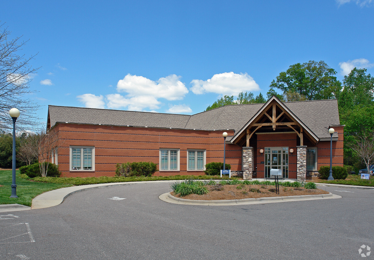
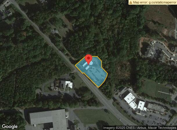
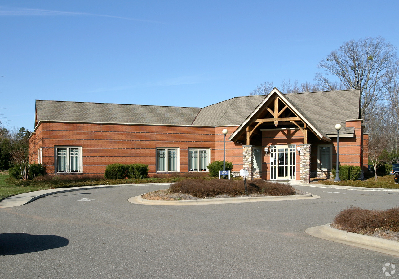
Property Record
1225 Lewisville Clemmons Rd, Lewisville, NC 27023

NEARBY LISTINGS FOR SALE OR LEASE
Property Detail
1225 Lewisville Clemmons Rd
Winston-Salem, NC
Family Medical Assoc Of Lewisv
5885-80-9947
FAMILY MEDICAL ASSOC OF LEWISV LO006A BL4433 BU1
Medicalbuilding
Forsyth
X
North Carolina
3710588500J
6a
2023
1.45 AC
2023
Western Forsyth County
004011
Greensboro/Winston-Salem
7,819 SF
DEMOGRAPHICS near 1225 Lewisville Clemmons Rd
1 Mile
3 Mile
5 Mile
2024 Total Population
4,194
37,868
88,022
2029 Population
4,353
39,412
91,509
Pop Growth 2024-2029
+ 3.79%
+ 4.08%
+ 3.96%
Average Age
42
41
42
2024 Total Households
1,673
15,794
36,971
HH Growth 2024-2029
+ 3.77%
+ 4.03%
+ 3.96%
Median Household Inc
$83,353
$82,988
$80,295
Avg Household Size
2.50
2.40
2.30
2024 Avg HH Vehicles
2.00
2.00
2.00
Median Home Value
$276,182
$294,573
$286,709
Median Year Built
1991
1990
1986
Nearby Places
- Restaurants
- Banks
- Shops
- Fitness
- Groceries
PUBLIC TRANSPORTATION
AIRPORT
Piedmont Triad International
DRIVE
WALK
Distance
Piedmont Triad International
42 min
29.4 mi
Freight Ports
Port of Wilmington
DRIVE
WALK
Distance
Port of Wilmington
280 min
238.1 mi
Nearby Properties
Address
Land Use
TOTAL SIZE
Lot Size
Zoning
Address
Land Use
TOTAL SIZE
Lot Size
Zoning
124,972 SF
19.32 AC
MU-S
Address
Land Use
TOTAL SIZE
Lot Size
Zoning
61,125 SF
8.66 AC
MU-S
Address
Land Use
TOTAL SIZE
Lot Size
Zoning
121,563 SF
22.42 AC
PB-S
Address
Land Use
TOTAL SIZE
Lot Size
Zoning
94,854 SF
31.49 AC
RM12,RM18
Address
Land Use
TOTAL SIZE
Lot Size
Zoning
187,927 SF
20.53 AC
CD1-S
Address
Land Use
TOTAL SIZE
Lot Size
Zoning
198,651 SF
60 AC
IP
Address
Land Use
TOTAL SIZE
Lot Size
Zoning
59,930 SF
8.04 AC
PB-S
Address
Land Use
TOTAL SIZE
Lot Size
Zoning
179,142 SF
42.52 AC
RS9-S
Address
Land Use
TOTAL SIZE
Lot Size
Zoning
98,507 SF
18.33 AC
RM12
Address
Land Use
TOTAL SIZE
Lot Size
Zoning
162,383 SF
32.47 AC
PB-S,RM18
Address
Land Use
TOTAL SIZE
Lot Size
Zoning
63,528 SF
14.71 AC
RM12-S
Address
Land Use
TOTAL SIZE
Lot Size
Zoning
349,983 SF
19.63 AC
HB-S
Address
Land Use
TOTAL SIZE
Lot Size
Zoning
56,638 SF
16.54 AC
RM8-S
Address
Land Use
TOTAL SIZE
Lot Size
Zoning
87,969 SF
9.50 AC
PB-S
Address
Land Use
TOTAL SIZE
Lot Size
Zoning
75,507 SF
12.46 AC
RM18
Address
Land Use
TOTAL SIZE
Lot Size
Zoning
45,427 SF
17.84 AC
RM8-S
Address
Land Use
TOTAL SIZE
Lot Size
Zoning
98,396 SF
18.91 AC
RM8
Address
Land Use
TOTAL SIZE
Lot Size
Zoning
51,434 SF
25.46 AC
RS9
Address
Land Use
TOTAL SIZE
Lot Size
Zoning
100 SF
4.12 AC
IP-S
Address
Land Use
TOTAL SIZE
Lot Size
Zoning
79,355 SF
14.91 AC
IP-S
Address
Land Use
TOTAL SIZE
Lot Size
Zoning
89,335 SF
44.77 AC
IP
Address
Land Use
TOTAL SIZE
Lot Size
Zoning
75,361 SF
15.20 AC
RM12
Address
Land Use
TOTAL SIZE
Lot Size
Zoning
152,991 SF
13.94 AC
HB-S
Address
Land Use
TOTAL SIZE
Lot Size
Zoning
69,984 SF
16.14 AC
RM8
Address
Land Use
TOTAL SIZE
Lot Size
Zoning
75,795 SF
8.59 AC
PB-S,RM12
Address
Land Use
TOTAL SIZE
Lot Size
Zoning
75,991 SF
8.68 AC
PB-S,RM12
Address
Land Use
TOTAL SIZE
Lot Size
Zoning
45,023 SF
14.02 AC
IP,RM8
Address
Land Use
TOTAL SIZE
Lot Size
Zoning
38,727 SF
6.84 AC
RM8-S
Address
Land Use
TOTAL SIZE
Lot Size
Zoning
54,297 SF
8.44 AC
HB-S
Address
Land Use
TOTAL SIZE
Lot Size
Zoning
82,551 SF
7.23 AC
HB,HB-S
The World's #1 Commercial Real Estate Marketplace
Connect with us
© 2025 CoStar Group
The information above has been obtained from sources believed reliable. While we do not doubt its accuracy we have not verified it and make no guarantee, warranty or representation about it. It is your responsibility to independently confirm its accuracy and completeness. Any projections, opinions, assumptions, or estimates used are for example only and do not represent the current or future performance of the property. The value of this transaction to you depends on tax and other factors which should be evaluated by your tax, financial, and legal advisors. You and your advisors should conduct a careful, independent investigation of the property to determine to your satisfaction the suitability of the property for your needs.