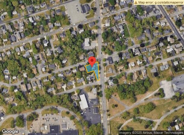
Property Record
1227 Ashley Blvd, New Bedford, MA 02745
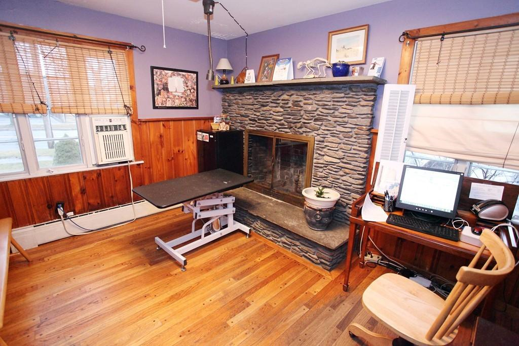
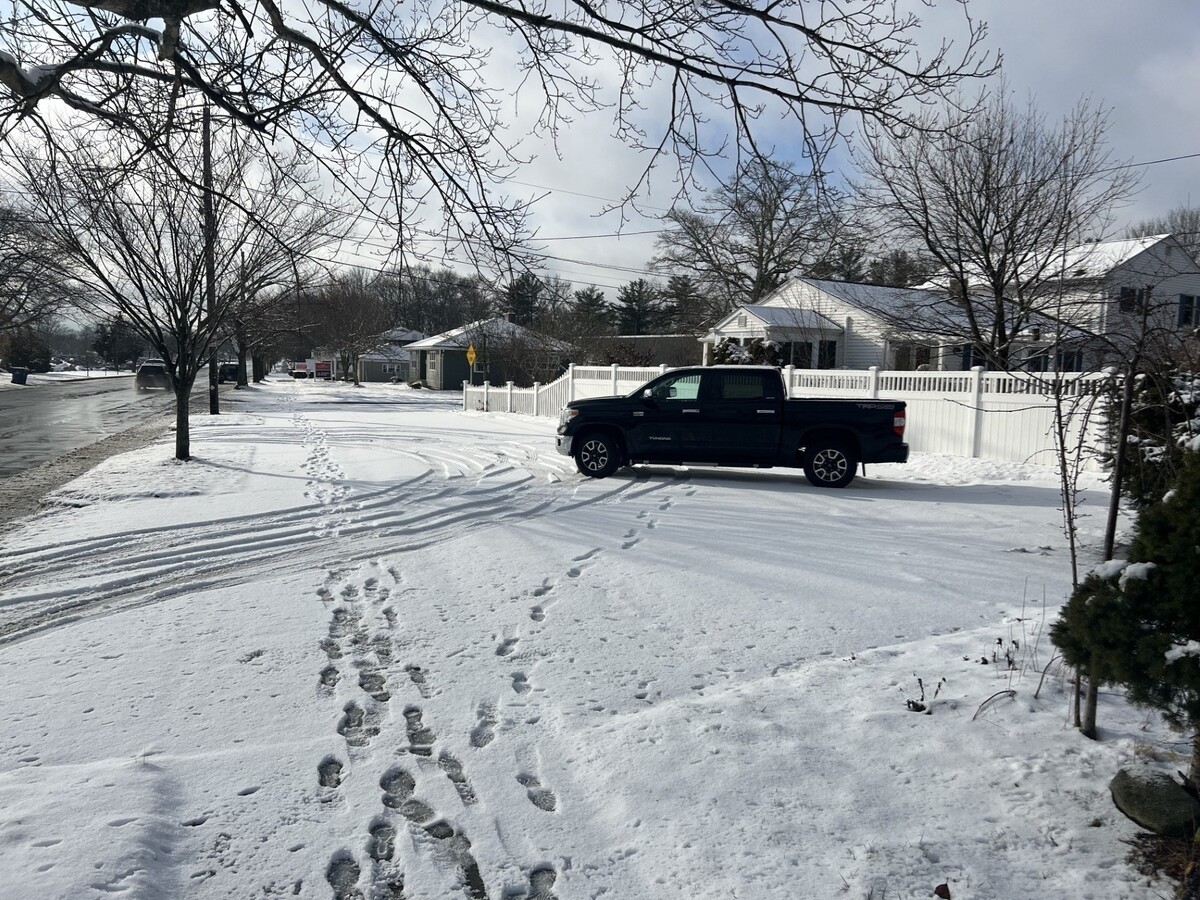
This Property Is For Sale
NEARBY LISTINGS FOR SALE OR LEASE
Property Detail
1227 Ashley Blvd
NEWB-000130C-000000-000431
Belmont Park
Commercialofficeresidentialmixeduse
Bristol
X
Massachusetts
25005C0383H
431
0
0.25 AC
2024
Attleboro/New Bedford
650101
Boston
3,636 SF
Providence-Warwick, RI-MA
DEMOGRAPHICS near 1227 Ashley Blvd
1 Mile
3 Mile
5 Mile
2024 Total Population
9,079
53,266
109,506
2029 Population
9,003
52,348
107,501
Pop Growth 2024-2029
(0.84%)
(1.72%)
(1.83%)
Average Age
43
40
41
2024 Total Households
3,719
21,793
44,900
HH Growth 2024-2029
(0.89%)
(1.79%)
(1.91%)
Median Household Inc
$75,926
$57,379
$58,990
Avg Household Size
2.40
2.40
2.30
2024 Avg HH Vehicles
2.00
2.00
2.00
Median Home Value
$325,860
$318,342
$335,138
Median Year Built
1967
1952
1950
Nearby Places
- Restaurants
- Banks
- Shops
- Fitness
- Groceries
PUBLIC TRANSPORTATION
AIRPORT
Rhode Island Tf Green International
DRIVE
WALK
Distance
Rhode Island Tf Green International
56 min
38.8 mi
Freight Ports
Port of New Bedford Harbor
DRIVE
WALK
Distance
Port of New Bedford Harbor
9 min
4.3 mi
Nearby Properties
Address
Land Use
TOTAL SIZE
Lot Size
Zoning
Address
Land Use
TOTAL SIZE
Lot Size
Zoning
23.22 AC
RB
Address
Land Use
TOTAL SIZE
Lot Size
Zoning
243,052 SF
9.66 AC
RB
Address
Land Use
TOTAL SIZE
Lot Size
Zoning
101,866 SF
15.15 AC
OI
Address
Land Use
TOTAL SIZE
Lot Size
Zoning
157,346 SF
5.68 AC
RA
Address
Land Use
TOTAL SIZE
Lot Size
Zoning
54.60 AC
Address
Land Use
TOTAL SIZE
Lot Size
Zoning
24.95 AC
PB
Address
Land Use
TOTAL SIZE
Lot Size
Zoning
160,391 SF
2.86 AC
MUB
Address
Land Use
TOTAL SIZE
Lot Size
Zoning
44,156 SF
5.18 AC
GI
Address
Land Use
TOTAL SIZE
Lot Size
Zoning
11.67 AC
RC
Address
Land Use
TOTAL SIZE
Lot Size
Zoning
214,698 SF
4.66 AC
IB
Address
Land Use
TOTAL SIZE
Lot Size
Zoning
134,355 SF
2.21 AC
IB
Address
Land Use
TOTAL SIZE
Lot Size
Zoning
183,196 SF
3.62 AC
MUB
Address
Land Use
TOTAL SIZE
Lot Size
Zoning
118,757 SF
61.52 AC
IC
Address
Land Use
TOTAL SIZE
Lot Size
Zoning
116,158 SF
3.80 AC
IB
Address
Land Use
TOTAL SIZE
Lot Size
Zoning
239,765 SF
30.71 AC
IC
Address
Land Use
TOTAL SIZE
Lot Size
Zoning
64.98 AC
RA
Address
Land Use
TOTAL SIZE
Lot Size
Zoning
5,616 SF
132.66 AC
RA
Address
Land Use
TOTAL SIZE
Lot Size
Zoning
153,087 SF
29.27 AC
IC
Address
Land Use
TOTAL SIZE
Lot Size
Zoning
59,778 SF
14.95 AC
OI
Address
Land Use
TOTAL SIZE
Lot Size
Zoning
119,865 SF
3.22 AC
IA
Address
Land Use
TOTAL SIZE
Lot Size
Zoning
165,183 SF
11.29 AC
PB
Address
Land Use
TOTAL SIZE
Lot Size
Zoning
135,204 SF
1.74 AC
IB
Address
Land Use
TOTAL SIZE
Lot Size
Zoning
199,978 SF
31.41 AC
IC
Address
Land Use
TOTAL SIZE
Lot Size
Zoning
77,176 SF
3.52 AC
IB
Address
Land Use
TOTAL SIZE
Lot Size
Zoning
5.30 AC
RC
Address
Land Use
TOTAL SIZE
Lot Size
Zoning
169,256 SF
31.88 AC
GI
Address
Land Use
TOTAL SIZE
Lot Size
Zoning
39,910 SF
2.29 AC
RB
Address
Land Use
TOTAL SIZE
Lot Size
Zoning
8.34 AC
IA
Address
Land Use
TOTAL SIZE
Lot Size
Zoning
203.05 AC
IB
Address
Land Use
TOTAL SIZE
Lot Size
Zoning
85.25 AC
MUB
The World's #1 Commercial Real Estate Marketplace
Connect with us
© 2025 CoStar Group
The information above has been obtained from sources believed reliable. While we do not doubt its accuracy we have not verified it and make no guarantee, warranty or representation about it. It is your responsibility to independently confirm its accuracy and completeness. Any projections, opinions, assumptions, or estimates used are for example only and do not represent the current or future performance of the property. The value of this transaction to you depends on tax and other factors which should be evaluated by your tax, financial, and legal advisors. You and your advisors should conduct a careful, independent investigation of the property to determine to your satisfaction the suitability of the property for your needs.