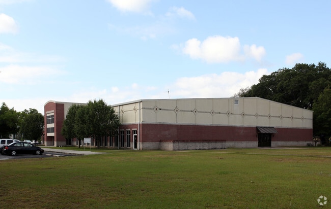
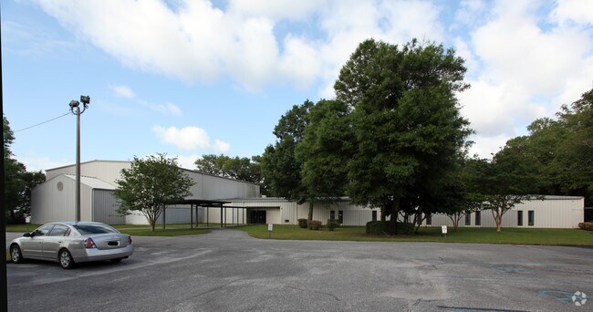
Property Record
123 Baptist Way, Pensacola, FL 32503


Property Detail
123 Baptist Way
48-1S-30-3112-000-000
COMMENCE AT THE INTERSECTION OF THE CENTERLINE OF BRENT LANE (S.R. #296, R/W VARIES) AND THE EASTERLY RIGHT OF WAY (R/W) OF LOUISVILLE AND NASHVILLE RAILROAD (100 FT R/W), SAID POINT ALSO KNOWN AS THE J.E. SPOONS NORTHWEST CORNER; THENCE PROCEED SOUT
Hospitalpublic
ESCAMBIA
C-3
Florida
B and X Area of moderate flood hazard, usually the area between the limits of the 100-year and 500-year floods.
52.64 AC
0
Central Pensacola/S Brent
2025
Pensacola
001401
Pensacola-Ferry Pass-Brent, FL
820,379 SF
NEARBY LISTINGS FOR SALE OR LEASE
-
-
View all Pensacola listings for sale on LoopNet.com
DEMOGRAPHICS near 123 Baptist Way
1 mile
3 mile
5 mile
2025 Total Population
8,532
63,263
167,914
2030 Population
8,683
64,708
171,850
Pop Growth 2025-2030
+ 1.77%
+ 2.28%
+ 2.34%
Average Age
31
38
40
2025 Total Households
1,767
23,900
68,890
HH Growth 2025-2030
+ 1.87%
+ 2.26%
+ 2.43%
Median Household Inc
$56,337
$59,682
$65,851
Avg Household Size
2.20
2.30
2.20
2025 Avg HH Vehicles
1.00
2.00
2.00
Median Home Value
$211,607
$249,982
$258,315
Median Year Built
1968
1973
1977
Nearby Places
Map Layers
Map Styles
 Street
 Aerial
Layers
 Traffic
 Biking
Places
Listings with unknown addresses are not visible on the map
- Restaurants
- Banks
- Shops
- Fitness
- Groceries
PUBLIC TRANSPORTATION
AIRPORT
Pensacola International
Drive
Walk
Distance
Pensacola International
11 min
4.1 mi
Nearby Properties
Address
Land Use
TOTAL SIZE
Lot Size
Zoning
Address
Land Use
TOTAL SIZE
Lot Size
Zoning
1,487,006 SF
39.92 AC
C-1
Address
Land Use
TOTAL SIZE
Lot Size
Zoning
431,154 SF
35.83 AC
ARZ
Address
Land Use
TOTAL SIZE
Lot Size
Zoning
39.22 AC
R-1AA
Address
Land Use
TOTAL SIZE
Lot Size
Zoning
1,479,067 SF
77.37 AC
COM
Address
Land Use
TOTAL SIZE
Lot Size
Zoning
5,732 SF
71.97 AC
R-1AA
Address
Land Use
TOTAL SIZE
Lot Size
Zoning
518,234 SF
30.84 AC
C-2
Address
Land Use
TOTAL SIZE
Lot Size
Zoning
305,650 SF
21.90 AC
HDMU
Address
Land Use
TOTAL SIZE
Lot Size
Zoning
655,451 SF
1,269.99 AC
ARZ
Address
Land Use
TOTAL SIZE
Lot Size
Zoning
210,644 SF
13.14 AC
R-2
Address
Land Use
TOTAL SIZE
Lot Size
Zoning
289,397 SF
12.38 AC
PUB
Address
Land Use
TOTAL SIZE
Lot Size
Zoning
202,638 SF
9.43 AC
HDMU
Address
Land Use
TOTAL SIZE
Lot Size
Zoning
197,545 SF
8.60 AC
R-2A
Address
Land Use
TOTAL SIZE
Lot Size
Zoning
171,830 SF
1.20 AC
C-1
Address
Land Use
TOTAL SIZE
Lot Size
Zoning
485,500 SF
15.92 AC
COM
Address
Land Use
TOTAL SIZE
Lot Size
Zoning
263,938 SF
58.17 AC
C-1,R-1AA,
Address
Land Use
TOTAL SIZE
Lot Size
Zoning
155,886 SF
5.98 AC
R-2
Address
Land Use
TOTAL SIZE
Lot Size
Zoning
189,008 SF
9.56 AC
R-2A
Address
Land Use
TOTAL SIZE
Lot Size
Zoning
168,911 SF
11.89 AC
C-2
Address
Land Use
TOTAL SIZE
Lot Size
Zoning
158,190 SF
22.79 AC
HC/LI
Address
Land Use
TOTAL SIZE
Lot Size
Zoning
258,438 SF
48.49 AC
PUB
Address
Land Use
TOTAL SIZE
Lot Size
Zoning
282,738 SF
14.64 AC
PUB
Address
Land Use
TOTAL SIZE
Lot Size
Zoning
176,462 SF
9.51 AC
HDR
Address
Land Use
TOTAL SIZE
Lot Size
Zoning
103,111 SF
12.02 AC
C-1
Address
Land Use
TOTAL SIZE
Lot Size
Zoning
176,574 SF
16.97 AC
HC/LI
Address
Land Use
TOTAL SIZE
Lot Size
Zoning
236,704 SF
35.17 AC
R-1AA
Address
Land Use
TOTAL SIZE
Lot Size
Zoning
169,963 SF
15.43 AC
HC/LI
Address
Land Use
TOTAL SIZE
Lot Size
Zoning
225,899 SF
26.47 AC
C-1,R-1AA
Address
Land Use
TOTAL SIZE
Lot Size
Zoning
107,722 SF
2.84 AC
COM
Address
Land Use
TOTAL SIZE
Lot Size
Zoning
120,025 SF
7.97 AC
R-2A
The World's #1 Commercial Real Estate Marketplace
Connect with us
© 2026 CoStar Group
The information above has been obtained from sources believed reliable. While we do not doubt its accuracy we have not verified it and make no guarantee, warranty or representation about it. It is your responsibility to independently confirm its accuracy and completeness. Any projections, opinions, assumptions, or estimates used are for example only and do not represent the current or future performance of the property. The value of this transaction to you depends on tax and other factors which should be evaluated by your tax, financial, and legal advisors. You and your advisors should conduct a careful, independent investigation of the property to determine to your satisfaction the suitability of the property for your needs.