Property Record
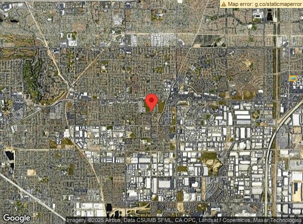
12323 Cultural Center Dr, Rancho Cucamonga, CA 91730
NEARBY LISTINGS FOR SALE OR LEASE
Property Detail
12323 Cultural Center Dr
Riverside-San Bernardino-Ontario, CA
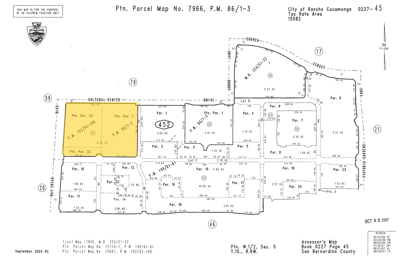
Parcel Map No 15716 1
1090-531-02
PARCEL MAP 15641 PARCELS 22 AND 23 AND THAT PTN PARCEL 1 PARCEL MAP 7966 LYING W OF PARCEL C AND N OF PARCEL F PARCEL MAP 15716-1 AND S OF CULTURAL CENTER EX ANY PTN LYING WITHIN PARCEL MAP 15716-1
Vacantlandnec
San Bernardino
X
California
06071C8635J
6.38 AC
2023
Airport Area
2024
Inland Empire (California)
002107
DEMOGRAPHICS near 12323 Cultural Center Dr
1 Mile
3 Mile
5 Mile
2024 Total Population
19,311
115,535
272,295
2029 Population
19,728
117,271
276,419
Pop Growth 2024-2029
+ 2.16%
+ 1.50%
+ 1.51%
Average Age
36
37
37
2024 Total Households
6,561
36,953
83,556
HH Growth 2024-2029
+ 2.09%
+ 1.64%
+ 1.56%
Median Household Inc
$115,632
$104,473
$99,352
Avg Household Size
2.90
3.00
3.20
2024 Avg HH Vehicles
2.00
2.00
2.00
Median Home Value
$647,344
$645,442
$602,025
Median Year Built
2002
1992
1988
Nearby Places
- Restaurants
- Banks
- Shops
- Fitness
- Groceries
PUBLIC TRANSPORTATION
COMMUTER RAIL
Rancho Cucamonga (San Bernardino Line - Southern California Regional Rail Authority (Metrolink))
DRIVE
WALK
Distance
Rancho Cucamonga (San Bernardino Line - Southern California Regional Rail Authority (Metrolink))
5 min
2.8 mi
Upland (San Bernardino Line - Southern California Regional Rail Authority (Metrolink))
DRIVE
WALK
Distance
Upland (San Bernardino Line - Southern California Regional Rail Authority (Metrolink))
8 min
4.2 mi
AIRPORT
Ontario International
DRIVE
WALK
Distance
Ontario International
8 min
4.1 mi
Freight Ports
Port of Long Beach
DRIVE
WALK
Distance
Port of Long Beach
70 min
55.6 mi
Nearby Properties
Address
Land Use
TOTAL SIZE
Lot Size
Zoning
Address
Land Use
TOTAL SIZE
Lot Size
Zoning
1,459,702 SF
96.41 AC
Address
Land Use
TOTAL SIZE
Lot Size
Zoning
707,551 SF
20.82 AC
Address
Land Use
TOTAL SIZE
Lot Size
Zoning
275,783 SF
11.82 AC
Address
Land Use
TOTAL SIZE
Lot Size
Zoning
261,114 SF
11.23 AC
Address
Land Use
TOTAL SIZE
Lot Size
Zoning
293,860 SF
16.10 AC
Address
Land Use
TOTAL SIZE
Lot Size
Zoning
145,111 SF
48.01 AC
Address
Land Use
TOTAL SIZE
Lot Size
Zoning
545,161 SF
11.10 AC
Address
Land Use
TOTAL SIZE
Lot Size
Zoning
453,960 SF
18.54 AC
Address
Land Use
TOTAL SIZE
Lot Size
Zoning
591,495 SF
18.29 AC
Address
Land Use
TOTAL SIZE
Lot Size
Zoning
1,052,840 SF
41.85 AC
Address
Land Use
TOTAL SIZE
Lot Size
Zoning
535,545 SF
10.24 AC
Address
Land Use
TOTAL SIZE
Lot Size
Zoning
611,573 SF
26.64 AC
Address
Land Use
TOTAL SIZE
Lot Size
Zoning
87,909 SF
30.12 AC
Address
Land Use
TOTAL SIZE
Lot Size
Zoning
286,732 SF
9.58 AC
Address
Land Use
TOTAL SIZE
Lot Size
Zoning
440,209 SF
10.34 AC
Address
Land Use
TOTAL SIZE
Lot Size
Zoning
830,300 SF
39.99 AC
Address
Land Use
TOTAL SIZE
Lot Size
Zoning
190,724 SF
10.69 AC
Address
Land Use
TOTAL SIZE
Lot Size
Zoning
387,965 SF
10.92 AC
Address
Land Use
TOTAL SIZE
Lot Size
Zoning
468,682 SF
19.40 AC
Address
Land Use
TOTAL SIZE
Lot Size
Zoning
174,092 SF
4.42 AC
Address
Land Use
TOTAL SIZE
Lot Size
Zoning
358,375 SF
9.30 AC
Address
Land Use
TOTAL SIZE
Lot Size
Zoning
246,012 SF
5.97 AC
Address
Land Use
TOTAL SIZE
Lot Size
Zoning
314,559 SF
9.34 AC
Address
Land Use
TOTAL SIZE
Lot Size
Zoning
573,220 SF
32.33 AC
Address
Land Use
TOTAL SIZE
Lot Size
Zoning
780,648 SF
13.59 AC
Address
Land Use
TOTAL SIZE
Lot Size
Zoning
Address
Land Use
TOTAL SIZE
Lot Size
Zoning
329,030 SF
15.98 AC
Address
Land Use
TOTAL SIZE
Lot Size
Zoning
303,915 SF
11.13 AC
Address
Land Use
TOTAL SIZE
Lot Size
Zoning
553,882 SF
24.59 AC
Address
Land Use
TOTAL SIZE
Lot Size
Zoning
84,378 SF
15.32 AC
The World's #1 Commercial Real Estate Marketplace
Connect with us
© 2025 CoStar Group
The information above has been obtained from sources believed reliable. While we do not doubt its accuracy we have not verified it and make no guarantee, warranty or representation about it. It is your responsibility to independently confirm its accuracy and completeness. Any projections, opinions, assumptions, or estimates used are for example only and do not represent the current or future performance of the property. The value of this transaction to you depends on tax and other factors which should be evaluated by your tax, financial, and legal advisors. You and your advisors should conduct a careful, independent investigation of the property to determine to your satisfaction the suitability of the property for your needs.