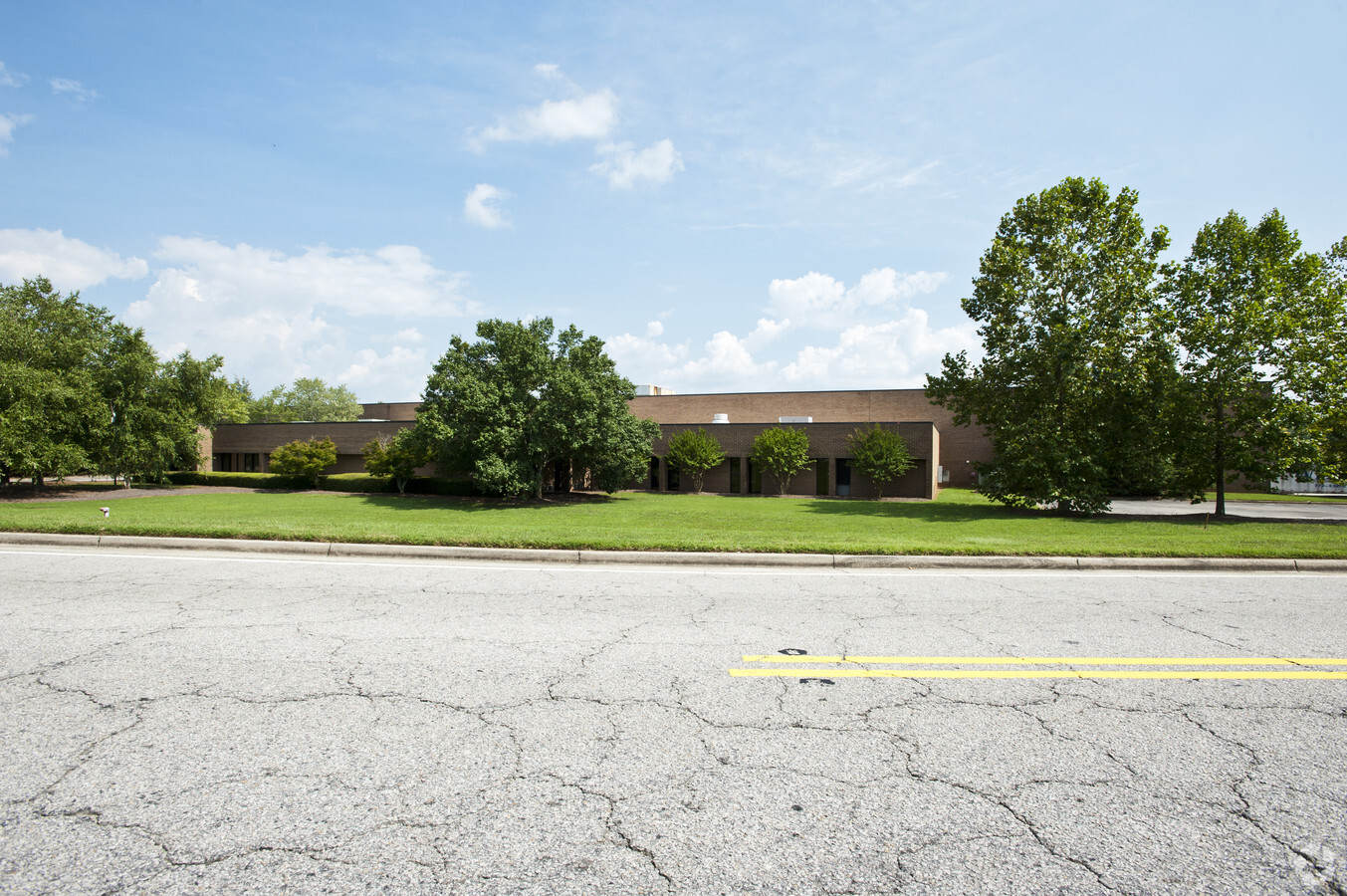
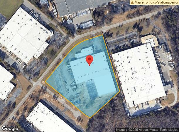
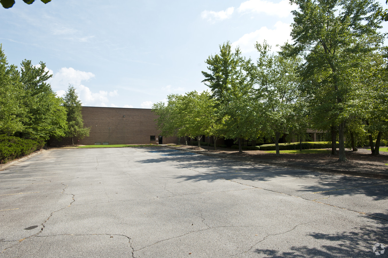
Property Record
1233 Palmour Dr, Gainesville, GA 30501

NEARBY LISTINGS FOR SALE OR LEASE
Property Detail
1233 Palmour Dr
Gainesville, GA
Gainesville Indust Park So
15-00035-00-022
LOT 8 PALMOUR DRIVE
Manufacturinglight
Hall
X
Georgia
13139C0189G
8
2024
9.81 AC
2024
I-985/Gainesville
001304
Atlanta
116,812 SF
DEMOGRAPHICS near 1233 Palmour Dr
1 Mile
3 Mile
5 Mile
2024 Total Population
2,904
37,748
85,042
2029 Population
3,159
41,693
94,248
Pop Growth 2024-2029
+ 8.78%
+ 10.45%
+ 10.83%
Average Age
30
33
36
2024 Total Households
714
11,538
28,781
HH Growth 2024-2029
+ 8.54%
+ 10.41%
+ 10.82%
Median Household Inc
$59,725
$51,180
$56,300
Avg Household Size
3.60
3.10
2.80
2024 Avg HH Vehicles
2.00
2.00
2.00
Median Home Value
$148,742
$209,144
$243,579
Median Year Built
1984
1989
1991
Nearby Places
- Restaurants
- Banks
- Shops
- Fitness
- Groceries
PUBLIC TRANSPORTATION
COMMUTER RAIL
Gainesville Amtrak Station (Crescent - Amtrak)
DRIVE
WALK
Distance
Gainesville Amtrak Station (Crescent - Amtrak)
5 min
2.2 mi
Freight Ports
Georgia Ports - Savannah
DRIVE
WALK
Distance
Georgia Ports - Savannah
319 min
252.1 mi
Nearby Properties
Address
Land Use
TOTAL SIZE
Lot Size
Zoning
Address
Land Use
TOTAL SIZE
Lot Size
Zoning
564,132 SF
48.45 AC
EX
Address
Land Use
TOTAL SIZE
Lot Size
Zoning
39,637 SF
31.55 AC
R-II
Address
Land Use
TOTAL SIZE
Lot Size
Zoning
27,221 SF
2.23 AC
G-B
Address
Land Use
TOTAL SIZE
Lot Size
Zoning
2,160 SF
5.60 AC
PUD
Address
Land Use
TOTAL SIZE
Lot Size
Zoning
760,440 SF
53.33 AC
L-I
Address
Land Use
TOTAL SIZE
Lot Size
Zoning
3,284 SF
28.53 AC
PUD
Address
Land Use
TOTAL SIZE
Lot Size
Zoning
3,620 SF
20.20 AC
R-B
Address
Land Use
TOTAL SIZE
Lot Size
Zoning
277,684 SF
23.06 AC
L-I
Address
Land Use
TOTAL SIZE
Lot Size
Zoning
77,333 SF
11.74 AC
G-B
Address
Land Use
TOTAL SIZE
Lot Size
Zoning
54,751 SF
33.38 AC
EX
Address
Land Use
TOTAL SIZE
Lot Size
Zoning
346,875 SF
82.09 AC
H-I
Address
Land Use
TOTAL SIZE
Lot Size
Zoning
157,050 SF
144.96 AC
O-I
Address
Land Use
TOTAL SIZE
Lot Size
Zoning
19,875 SF
19.76 AC
R-B
Address
Land Use
TOTAL SIZE
Lot Size
Zoning
76,726 SF
0.42 AC
C-B
Address
Land Use
TOTAL SIZE
Lot Size
Zoning
100,864 SF
4.10 AC
PUD
Address
Land Use
TOTAL SIZE
Lot Size
Zoning
469,180 SF
25.56 AC
L-I
Address
Land Use
TOTAL SIZE
Lot Size
Zoning
132,557 SF
32.85 AC
O-I
Address
Land Use
TOTAL SIZE
Lot Size
Zoning
44,388 SF
1.66 AC
O-I
Address
Land Use
TOTAL SIZE
Lot Size
Zoning
6,852 SF
3.15 AC
PUD
Address
Land Use
TOTAL SIZE
Lot Size
Zoning
258,372 SF
24.38 AC
L-I
Address
Land Use
TOTAL SIZE
Lot Size
Zoning
46,795 SF
17.38 AC
PUD
Address
Land Use
TOTAL SIZE
Lot Size
Zoning
102,317 SF
6.90 AC
PUD
Address
Land Use
TOTAL SIZE
Lot Size
Zoning
11,430 SF
38 AC
R-I
Address
Land Use
TOTAL SIZE
Lot Size
Zoning
258,800 SF
52.20 AC
H-I
Address
Land Use
TOTAL SIZE
Lot Size
Zoning
308,672 SF
41.22 AC
L-I
Address
Land Use
TOTAL SIZE
Lot Size
Zoning
308,672 SF
41.22 AC
L-I
Address
Land Use
TOTAL SIZE
Lot Size
Zoning
4,370 SF
262.63 AC
H-I
Address
Land Use
TOTAL SIZE
Lot Size
Zoning
1,441 SF
10.46 AC
R-II
Address
Land Use
TOTAL SIZE
Lot Size
Zoning
140,805 SF
3.74 AC
G-B
Address
Land Use
TOTAL SIZE
Lot Size
Zoning
91,728 SF
15 AC
L-I
The World's #1 Commercial Real Estate Marketplace
Connect with us
© 2025 CoStar Group
The information above has been obtained from sources believed reliable. While we do not doubt its accuracy we have not verified it and make no guarantee, warranty or representation about it. It is your responsibility to independently confirm its accuracy and completeness. Any projections, opinions, assumptions, or estimates used are for example only and do not represent the current or future performance of the property. The value of this transaction to you depends on tax and other factors which should be evaluated by your tax, financial, and legal advisors. You and your advisors should conduct a careful, independent investigation of the property to determine to your satisfaction the suitability of the property for your needs.