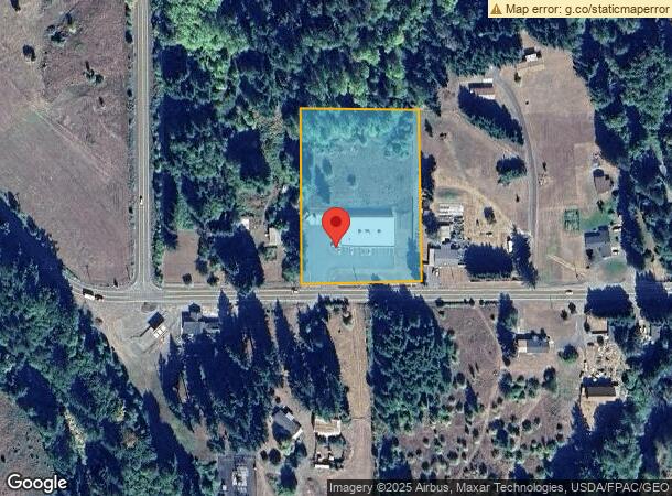
Property Record
1234 State Route 506, Vader, WA 98593

NEARBY LISTINGS FOR SALE OR LEASE
-
-
View all Vader listings for sale on LoopNet.com
Property Detail
1234 State Route 506
Centralia, WA
SECTION 29 TOWNSHIP 11N RANGE 02W S 470 E 4.50 AC SW4 SW4 SW4
012574-001-000
Lewis
Storebuilding
Washington
2024
3 AC
2024
Washington State Area
971600
Other Market Areas
3,456 SF
DEMOGRAPHICS near 1234 State Route 506
1 Mile
3 Mile
5 Mile
2024 Total Population
697
1,925
4,035
2029 Population
770
2,113
4,395
Pop Growth 2024-2029
+ 10.47%
+ 9.77%
+ 8.92%
Average Age
45
46
47
2024 Total Households
275
758
1,640
HH Growth 2024-2029
+ 10.55%
+ 9.76%
+ 8.78%
Median Household Inc
$73,706
$78,326
$78,100
Avg Household Size
2.50
2.50
2.40
2024 Avg HH Vehicles
3.00
3.00
3.00
Median Home Value
$379,850
$392,134
$388,332
Median Year Built
1980
1981
1980
Nearby Places
- Restaurants
- Banks
- Shops
- Fitness
- Groceries
SALE & LEASE HISTORY
LISTING DATE
SALE/LEASE

Jun 11, 2020
For Sale
Dec 13, 2021
For Sale
Nearby Properties
Address
Land Use
TOTAL SIZE
Lot Size
Zoning
Address
Land Use
TOTAL SIZE
Lot Size
Zoning
4,173 SF
33.96 AC
RDD5
Address
Land Use
TOTAL SIZE
Lot Size
Zoning
1,832 SF
40 AC
RDD20
Address
Land Use
TOTAL SIZE
Lot Size
Zoning
124.40 AC
MINE
Address
Land Use
TOTAL SIZE
Lot Size
Zoning
3,796 SF
41.39 AC
RDD5
Address
Land Use
TOTAL SIZE
Lot Size
Zoning
5 AC
RDD20
Address
Land Use
TOTAL SIZE
Lot Size
Zoning
5,344 SF
20 AC
MINE
Address
Land Use
TOTAL SIZE
Lot Size
Zoning
3,368 SF
51.41 AC
RDD20
Address
Land Use
TOTAL SIZE
Lot Size
Zoning
18,900 SF
13.53 AC
ARL
Address
Land Use
TOTAL SIZE
Lot Size
Zoning
9.02 AC
Address
Land Use
TOTAL SIZE
Lot Size
Zoning
149.63 AC
ARL
Address
Land Use
TOTAL SIZE
Lot Size
Zoning
2,224 SF
32.57 AC
ARL
Address
Land Use
TOTAL SIZE
Lot Size
Zoning
2,112 SF
5.02 AC
CM
Address
Land Use
TOTAL SIZE
Lot Size
Zoning
2,752 SF
67.11 AC
ARL
Address
Land Use
TOTAL SIZE
Lot Size
Zoning
2,394 SF
35.08 AC
Address
Land Use
TOTAL SIZE
Lot Size
Zoning
2,096 SF
28.70 AC
RDD5
Address
Land Use
TOTAL SIZE
Lot Size
Zoning
2,288 SF
18.72 AC
Address
Land Use
TOTAL SIZE
Lot Size
Zoning
3,553 SF
6 AC
Address
Land Use
TOTAL SIZE
Lot Size
Zoning
2,976 SF
8.23 AC
RDD20
Address
Land Use
TOTAL SIZE
Lot Size
Zoning
1,816 SF
32.30 AC
Address
Land Use
TOTAL SIZE
Lot Size
Zoning
12.93 AC
RDD10
Address
Land Use
TOTAL SIZE
Lot Size
Zoning
4,404 SF
9.35 AC
RDD20
Address
Land Use
TOTAL SIZE
Lot Size
Zoning
1,716 SF
0.41 AC
R1
Address
Land Use
TOTAL SIZE
Lot Size
Zoning
2,602 SF
36.61 AC
MINE
Address
Land Use
TOTAL SIZE
Lot Size
Zoning
2,848 SF
37.78 AC
RDD20
Address
Land Use
TOTAL SIZE
Lot Size
Zoning
1,716 SF
30 AC
RDD10
Address
Land Use
TOTAL SIZE
Lot Size
Zoning
1,320 SF
3.88 AC
Address
Land Use
TOTAL SIZE
Lot Size
Zoning
2,761 SF
18.89 AC
RDD5
Address
Land Use
TOTAL SIZE
Lot Size
Zoning
3,396 SF
36.22 AC
RDD5
Address
Land Use
TOTAL SIZE
Lot Size
Zoning
2,369 SF
6.38 AC
RDD5
The World's #1 Commercial Real Estate Marketplace
Connect with us
© 2025 CoStar Group
The information above has been obtained from sources believed reliable. While we do not doubt its accuracy we have not verified it and make no guarantee, warranty or representation about it. It is your responsibility to independently confirm its accuracy and completeness. Any projections, opinions, assumptions, or estimates used are for example only and do not represent the current or future performance of the property. The value of this transaction to you depends on tax and other factors which should be evaluated by your tax, financial, and legal advisors. You and your advisors should conduct a careful, independent investigation of the property to determine to your satisfaction the suitability of the property for your needs.