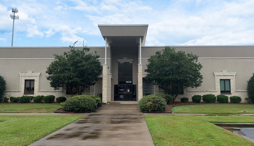
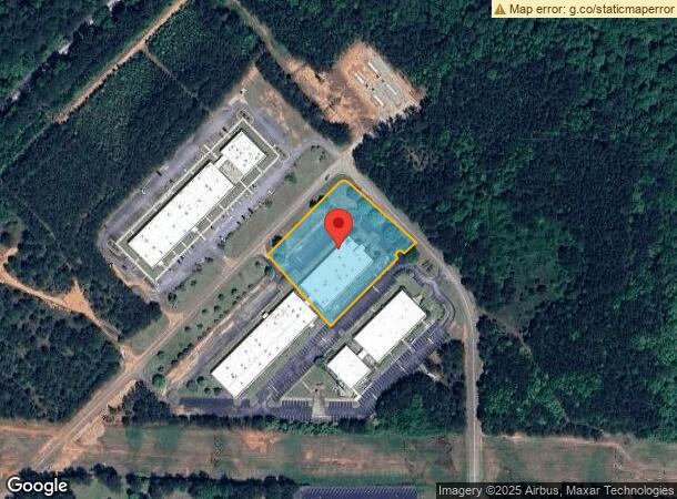
Property Record
1239 Og Skinner Dr, West Point, GA 31833
This Property Is For Sale
NEARBY LISTINGS FOR SALE OR LEASE
Property Detail
1239 Og Skinner Dr
094-4B-000-041C
Pittman
Officebuilding
1239 O G SKINNER DR/PITTMAN ST
X
Troup
13285C0218F
Georgia
2024
2.54 AC
2024
Troup County
961000
Columbus GA
20,387 SF
LaGrange, GA
DEMOGRAPHICS near 1239 Og Skinner Dr
1 Mile
3 Mile
5 Mile
2024 Total Population
1,693
11,878
19,030
2029 Population
1,744
12,116
19,142
Pop Growth 2024-2029
+ 3.01%
+ 2.00%
+ 0.59%
Average Age
40
40
41
2024 Total Households
681
4,613
7,540
HH Growth 2024-2029
+ 2.94%
+ 2.23%
+ 0.70%
Median Household Inc
$46,160
$46,603
$47,276
Avg Household Size
2.50
2.40
2.40
2024 Avg HH Vehicles
2.00
2.00
2.00
Median Home Value
$138,541
$146,877
$135,556
Median Year Built
1980
1973
1973
Nearby Places
- Restaurants
- Banks
- Shops
- Fitness
- Groceries
PUBLIC TRANSPORTATION
AIRPORT
Columbus
DRIVE
WALK
Distance
Columbus
45 min
33.7 mi
Freight Ports
Port of Panama City
DRIVE
WALK
Distance
Port of Panama City
280 min
221.6 mi
Nearby Properties
Address
Land Use
TOTAL SIZE
Lot Size
Zoning
Address
Land Use
TOTAL SIZE
Lot Size
Zoning
39,034.56 AC
UNAVAILABL
Address
Land Use
TOTAL SIZE
Lot Size
Zoning
517,521 SF
27.03 AC
17-I-1
Address
Land Use
TOTAL SIZE
Lot Size
Zoning
255,952 SF
1 AC
17-I-1
Address
Land Use
TOTAL SIZE
Lot Size
Zoning
311,435 SF
1 AC
17-I-1
Address
Land Use
TOTAL SIZE
Lot Size
Zoning
426,400 SF
1 AC
17-I-1
Address
Land Use
TOTAL SIZE
Lot Size
Zoning
Address
Land Use
TOTAL SIZE
Lot Size
Zoning
132,260 SF
1 AC
Address
Land Use
TOTAL SIZE
Lot Size
Zoning
17,098 SF
19.05 AC
17-SPLIT
Address
Land Use
TOTAL SIZE
Lot Size
Zoning
307,200 SF
32.39 AC
003
Address
Land Use
TOTAL SIZE
Lot Size
Zoning
28,850 SF
6.63 AC
17-MXD-1
Address
Land Use
TOTAL SIZE
Lot Size
Zoning
132,600 SF
1 AC
Address
Land Use
TOTAL SIZE
Lot Size
Zoning
124,448 SF
25 AC
004
Address
Land Use
TOTAL SIZE
Lot Size
Zoning
1 AC
17-UNAVAIL
Address
Land Use
TOTAL SIZE
Lot Size
Zoning
6,800 SF
10 AC
17-I-1
Address
Land Use
TOTAL SIZE
Lot Size
Zoning
42,369 SF
1.49 AC
17-I-1
Address
Land Use
TOTAL SIZE
Lot Size
Zoning
31,290 SF
0.75 AC
17-CGN
Address
Land Use
TOTAL SIZE
Lot Size
Zoning
523.41 AC
17-MXD-1
Address
Land Use
TOTAL SIZE
Lot Size
Zoning
19,493 SF
15 AC
17-R-1
Address
Land Use
TOTAL SIZE
Lot Size
Zoning
185.02 AC
17-R/P
Address
Land Use
TOTAL SIZE
Lot Size
Zoning
106,133 SF
8.37 AC
17-I-1
Address
Land Use
TOTAL SIZE
Lot Size
Zoning
20,409 SF
2.46 AC
17-R-1
Address
Land Use
TOTAL SIZE
Lot Size
Zoning
36,225 SF
5.74 AC
17-I-1
Address
Land Use
TOTAL SIZE
Lot Size
Zoning
7,326 SF
4.50 AC
17-I-1
Address
Land Use
TOTAL SIZE
Lot Size
Zoning
18,960 SF
0.36 AC
17-CBD
Address
Land Use
TOTAL SIZE
Lot Size
Zoning
34,584 SF
3.68 AC
17-I-1
Address
Land Use
TOTAL SIZE
Lot Size
Zoning
17,852 SF
1.26 AC
17-CBD
Address
Land Use
TOTAL SIZE
Lot Size
Zoning
8,032 SF
32.02 AC
Address
Land Use
TOTAL SIZE
Lot Size
Zoning
23,487 SF
2 AC
17-I-1
Address
Land Use
TOTAL SIZE
Lot Size
Zoning
51,408 SF
0.72 AC
17-CGN
The World's #1 Commercial Real Estate Marketplace
Connect with us
© 2025 CoStar Group
The information above has been obtained from sources believed reliable. While we do not doubt its accuracy we have not verified it and make no guarantee, warranty or representation about it. It is your responsibility to independently confirm its accuracy and completeness. Any projections, opinions, assumptions, or estimates used are for example only and do not represent the current or future performance of the property. The value of this transaction to you depends on tax and other factors which should be evaluated by your tax, financial, and legal advisors. You and your advisors should conduct a careful, independent investigation of the property to determine to your satisfaction the suitability of the property for your needs.