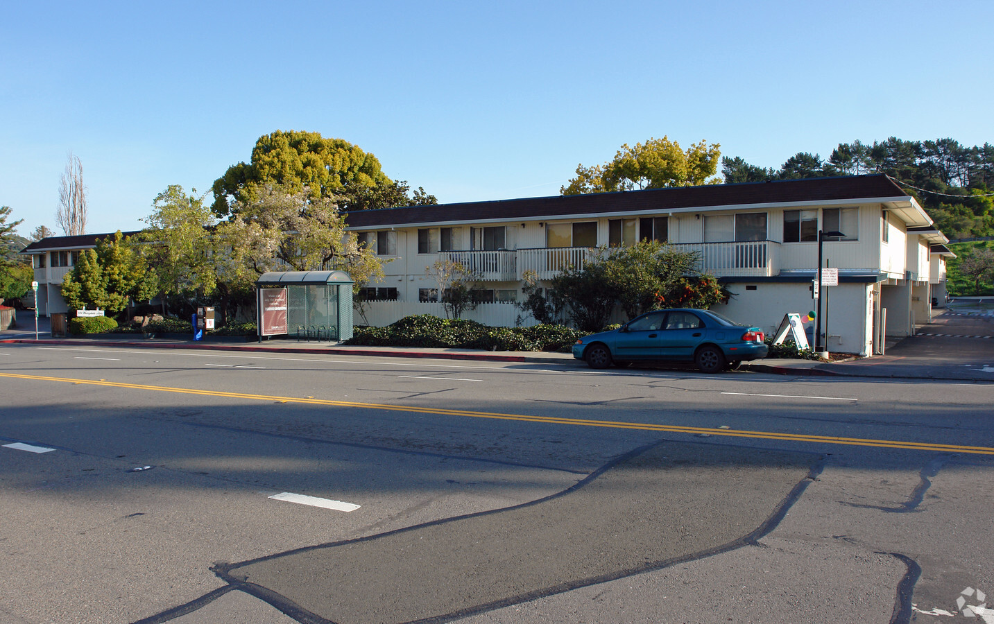
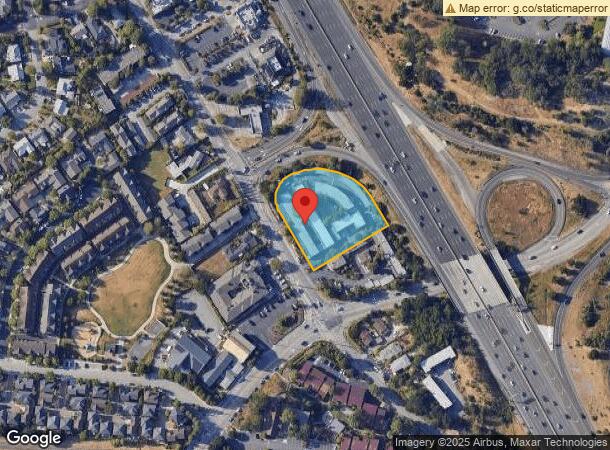
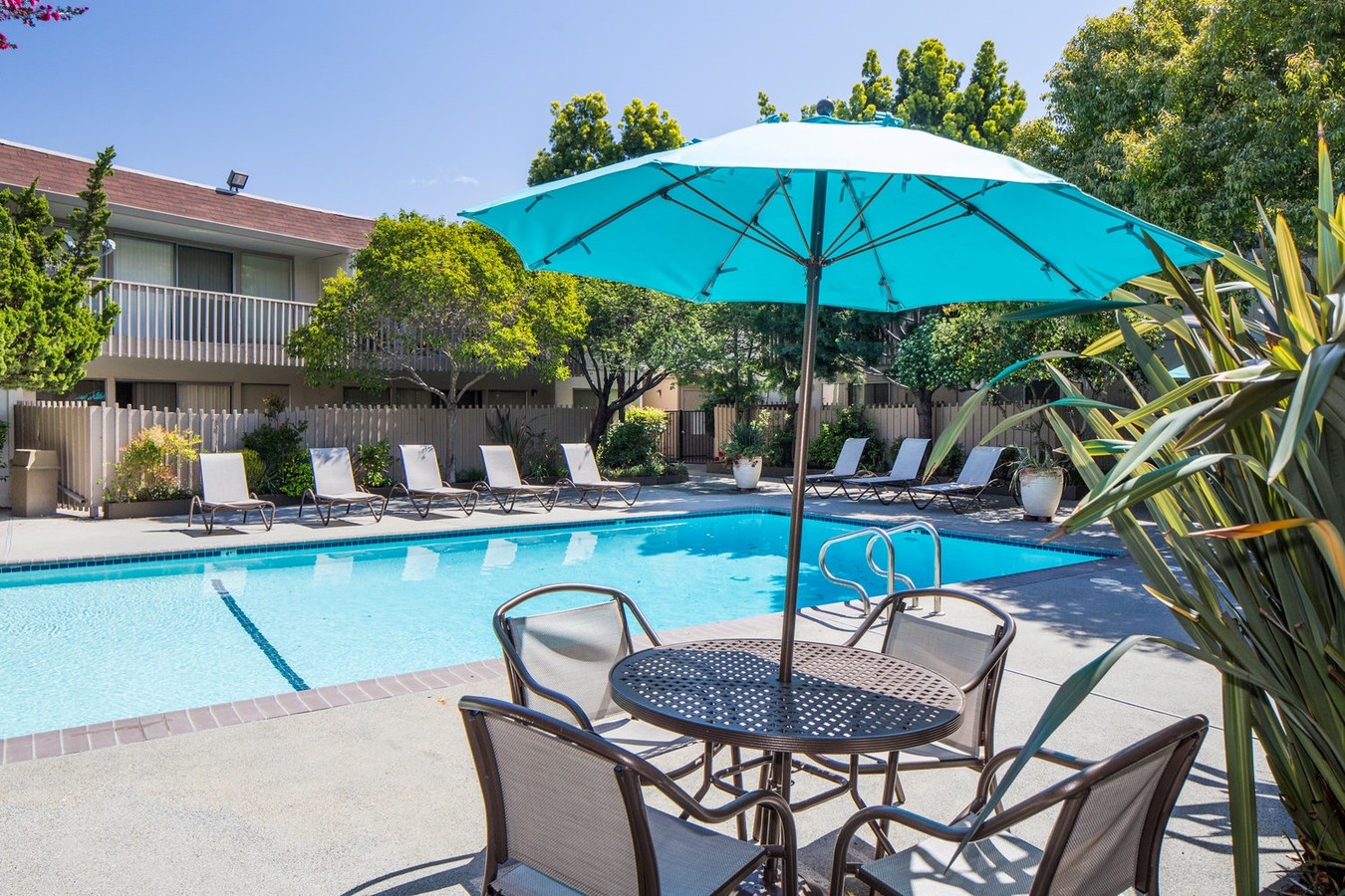
Property Record
124 Merrydale Rd, San Rafael, CA 94903

NEARBY LISTINGS FOR SALE OR LEASE
Property Detail
124 Merrydale Rd
San Rafael, CA
Golf Links
179-141-03
MAP F5 00566
Multifamilydwelling
Marin
X
California
06041C0456F
11-16
2024
1.54 AC
2024
Civic Center
108201
North Bay/Santa Rosa
33,520 SF
DEMOGRAPHICS near 124 Merrydale Rd
1 Mile
3 Mile
5 Mile
2024 Total Population
9,548
86,898
133,420
2029 Population
9,292
84,275
129,711
Pop Growth 2024-2029
(2.68%)
(3.02%)
(2.78%)
Average Age
46
44
45
2024 Total Households
3,932
33,447
52,667
HH Growth 2024-2029
(2.57%)
(3.00%)
(2.80%)
Median Household Inc
$96,330
$111,698
$114,812
Avg Household Size
2.30
2.50
2.40
2024 Avg HH Vehicles
2.00
2.00
2.00
Median Home Value
$1,029,103
$1,078,202
$1,076,698
Median Year Built
1968
1962
1964
Nearby Places
- Restaurants
- Banks
- Shops
- Fitness
- Groceries
PUBLIC TRANSPORTATION
COMMUTER RAIL
Marin Civic Center Smart (Main Line - Sonoma Marin Area Rail Transit)
DRIVE
WALK
Distance
Marin Civic Center Smart (Main Line - Sonoma Marin Area Rail Transit)
4 min
16 min
0.9 mi
San Rafael Smart (Main Line - Sonoma Marin Area Rail Transit)
DRIVE
WALK
Distance
San Rafael Smart (Main Line - Sonoma Marin Area Rail Transit)
4 min
2.2 mi
AIRPORT
San Francisco International
DRIVE
WALK
Distance
San Francisco International
52 min
32.9 mi
Metro Oakland International
DRIVE
WALK
Distance
Metro Oakland International
45 min
33.0 mi
Freight Ports
Port of Richmond
DRIVE
WALK
Distance
Port of Richmond
22 min
13.7 mi
Nearby Properties
Address
Land Use
TOTAL SIZE
Lot Size
Zoning
Address
Land Use
TOTAL SIZE
Lot Size
Zoning
283,663 SF
27.98 AC
Address
Land Use
TOTAL SIZE
Lot Size
Zoning
23.79 AC
Address
Land Use
TOTAL SIZE
Lot Size
Zoning
87,058 SF
1.33 AC
Address
Land Use
TOTAL SIZE
Lot Size
Zoning
221,660 SF
9.69 AC
PC
Address
Land Use
TOTAL SIZE
Lot Size
Zoning
146,832 SF
5.50 AC
Address
Land Use
TOTAL SIZE
Lot Size
Zoning
167,392 SF
12.79 AC
Address
Land Use
TOTAL SIZE
Lot Size
Zoning
147,502 SF
1.02 AC
Address
Land Use
TOTAL SIZE
Lot Size
Zoning
132,040 SF
11.74 AC
Address
Land Use
TOTAL SIZE
Lot Size
Zoning
91,158 SF
1.89 AC
Address
Land Use
TOTAL SIZE
Lot Size
Zoning
11.63 AC
Address
Land Use
TOTAL SIZE
Lot Size
Zoning
15.91 AC
SPD
Address
Land Use
TOTAL SIZE
Lot Size
Zoning
94,745 SF
1.46 AC
Address
Land Use
TOTAL SIZE
Lot Size
Zoning
75,888 SF
10.99 AC
Address
Land Use
TOTAL SIZE
Lot Size
Zoning
195,460 SF
6.10 AC
Address
Land Use
TOTAL SIZE
Lot Size
Zoning
71,527 SF
1.86 AC
Address
Land Use
TOTAL SIZE
Lot Size
Zoning
177,460 SF
13 AC
Address
Land Use
TOTAL SIZE
Lot Size
Zoning
11,830 SF
0.65 AC
Address
Land Use
TOTAL SIZE
Lot Size
Zoning
85,066 SF
1.29 AC
Address
Land Use
TOTAL SIZE
Lot Size
Zoning
87,840 SF
1.19 AC
Address
Land Use
TOTAL SIZE
Lot Size
Zoning
33,641 SF
1.60 AC
Address
Land Use
TOTAL SIZE
Lot Size
Zoning
Address
Land Use
TOTAL SIZE
Lot Size
Zoning
6.39 AC
Address
Land Use
TOTAL SIZE
Lot Size
Zoning
142,341 SF
5.83 AC
Address
Land Use
TOTAL SIZE
Lot Size
Zoning
132,813 SF
6.75 AC
Address
Land Use
TOTAL SIZE
Lot Size
Zoning
66,700 SF
0.99 AC
Address
Land Use
TOTAL SIZE
Lot Size
Zoning
42,410 SF
0.54 AC
Address
Land Use
TOTAL SIZE
Lot Size
Zoning
75,556 SF
0.78 AC
Address
Land Use
TOTAL SIZE
Lot Size
Zoning
97,200 SF
5.01 AC
Address
Land Use
TOTAL SIZE
Lot Size
Zoning
2.53 AC
Address
Land Use
TOTAL SIZE
Lot Size
Zoning
124,196 SF
9.77 AC
The World's #1 Commercial Real Estate Marketplace
Connect with us
© 2025 CoStar Group
The information above has been obtained from sources believed reliable. While we do not doubt its accuracy we have not verified it and make no guarantee, warranty or representation about it. It is your responsibility to independently confirm its accuracy and completeness. Any projections, opinions, assumptions, or estimates used are for example only and do not represent the current or future performance of the property. The value of this transaction to you depends on tax and other factors which should be evaluated by your tax, financial, and legal advisors. You and your advisors should conduct a careful, independent investigation of the property to determine to your satisfaction the suitability of the property for your needs.