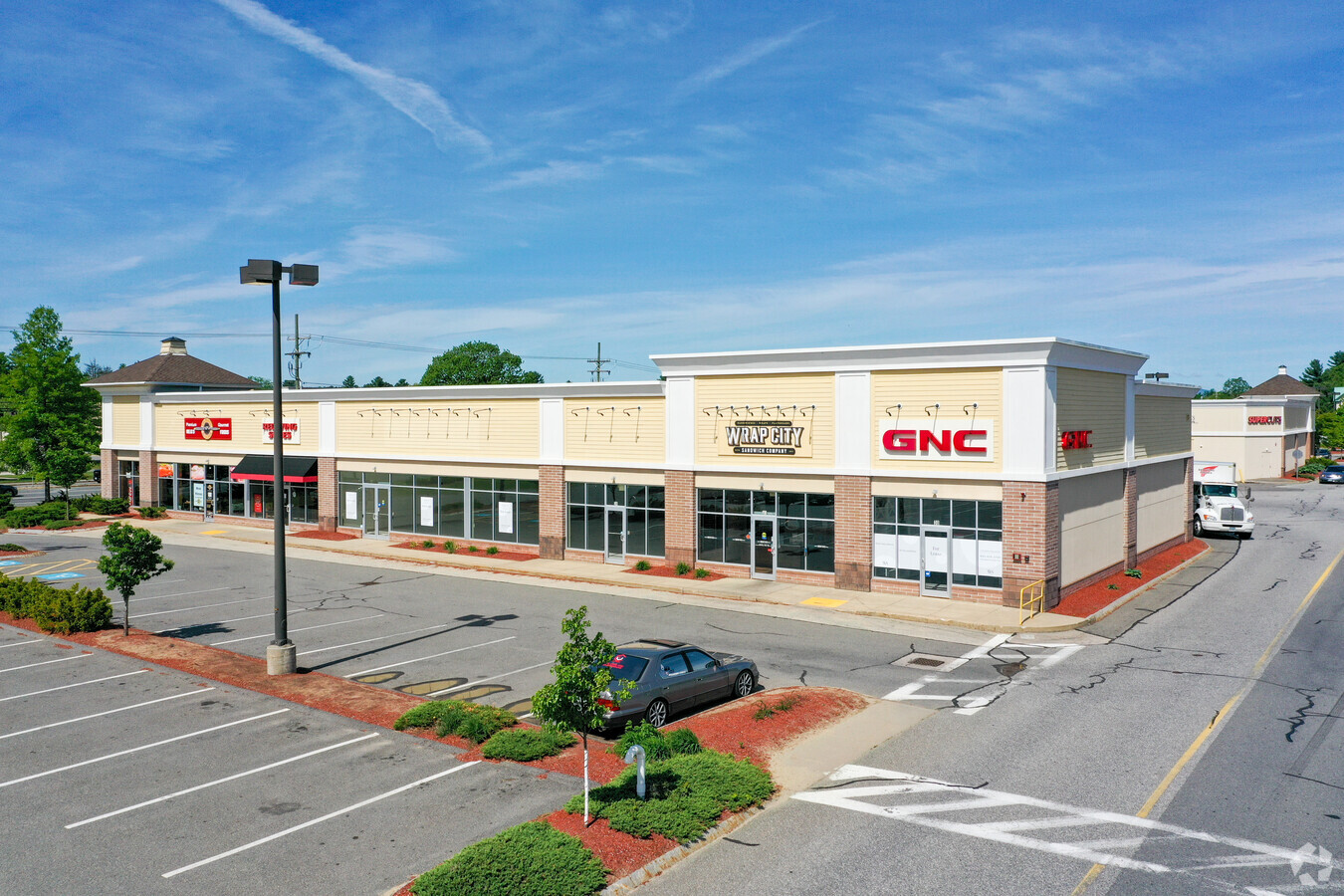
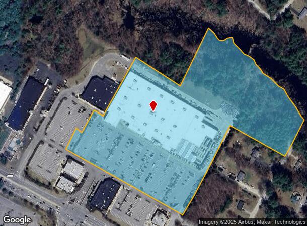
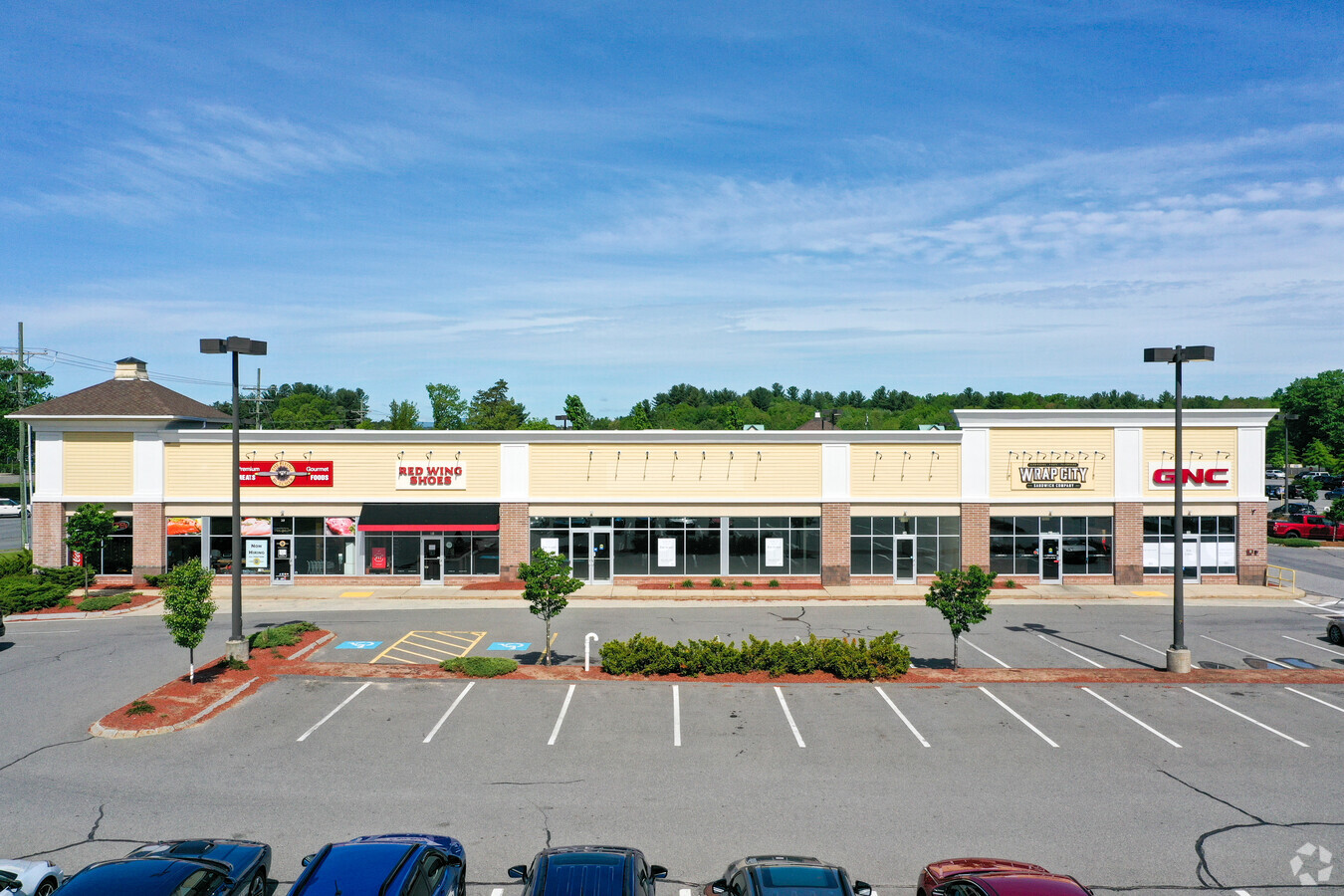
Property Record
124 State Route 101A, Amherst, NH 03031
NEARBY LISTINGS FOR SALE OR LEASE
Property Detail
124 State Route 101A
Departmentstore
Hillsborough
X
New Hampshire
33011C0487D
14.16 AC
2024
Hillsborough
2024
Boston
015200
Manchester-Nashua, NH
132,637 SF
AMHS-000002-000036
DEMOGRAPHICS near 124 State Route 101A
1 Mile
3 Mile
5 Mile
2024 Total Population
1,366
13,872
57,042
2029 Population
1,385
14,305
58,518
Pop Growth 2024-2029
+ 1.39%
+ 3.12%
+ 2.59%
Average Age
44
42
43
2024 Total Households
518
5,368
23,024
HH Growth 2024-2029
+ 1.35%
+ 3.30%
+ 2.63%
Median Household Inc
$145,376
$121,243
$113,488
Avg Household Size
2.60
2.50
2.40
2024 Avg HH Vehicles
2.00
2.00
2.00
Median Home Value
$448,305
$435,097
$397,228
Median Year Built
1979
1983
1981
Nearby Places
- Restaurants
- Banks
- Shops
- Fitness
- Groceries
PUBLIC TRANSPORTATION
AIRPORT
Manchester Boston Regional
DRIVE
WALK
Distance
Manchester Boston Regional
26 min
14.0 mi
Freight Ports
Port of Boston
DRIVE
WALK
Distance
Port of Boston
78 min
54.8 mi
SALE & LEASE HISTORY
LISTING DATE
SALE/LEASE

Feb 09, 2022
For Lease
Nearby Properties
Address
Land Use
TOTAL SIZE
Lot Size
Zoning
Address
Land Use
TOTAL SIZE
Lot Size
Zoning
621,927 SF
107.48 AC
INDUST
Address
Land Use
TOTAL SIZE
Lot Size
Zoning
259,644 SF
42.18 AC
RR
Address
Land Use
TOTAL SIZE
Lot Size
Zoning
337,000 SF
48.52 AC
PI
Address
Land Use
TOTAL SIZE
Lot Size
Zoning
360,491 SF
40.23 AC
IND
Address
Land Use
TOTAL SIZE
Lot Size
Zoning
180.50 AC
AI
Address
Land Use
TOTAL SIZE
Lot Size
Zoning
198 AC
R18
Address
Land Use
TOTAL SIZE
Lot Size
Zoning
227,260 SF
35 AC
PI
Address
Land Use
TOTAL SIZE
Lot Size
Zoning
93,448 SF
10 AC
RC
Address
Land Use
TOTAL SIZE
Lot Size
Zoning
125,916 SF
10.05 AC
GB
Address
Land Use
TOTAL SIZE
Lot Size
Zoning
200,012 SF
31.83 AC
C
Address
Land Use
TOTAL SIZE
Lot Size
Zoning
307,560 SF
23 AC
PI
Address
Land Use
TOTAL SIZE
Lot Size
Zoning
44,520 SF
8.51 AC
PI
Address
Land Use
TOTAL SIZE
Lot Size
Zoning
132,836 SF
8.61 AC
GB
Address
Land Use
TOTAL SIZE
Lot Size
Zoning
128,215 SF
13.55 AC
GB
Address
Land Use
TOTAL SIZE
Lot Size
Zoning
137,328 SF
11.10 AC
AI
Address
Land Use
TOTAL SIZE
Lot Size
Zoning
67,994 SF
8.60 AC
PI
Address
Land Use
TOTAL SIZE
Lot Size
Zoning
34,844 SF
15.89 AC
GB
Address
Land Use
TOTAL SIZE
Lot Size
Zoning
32.20 AC
PI
Address
Land Use
TOTAL SIZE
Lot Size
Zoning
64,589 SF
26.11 AC
RR11
Address
Land Use
TOTAL SIZE
Lot Size
Zoning
19,442 SF
14.46 AC
AI
Address
Land Use
TOTAL SIZE
Lot Size
Zoning
131,191 SF
51.10 AC
C2- GE
Address
Land Use
TOTAL SIZE
Lot Size
Zoning
110,892 SF
18.38 AC
C2- GE
Address
Land Use
TOTAL SIZE
Lot Size
Zoning
150,052 SF
10.50 AC
PI
Address
Land Use
TOTAL SIZE
Lot Size
Zoning
79,869 SF
24.53 AC
RESIDE
Address
Land Use
TOTAL SIZE
Lot Size
Zoning
4.19 AC
IND
Address
Land Use
TOTAL SIZE
Lot Size
Zoning
99,865 SF
7.68 AC
AI
Address
Land Use
TOTAL SIZE
Lot Size
Zoning
66,088 SF
12.48 AC
ICI
Address
Land Use
TOTAL SIZE
Lot Size
Zoning
91,234 SF
8.92 AC
C
Address
Land Use
TOTAL SIZE
Lot Size
Zoning
98,820 SF
8.12 AC
AI
The World's #1 Commercial Real Estate Marketplace
Connect with us
© 2025 CoStar Group
The information above has been obtained from sources believed reliable. While we do not doubt its accuracy we have not verified it and make no guarantee, warranty or representation about it. It is your responsibility to independently confirm its accuracy and completeness. Any projections, opinions, assumptions, or estimates used are for example only and do not represent the current or future performance of the property. The value of this transaction to you depends on tax and other factors which should be evaluated by your tax, financial, and legal advisors. You and your advisors should conduct a careful, independent investigation of the property to determine to your satisfaction the suitability of the property for your needs.